

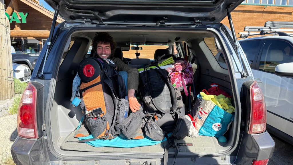
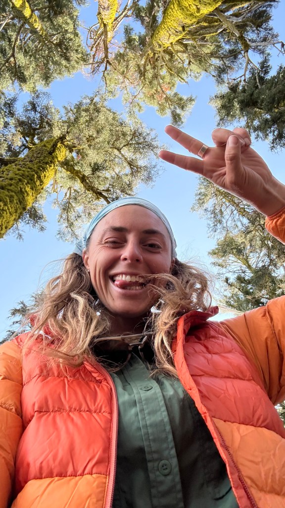
- Day 0: Getting to Lake Tahoe
- Day 1: 17.6 miles
- Day 2: 20.4 miles
- Day 3: 21 miles
- Day 4: 21.4 miles
- Day 5: 18.2 miles
- Day 6: 15.3 miles
- Day 7: 22.7 miles
- Day 8: 22 miles
- Day 9: 20.7 miles
Day 0: Getting to Lake Tahoe
The drive up to Lake Tahoe from San Diego was about 10 hours. Since I was going alone, I decided I would break up the drive to make it a little more enjoyable. So, I decided to visit one of my favorite Eastern Sierra mountain towns, Mammoth Lakes.
Mammoth Lakes is a cute and fun little mountain town at over 7,500 feet of elevation surrounded by snow capped Sierra Nevada mountains and dotted with pristine alpine lakes. There is lots of great hiking and backpacking trails in the area, and lots of camping options!
With it being mid June, I knew the lower elevations would be too hot for camping, so Mammoth Lakes seemed like the perfect spot to camp for the night. I stopped at my favorite brewery for a beer and some food before looking for a place to camp.
I was stoked to find that my favorite dispersed site was available and I had it all to myself!

The following day I got up with the sun and hit the road for Lake Tahoe. It was only about 3 hours to get to from Mammoth Lakes to Lake Tahoe. My plan for the day was to head straight to Tahoe City to drop off my resupply box. I booked a room at the Pepper Tree Inn for day 6 of my thru-hike. I was hopeful that since I booked a room they would be willing to hold on to my resupply box for me until I got there, and luckily I was right!
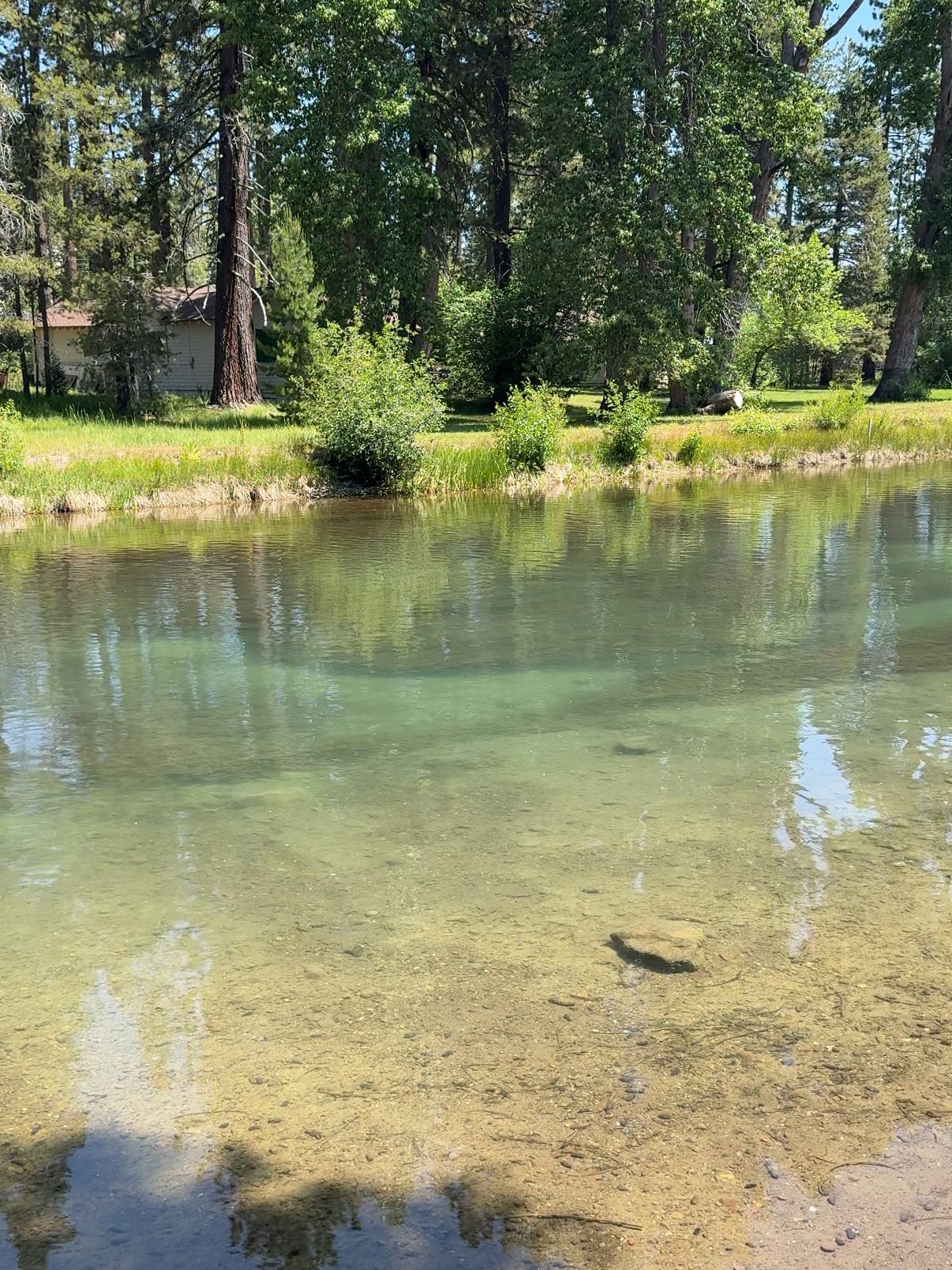
After dropping off my resupply box in Tahoe City, I found a spot along the Truckee River to lay and relax in the sun for a bit. Then I headed to South Lake Tahoe to check into a hotel for my last night of comfort and luxury before starting the trail.
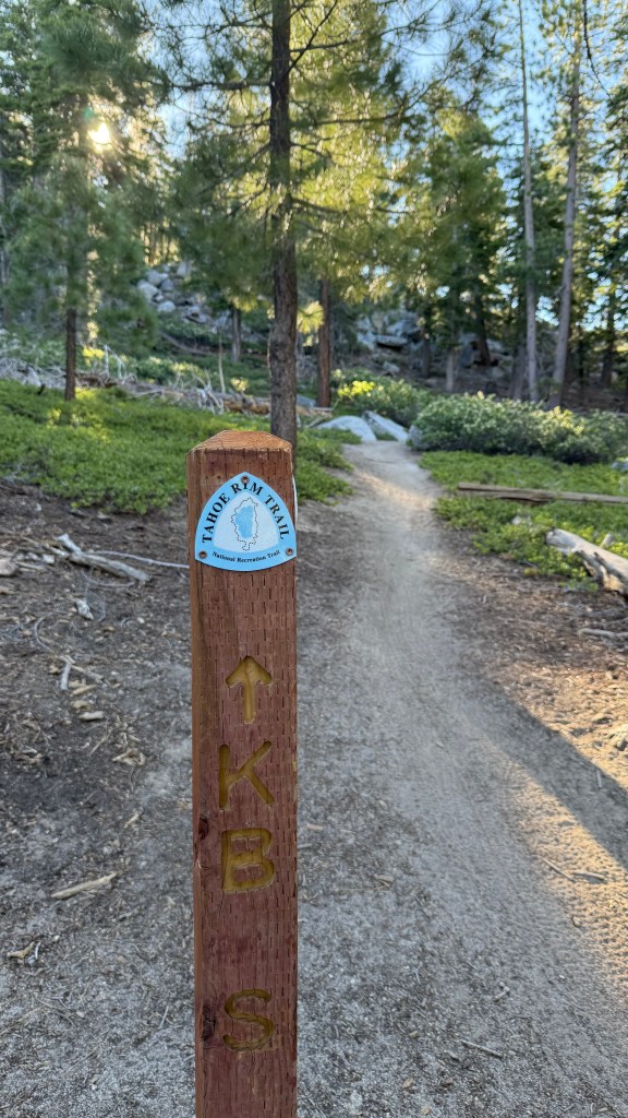
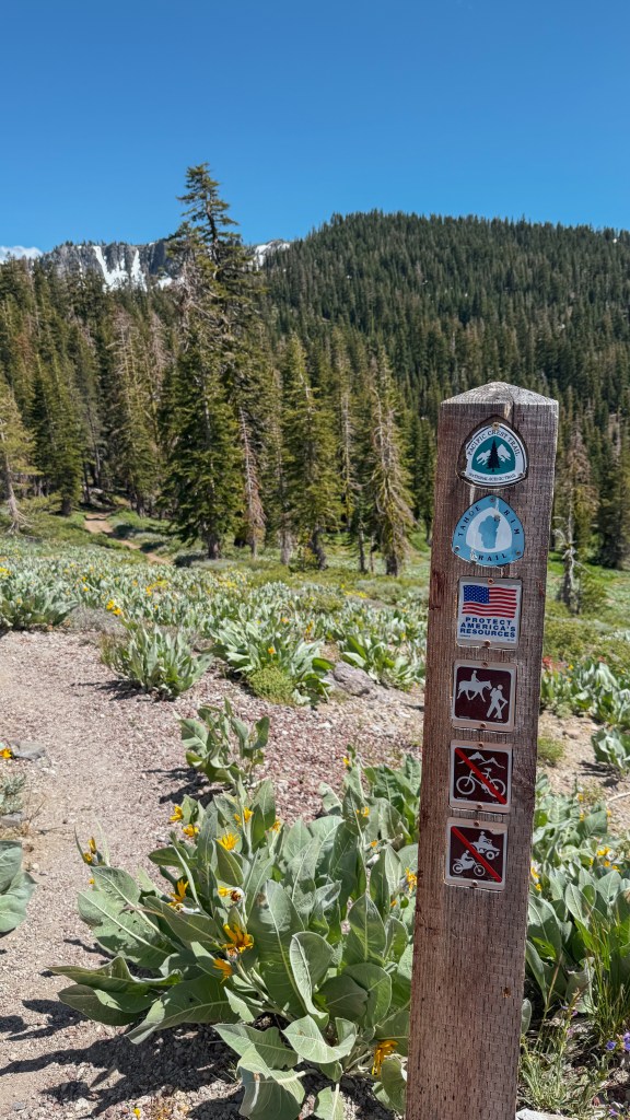
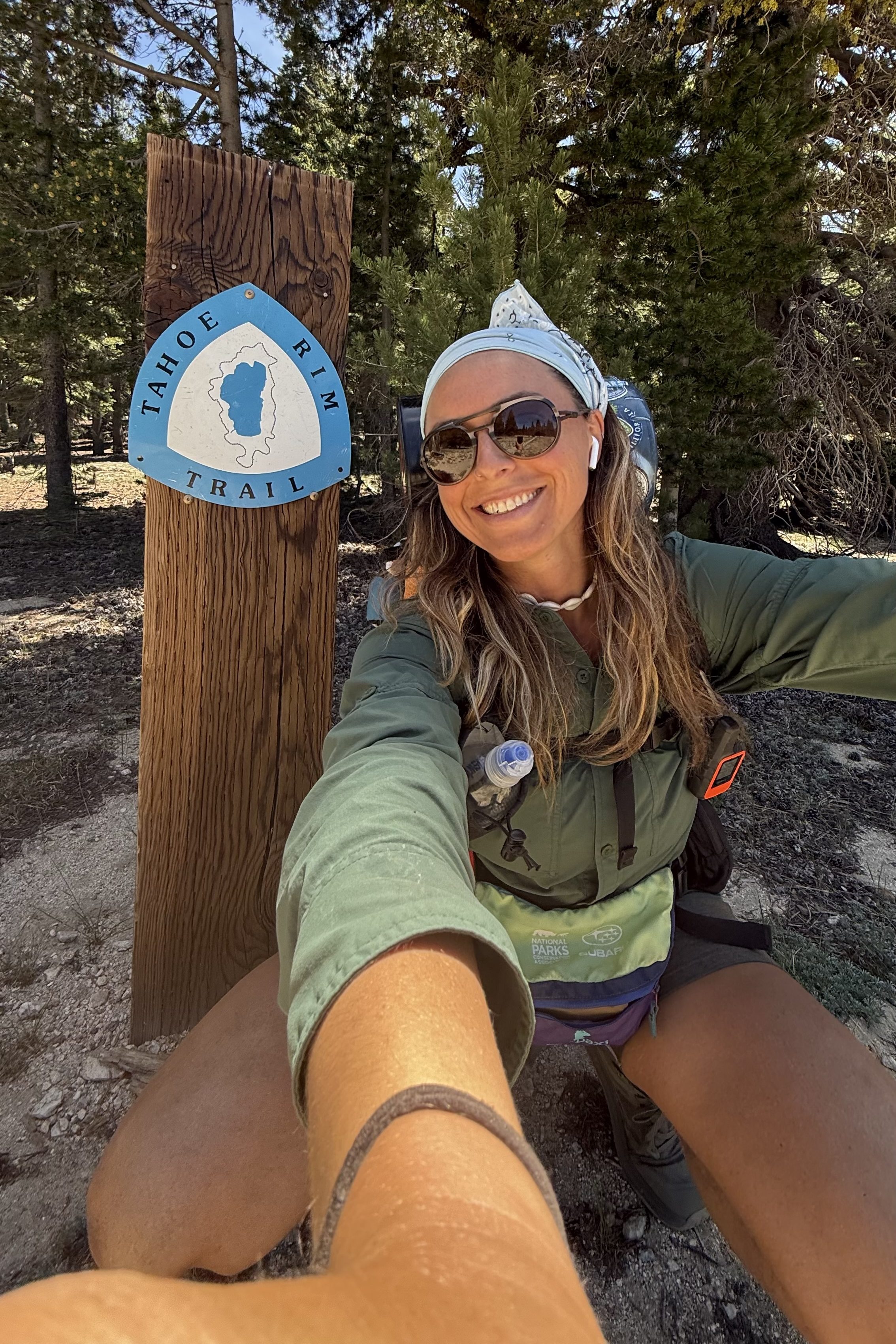
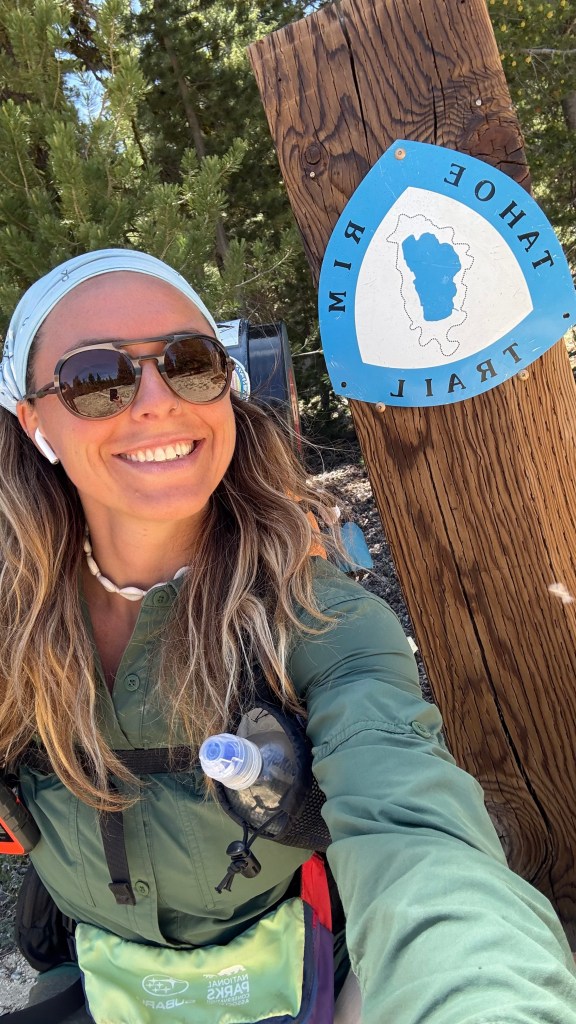
Day 1: 17.6 miles
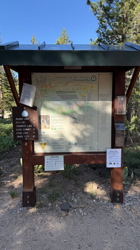
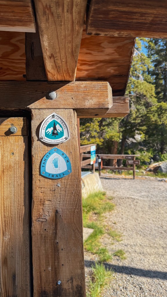
Spooner South Trailhead
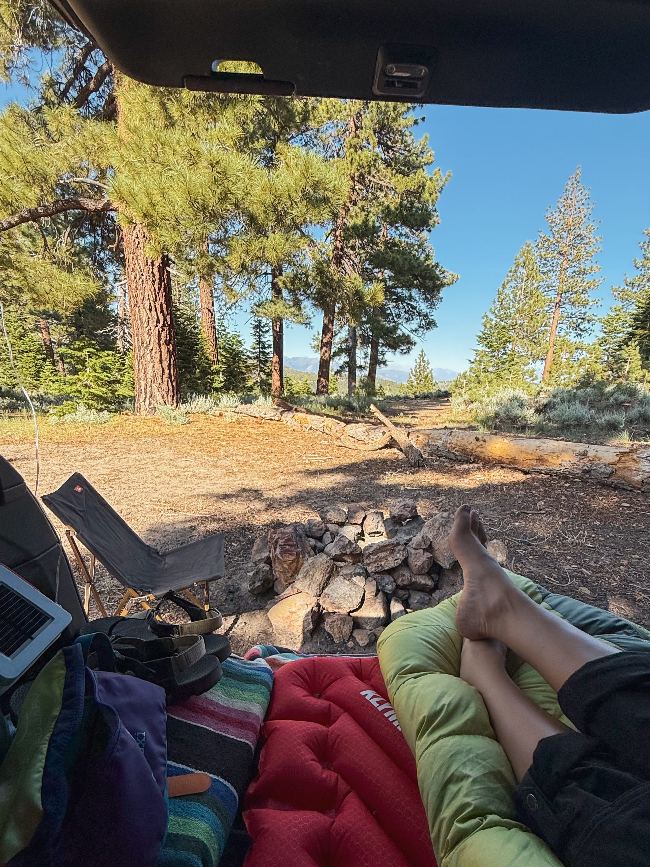
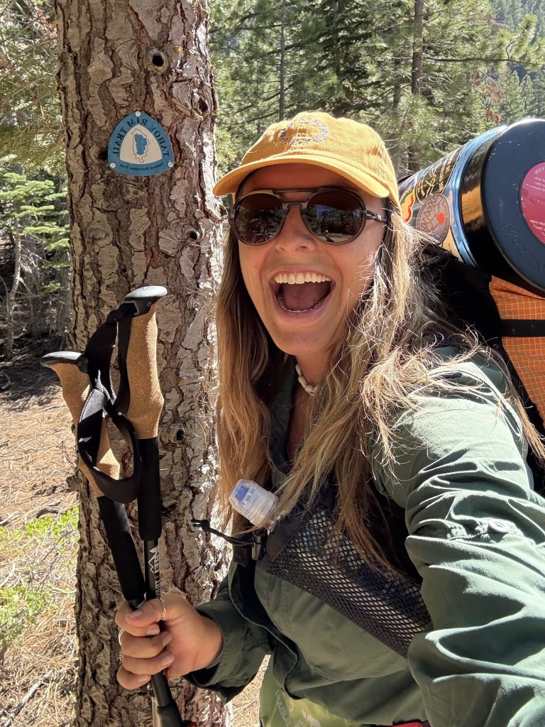
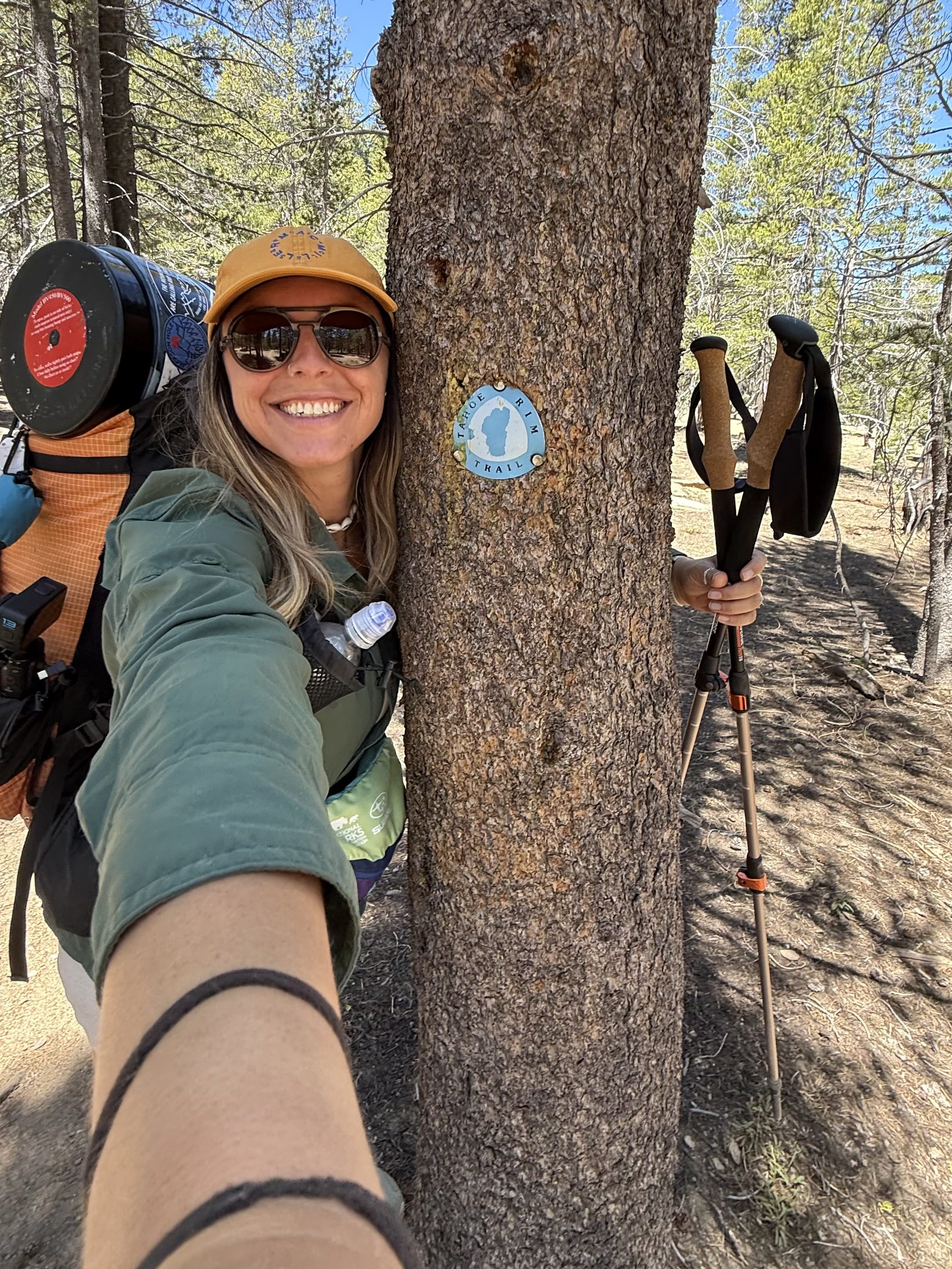
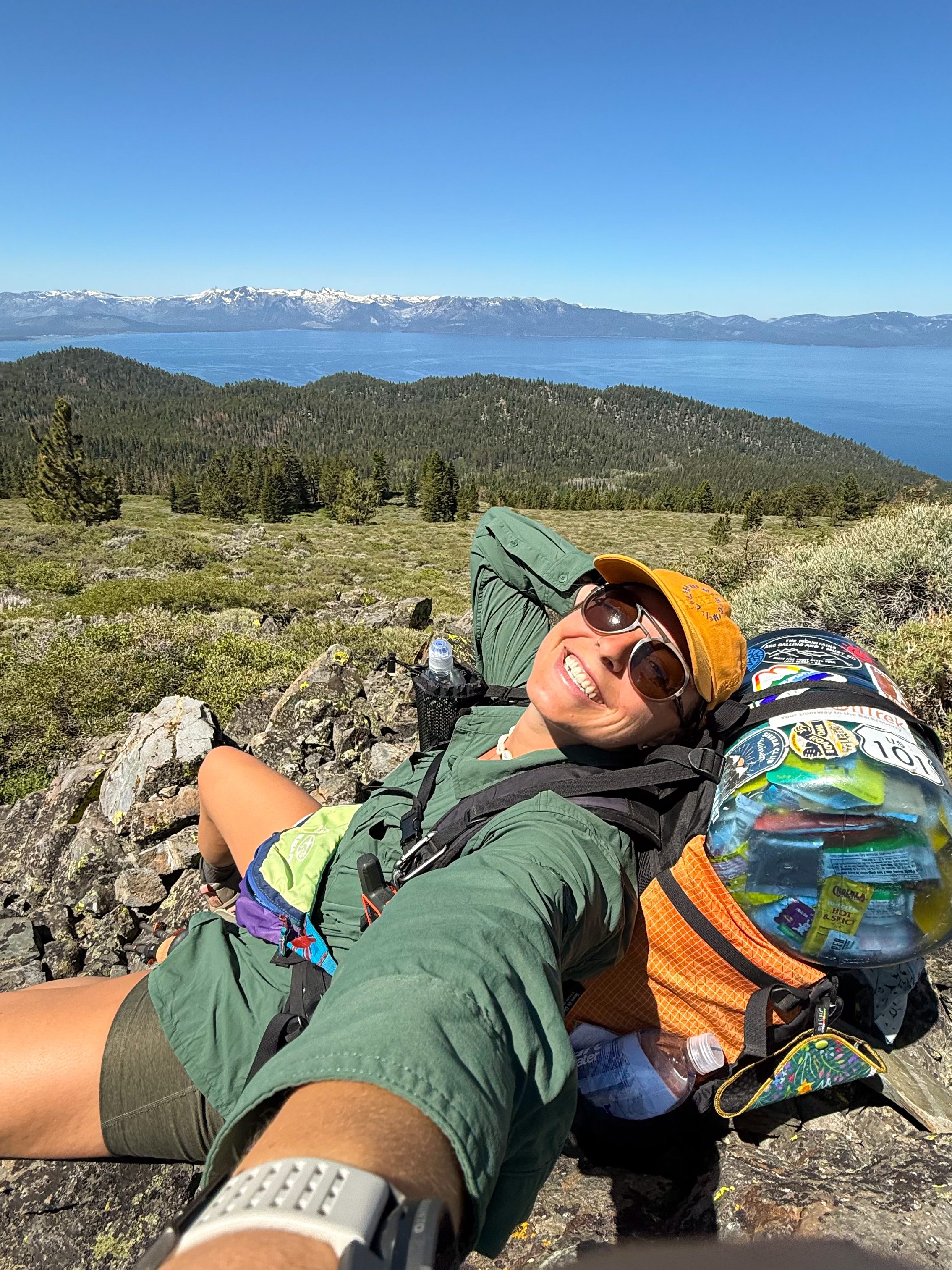
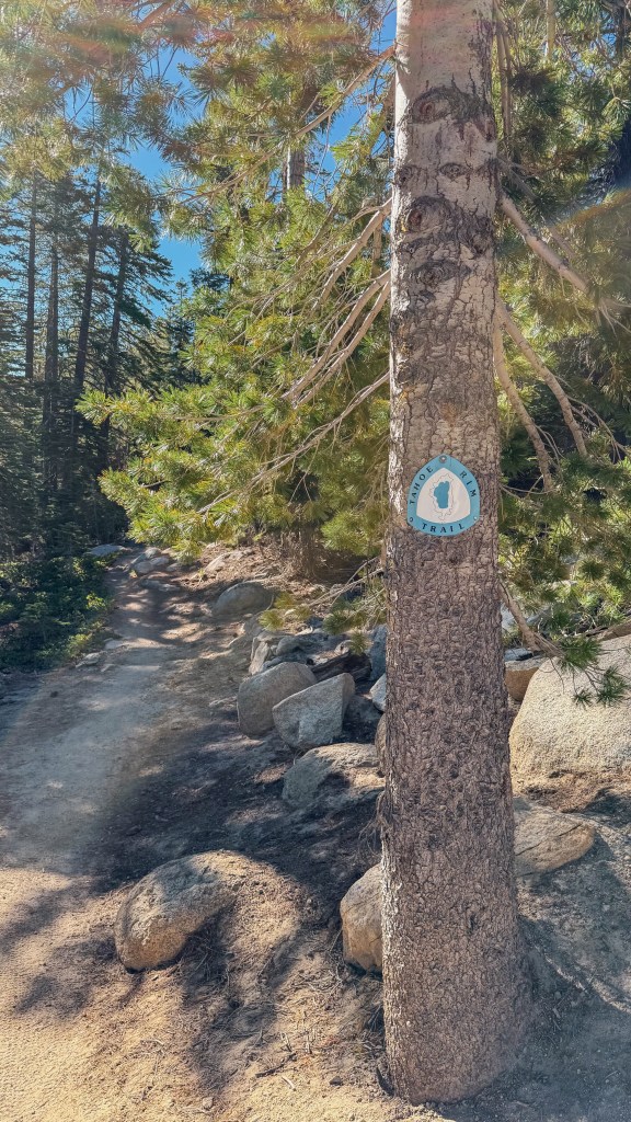
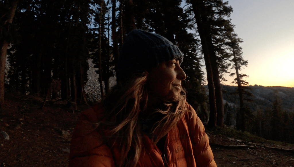
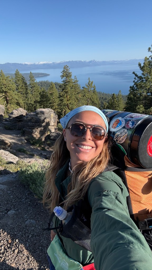
I was so excited about starting the trail that I woke up at 5:30 am ready to go! I checked out of my hotel room and drove over to the Spooner South Trailhead where I would start (and end) my journey. I parked the car and loaded up my pack. I chugged water trying to hydrate as much as possible since I was starting in a dry section. I chatted with a few hikers who were heading out for a day hike and lived in the area. I inquired about trail conditions, particularly curious about the snow, which was melting fast. Our conversation convinced me to leave my micro spikes behind. I was happy to lighten the load of my pack.
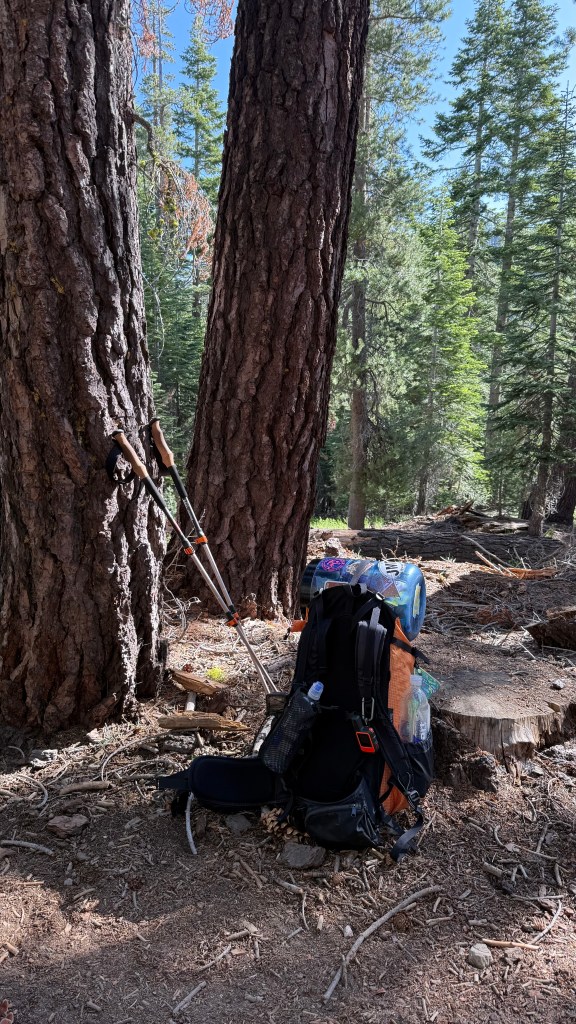
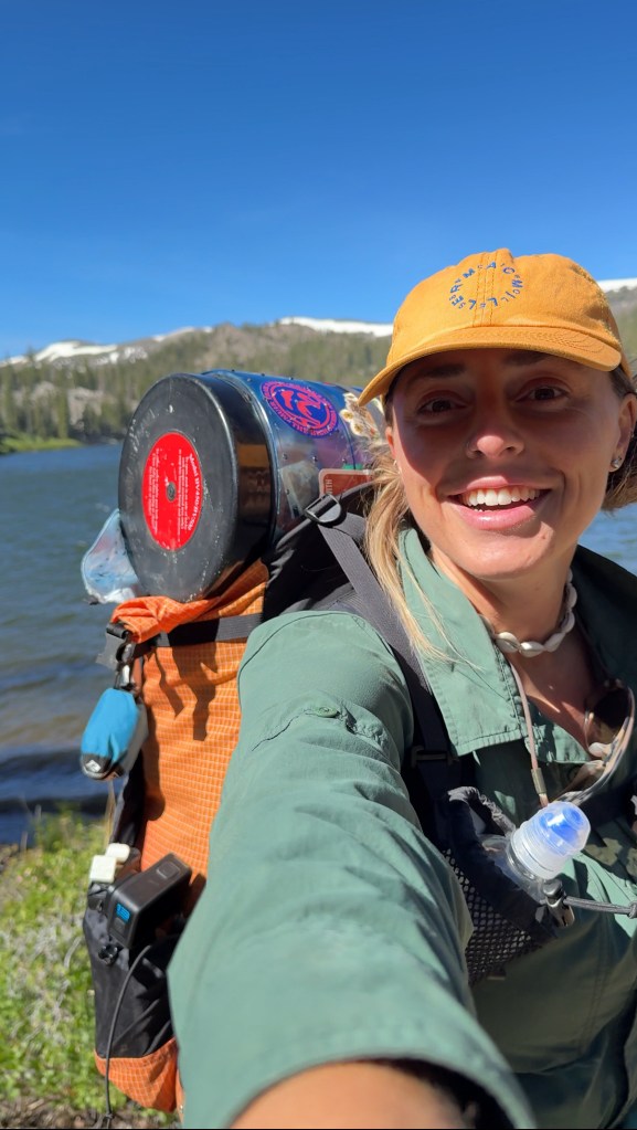
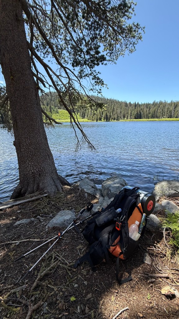
I used the pit toilet, locked up the car, loaded my pack onto my back, started my GPS. I started to climb up the trail, taking my first official steps on the Tahoe Rim Trail. I carried 30 pounds on my back. This included 6 days of food and 3 liters of water to get me through a 16 mile dry stretch. Even though my pack was heavy, there was a big smile across my face and excitement in my eyes.


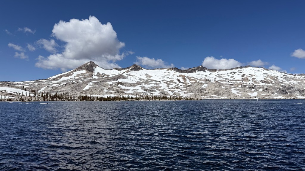
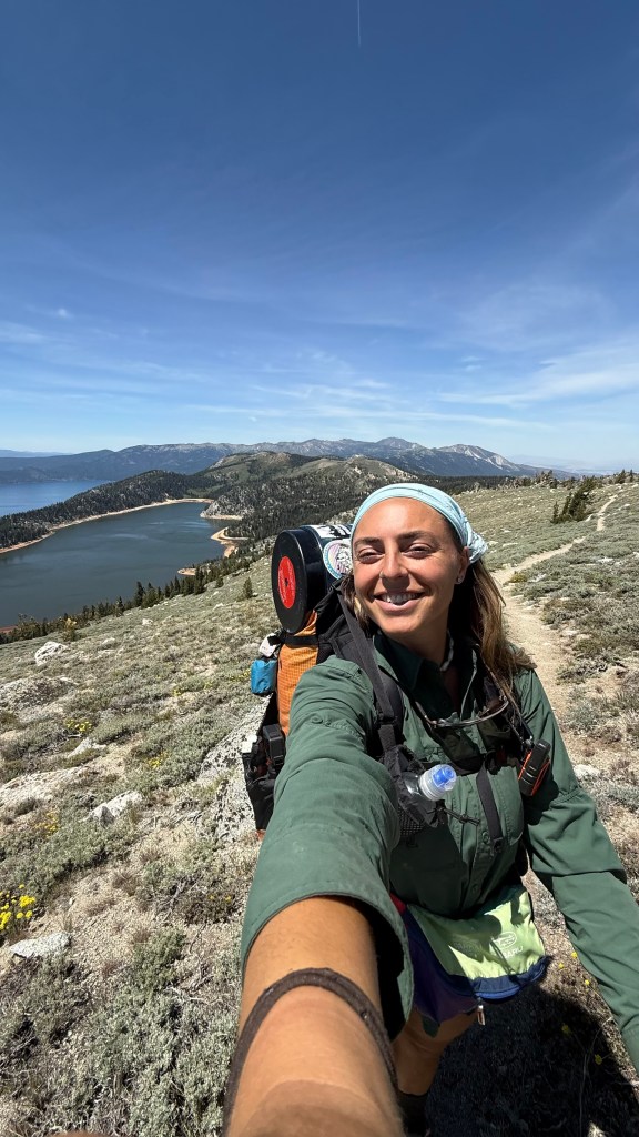
The day began with climbing up switchbacks through a wooded area. I love the smell of pine on a hot summer day. After a couple of miles, the trees opened up and I had a panoramic view of Lake Tahoe. My first views of the lake on the TRT.
Gazing across the lake at the snow covered mountains in the Desolation Wilderness, I was looking into the future. In a few days I would be climbing those snow covered mountains, looking back at where I am now. I wondered if I would make it there, and how I would feel when I did.
The trail continued for about a mile with this stunning panoramic view before dipping back into the forest with periodic views of the lake through the trees.
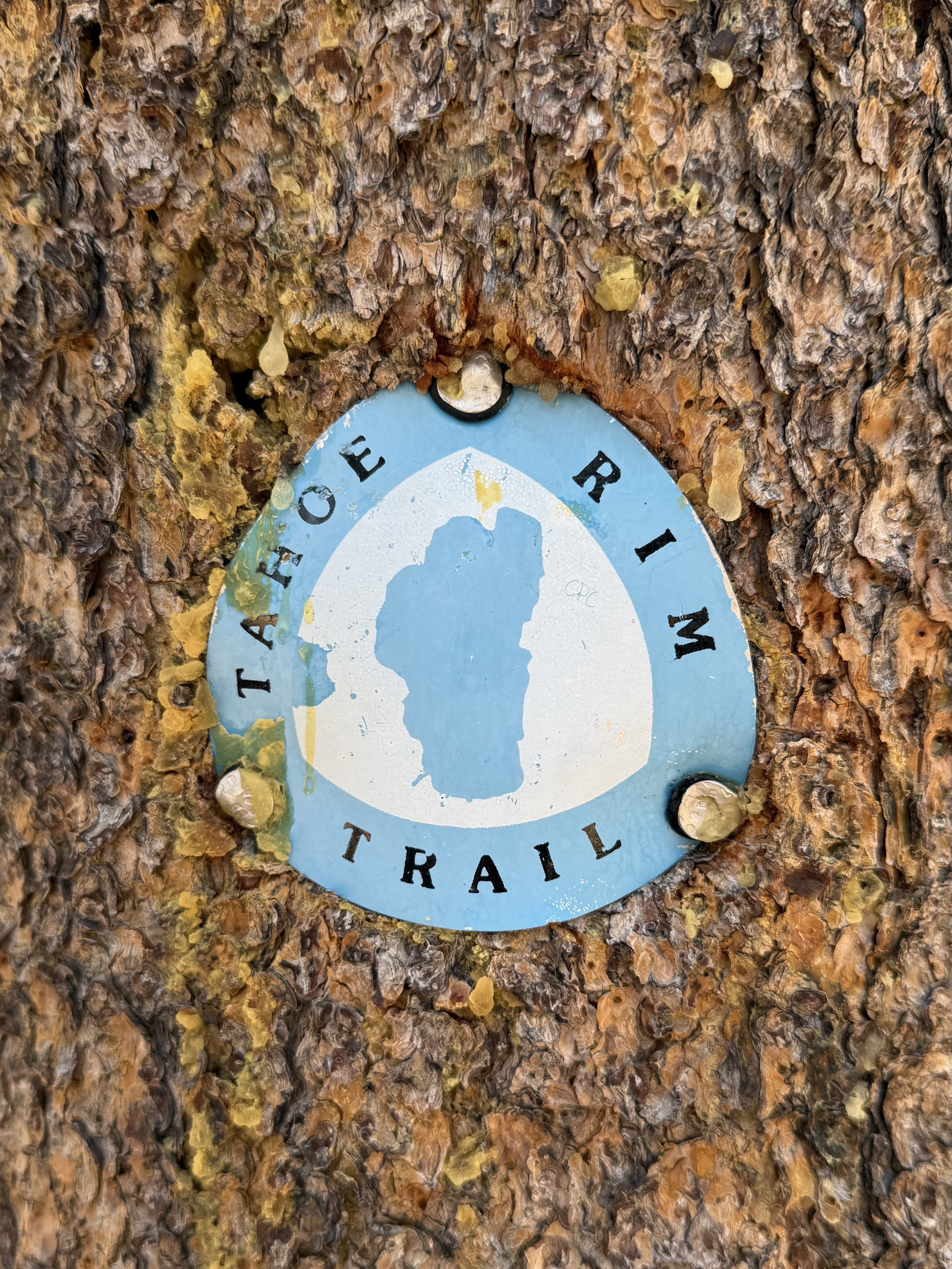
As I hiked, I oriented myself by imagining the lake like a clock face. Spooner Trailhead would be about 3 o’clock. South Lake Tahoe is 6 o’clock. Echo Lake is 7 o’clock. Tahoe City is 10 o’clock. Relay Peak is 12 o’clock.
Here is a visual using the map:

Today I started hiking at 3 o’clock (Spooner Trailhead) and ended around 4:30 (a few miles past Kingsbury). As I hiked, my perspective of the lake changed with new angles revealing new mountains, bays, and horizons. So even though you are hiking around the same lake all day, you are always seeing it from a new perspective;
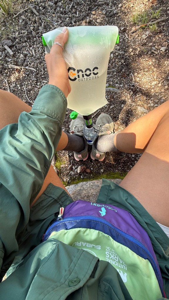
The northeast sections of the TRT, from 10 to 4 o’clock, are mostly dry. These areas require some lengthy water carries. Today I had a 16 mile water carry which was most of my day. I was sure to hydrate before starting the trail, then rationed 3 liters over the 16 mile carry. By the time I made it to Edgewood Creek, I was quite thirsty. I filtered and drank, then filtered some more. I also had some snacks and a stretch before continuing down the trail looking for a campsite.
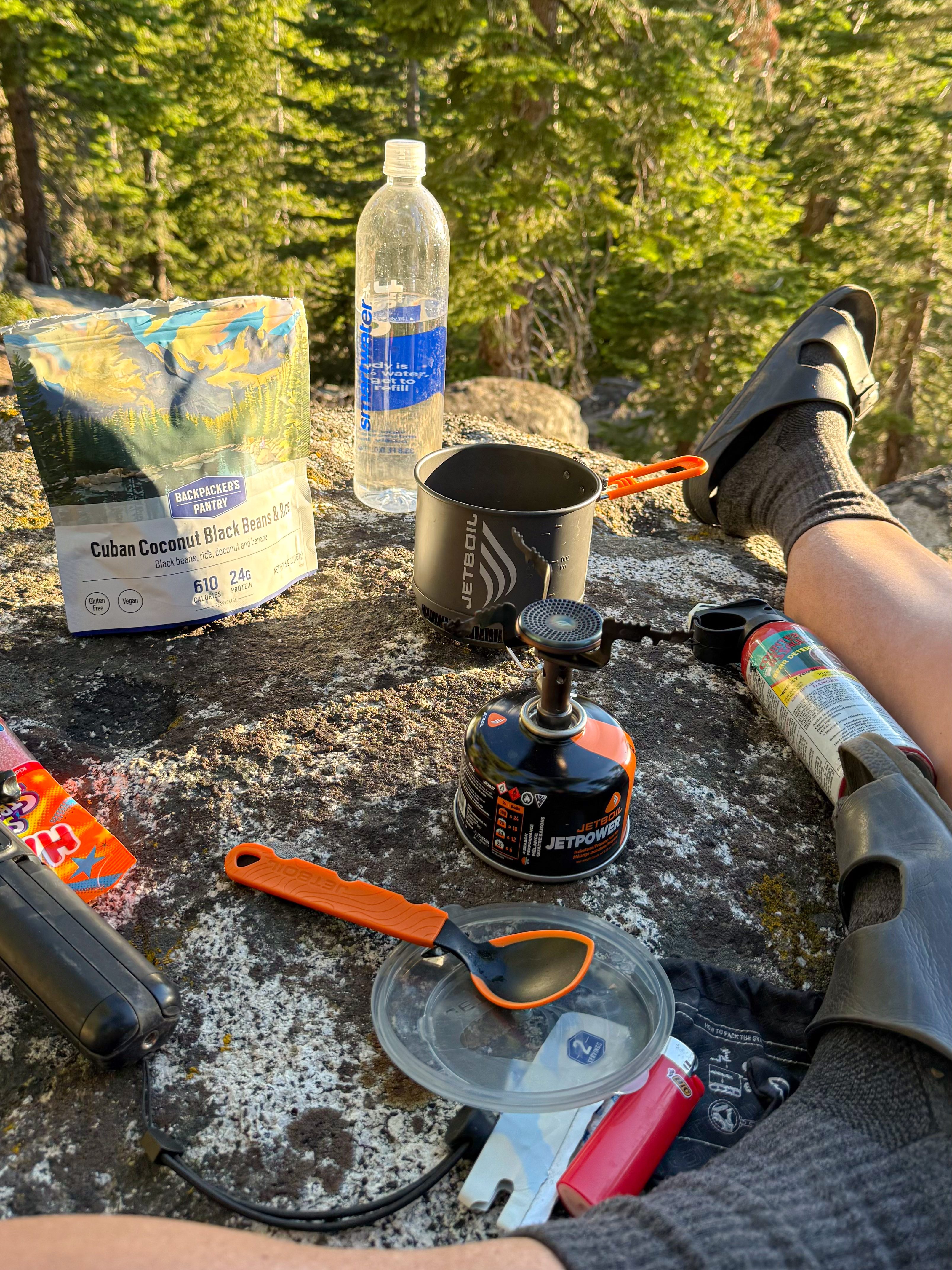
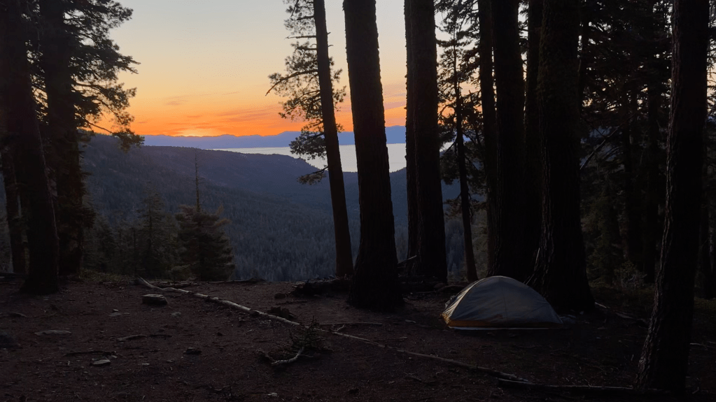
I found a snug spot for my tent among a pile of boulders with a great view of the lake through some trees. I stretched and laid in the sun for while before making dinner. Tonight, I would have the Cuban Black Beans and Rice from Backpackers Pantry. It has banana and coconut in it which I loved! I would definitely get this meal again.
I watched the sunset and reflected on my first day. Then I fell asleep imagining what the next couple of weeks would hold for me.


Day 2: 20.4 miles
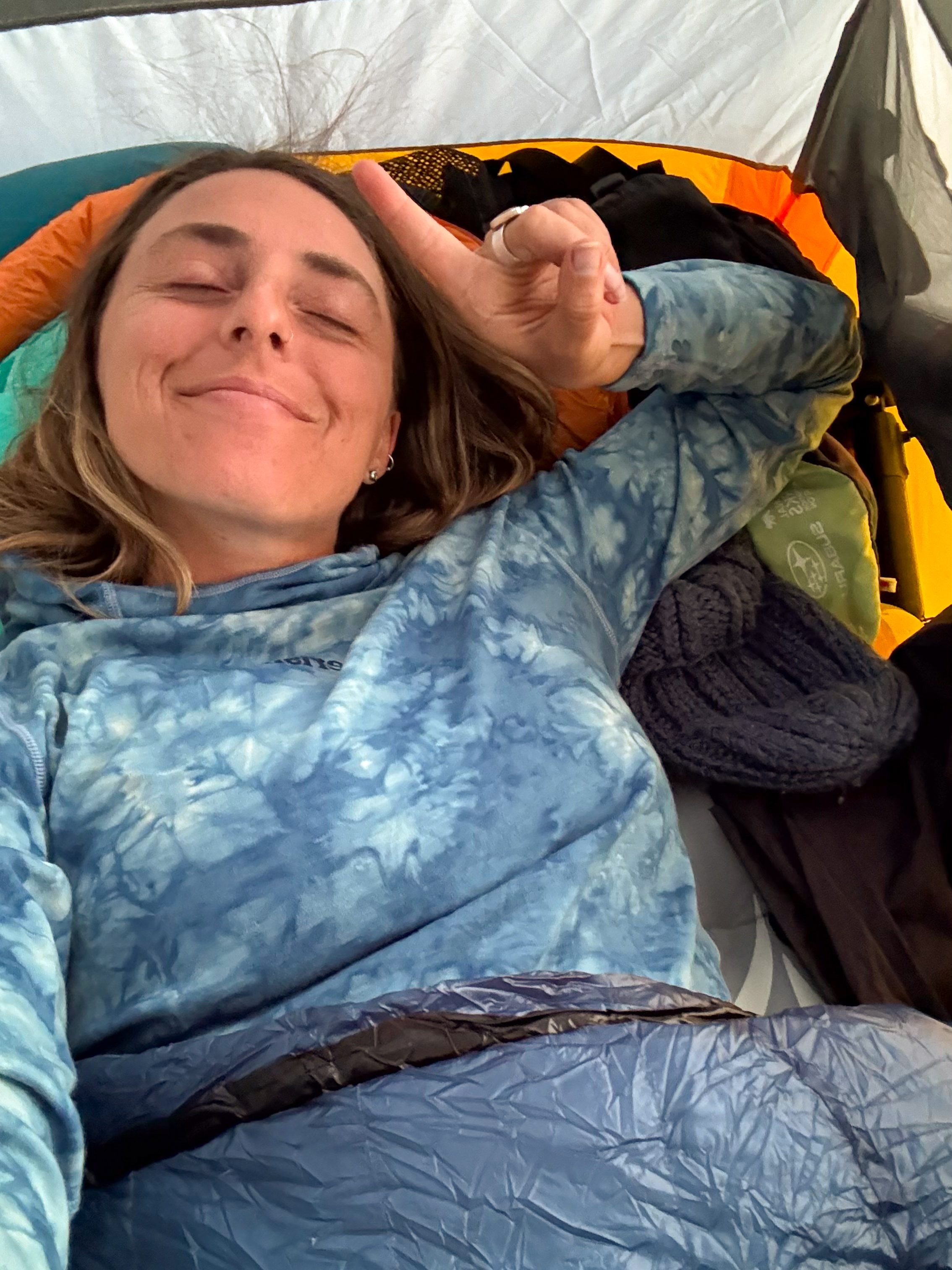
It was a perfect first night on trail. There was a light breeze through the night and it didn’t get too cold. I managed to sleep through the night without any issues. I awoke to the sunrise and was surprised by how good I felt. My body wasn’t sore from the 17+ miles and I was ready to have another great day on trail.

I prepared some coffee and breakfast as the sun climbed over the horizon and into the sky. Then I changed into my hiking clothes, packed up camp, had a look at the map to plan my day.
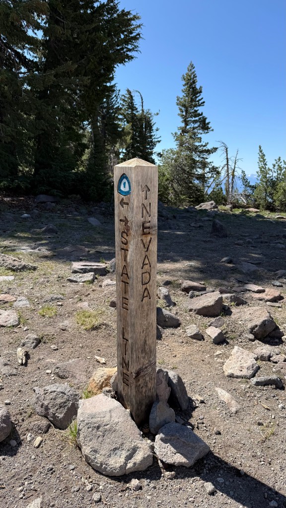
I was aiming for about 20 miles and looking at the FarOut map, I saw that in about 5 miles I would be crossing the Nevada/California border. In 10 miles I’ll get to Star Lake, my first lake of the trail. And in 12 miles I will reach my high point for the day at the Freel Peak Junction.


The day started with passing under a ski lift. After come climbing, the trees opened up to featuring beautiful views of Nevada before crossing the border into California. There were several good water sources along the trail today which is always nice.
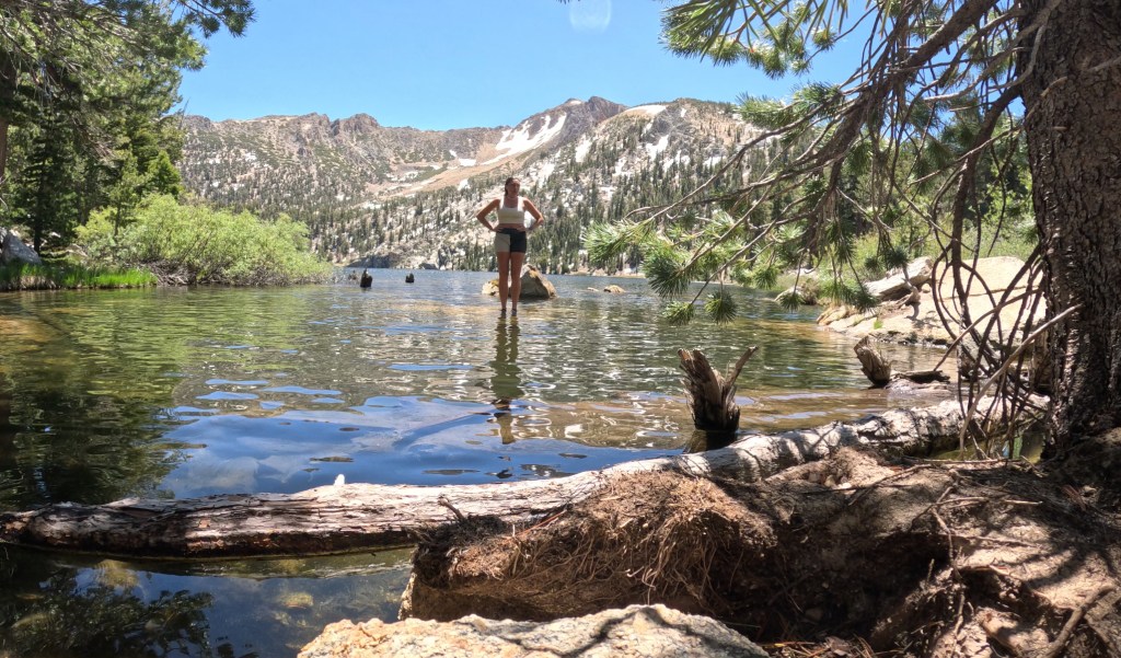
I made it to Star Lake before noon and stopped for a long midday break. I couldn’t resist taking a dip in the lake to cool off, it was freezing cold but felt amazing. I laid in the sun on top of my Tyvek ground sheet to dry. I had a snack, hydrated, stretched, had another snack, and hydrated some more. Once I felt hydrated, fueled, and dry, it was time to hit the trail again.
As I climbed toward my highest elevation for the day (the saddle before Freel Peak), I saw my first signs of snow in drifts or patches covering parts of the trail. It was nothing too scary or concerning, I definitely did not need my microspikes, and felt good about my decision to leave them behind.

I stopped for a break at the Freel Peak trail junction, looking back over the land that I had just traversed. It was very windy up there, with the wind blowing from the other side of the pass in the direction I was heading. There was one last little climb before mostly downhill the rest of the day.
As the trail trended downward there were many gorgeous views of Lake Tahoe and the surrounding area with lots of gorgeous exposed trail weaving through wildflower meadows. I took a break at the last water source for the day before setting off to find my campsite for the night.

It was a long day and it was getting late when I started looking for a campsite. I love a long day on trail with high mileage, but finding a campsite becomes harder after 6 pm. By then, most hikers have already found their spot for the evening leaving fewer options to choose from.
I had a couple of areas in mind for where to camp based on the FarOut comments. The sun was starting to get low when I came up on the first option. I found that two women were already there having their dinner. I stopped to chat and asked if they knew of any other spots nearby. With no luck, I continued on. The next spot I came to was also taken.
Personally, I do not like looking for campsites in the dark. Ideally, I like to have my tent set up before the sun starts setting. So when its getting close to sunset and I haven’t found a campsite, I start to get a little anxious. Luckily, about a mile later, I found a spot to set up camp as the sun was starting to set.
When I stopped the activity on my watch for the day, I was surprised to see that I had hiked about 20.5 miles and 6,800 ft of elevation gain!


I set up camp then prepared dinner, which tonight was Mac and Greens from Firepot. The meal was okay, but it was more food than I was able to stomach. I stashed my bear canister, did some stretches, and crawled into my tent to relax.
My legs and hips were sore which made it harder to fall asleep, but my exhaustion was stronger than the pain. I fell asleep shortly after the sun had set, but it was not a restful night. Around 1:30 am I jolted awake from a nightmare that a bear had broke into my car. Last year I made the biggest purchase of my life and got a 2025 Subaru Outback Wilderness that I love dearly. In my dream, the bear managed to get one of my car doors open, crawled in and the door closed behind them. The bear not knowing how to exit the vehicle, rips apart everything inside the car in an attempt at escape.
Now, this may have just been a dream, but this is something that commonly happens in the Lake Tahoe area. When I awoke from the nightmare, I had a sinking feeling in my gut that what I dreamed was true. My heart and thoughts started racing: how would I know if a bear broke in? What happens if they do? Does your car get towed? Would a ranger contact me somehow? Should I hike out in the morning and Uber over to my car to check on it? Is my hike over?
I realized my thoughts were running wild and I tried to calm myself down by acknowledging the present moment. It’s 1:30 am and I’m miles from the nearest road. There is nothing I can do in this moment, so I may as well try to go back to sleep and reassess the situation in the morning. Plus, it was only a dream, right?
Then, I remembered! When I bought the car, they had be download the My Subaru app which allows you to do things like, lock/unlock the car and check diagnostics. The app can tell me if my windows are closed, if the doors are closed and locked. When I opened the app my eyes widened and my stomach dropped.
There was a red alert stating that the passenger door was open and the car was unlocked… now I really started to panic.
I started at my phone screen for a while seeing if I can figure out any more information. I noticed in small font a date and time of when this information was last updated (6/18 at 7:55 am). What was I doing at that time?
At 7:55 am on 6/18 I was chatting with some ladies in the trail head parking lot with my passenger door open while I charged my electronics using my portable battery. This only slightly relieved my because it did not confirm nor deny whether my dream was true or not.
I didn’t have enough service to refresh the app, so I did my best to go back to sleep and would figure things out in the morning.
Day 3: 21 miles
I woke up with the sunrise and was surprised that fell back asleep after last nights nightmare and bear-anoia. Now that it was a new day I was feeling a little more clear-headed about the situation. I tried refreshing the My Subaru app again, and this time it actually updated!

And what a relief! The app reported that all windows and doors were closed and locked which eased all of my worries. I am so grateful for the My Subaru app and the ability to check on my car while I’m in the backcountry gives such peace of mind. Now every morning, refreshing and checking the app became part of my morning routine.


I prepared myself some coffee and breakfast, before packing up and hitting the trail. The day began with a descent into Big Meadow where the trail takes you through a trail head. I took the opportunity to use the restrooms and throw out some trash as I passed through.


Just beyond the Big Meadow Trail head, the trail leads you through a lush and beautiful meadow before you start climbing up towards Round Lake. This section of trail would have more frequent water sources and I was relieved to not have to carry as much water between sources.
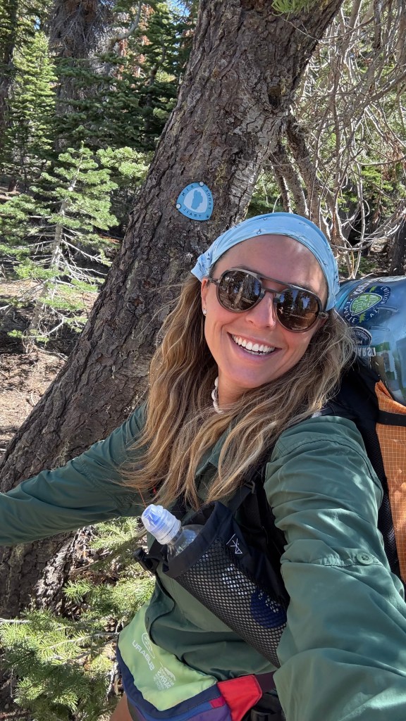
I had been looking forward to today. Not only would there be more water sources and lakes, but the TRT will meet the PCT! The PCT and TRT overlap for about 50 miles, through one of the most beautiful and popular sections of the trail, the Desolation Wilderness that I would be getting to tomorrow. I love hiking alongside PCT hikers and chatting with them about their experiences on trail, so I was really looking forward to this section of trail.

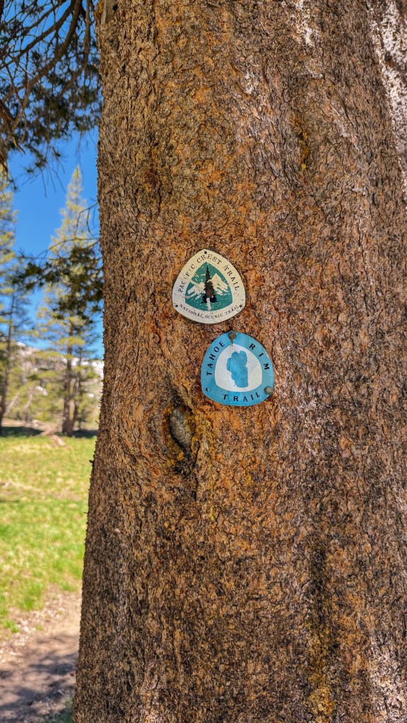
After Round Lake, I soon hit the PCT/TRT trail junction, then continued up toward Showers Lake. As soon as the two trail convened you felt a shift in the energy on trail. I hardly saw other hikers the last couple of days but now, every time I would stop for a break or to filter water, a PCT hiker would pass me. In general, the PCT hikers had a very positive energy about them. Every hiker that passed cheerfully greeted me and asked how things were going.
Their energy lured me in and I found myself tagging along with a group of them for the rest of the day. We chatted about the trail and life outside the trail. I learned everyone’s trail names and some of the stories behind them: Tinder Slayer, Trouble, Pipe Bomb, FreeBird, and Kiki. I learned that the positive energy among the group was due to today being a town day. This meant they would be hitching a ride to the nearest town for the night.
There was some snow on this section as we headed North toward Echo Lake and the Desolation Wilderness. Before reaching Echo Lake, the trail crosses Highway 50. There is no camping allowed between Highway 50 and the border of Desolation Wilderness.
My original plan was to camp somewhere south of the Highway 50 crossing before the no camping zone. Since I was keeping up with PCT hikers, who hike a fast pace, I found myself at the Highway 50 crossing earlier than I expected. Having already reached the no camping zone, I didn’t want to backtrack looking for a campsite. So I decided to hitch with my new PCT pals into South Lake Tahoe for the night.
I hadn’t planned on a town day this early in my hike, but I wanted to make the most of the moment. So Tinder and I smiled and waved at the passing cars with a thumb in the air. There were 4 of us which makes hitching a little more difficult because not many people have space for 4 and all out packs. The plan was for 2 of us to flag down a car. When one stopped, we would ask if they could fit all 4 of us. If not, we would just hitch 2 by 2.
Tinder has a ritual of playing music while waiting for a hitch. Whatever song is playing when a car stops becomes the “lucky hitch song.” This song is played first the next time he tries for a hitch. Today, the first song was Superbass by Nikki Minaj, and our lucky hitch song ended up being Higher by Creed.
A young man and his dog pulled over to pick us up. Luckily, there was enough room for all 4 of us to squeeze into the back. He wasn’t going as far as we wanted, but we accepted the ride anyway. He dropped us off in a parking lot not too far from town. We got lucky with a second hitch from a kind woman and her 5 year old son who brought us to a super market in a more central part of town.
From here, we each went our own ways. One was looking for a trail angel’s yard to crash in. Another was staying with family who came to visit. I set out looking for a good meal and a room for the night. I picked up some Pad Thai and a cold soda from a spot called MyThai. Then, I walked to the High Country Lodge who was able to reserve me a room at their sister property a few doors down.
It was a pretty spontaneous end to the day and I am very happy with how everything panned out. I wasn’t expecting to have a restaurant meal, shower, and clean soft bed tonight, but I am glad it happened and was grateful for a taste of the PCT experience.
Day 4: 21.4 miles
I had a great night sleep in the comfy motel bed but was ready to get back into the wilderness. Today I will be entering the Desolation Wilderness. The section everyone says is the most beautiful on the Tahoe Rim Trail and I was very excited. I went to Ernie’s Café next door to the motel. I ordered a breakfast burrito and coffee to go before calling an Uber to bring me back to the trail. I enjoyed my ride back to trail, chatting with my Uber driver about hiking and our life goals. She wished me luck and dropped me off at the Highway 50 road crossing, a few miles south of Echo Lake.
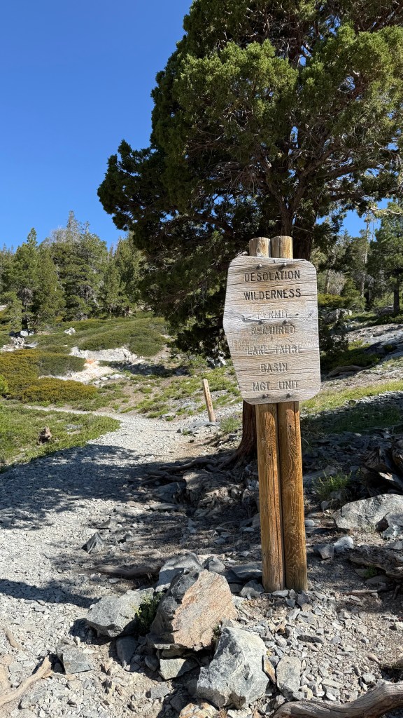
I hit the trail and was soon walking around Echo Lake and entering the Desolation Wilderness. Desolation Wilderness is the only section of trail that requires an overnight permit. Weekend/overnight backpackers have to reserve their backpacking permits for designated camping areas. The TRT thru-hiking permit gives you more freedom with where you spend the night, but limits you to 2 nights in the Desolation Wilderness boundary.
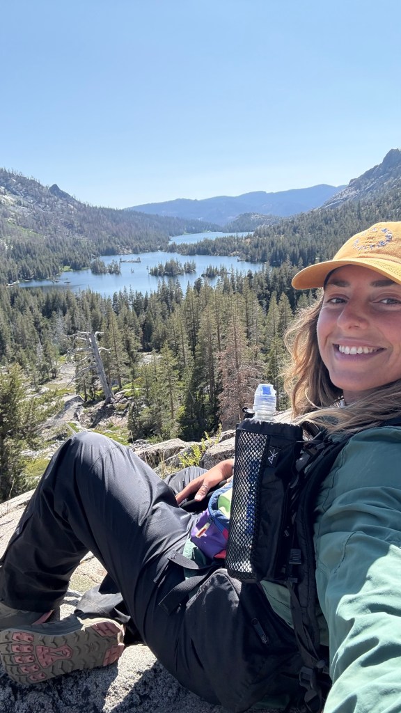
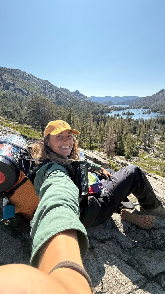
The trail skirts around Echo Lake and it climbs towards Lake Aloha, the most popular overnight backpacking destination on trail. This was the most crowded section of trail with dozens of weekend backpackers looking to spend a night next to an alpine lake. So, if you prefer solitude, I would recommend hiking past Lake Aloha to Heather Lake, Susie Lake or Gilmore Lake.


So far mosquitoes have not been an issue. I had hardly seen any on trail until I got to Lake Aloha. I stopped for a break and to take some photos of the lake and was swarmed by a cloud of them. I took it as my sign to move along.
It was nice to leave the mosquitoes and crowds behind and I climbed higher into the alpine. I can see why Desolation Wilderness is the most popular section of trail. It’s stunning, especially with a little snow still left on the mountains, emphasizing the ruggedness of the landscape.

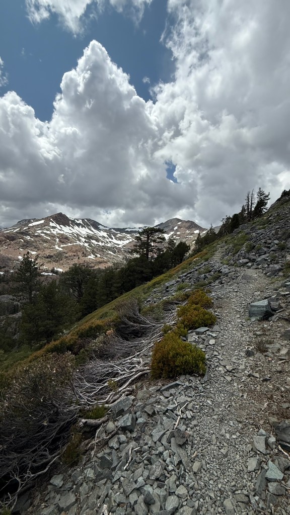

One of my favorite views on this stretch of trail was the last 3 miles before Dick’s Pass. The trail is exposed with a gorgeous view of Half Moon Lake framed by snowy mountains on the left, and a peek at the pass ahead. As I climbed, the wind stared picking up and the clouds were getting thicker and darker and as Dick’s Pass came into view, it began to snow. It was the type of snow that falls in chunks and it was accumulating quickly.

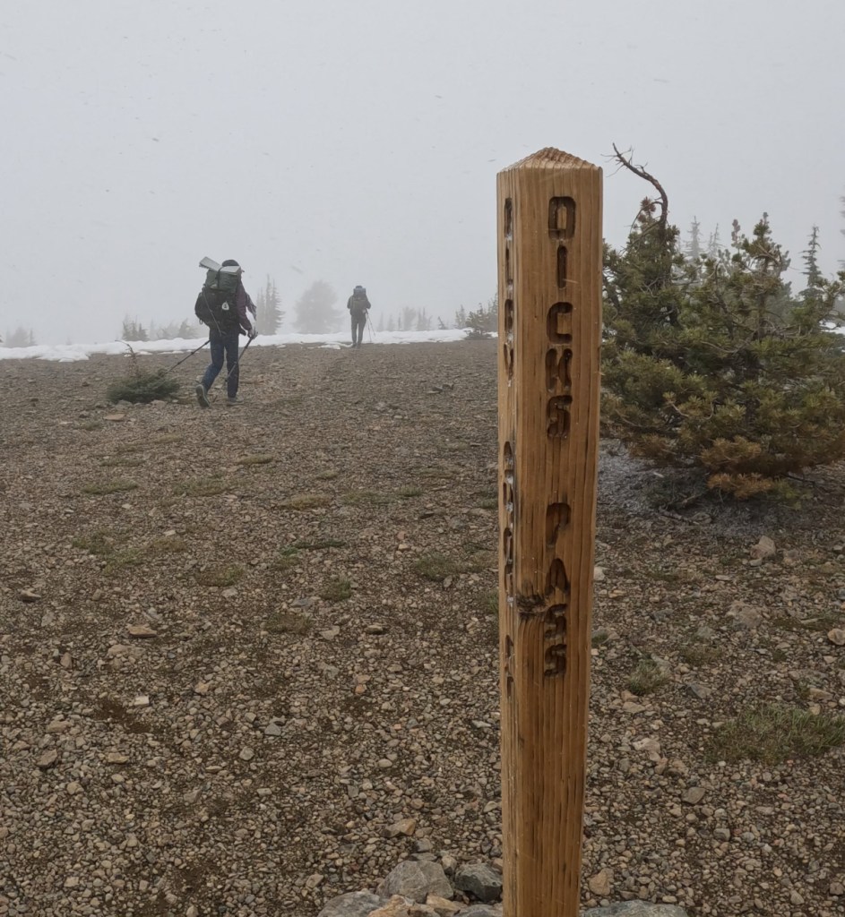

I threw on my puffy jacket and poncho, questioning my decision to leave my micro spikes and base layer leggings behind. The storm was blowing over from the north side of the pass making the trail conditions even worse on the other side. I had read a comment on FarOut that there was 1.5 miles of snow navigation before you can see the trail again. With the high winds, and quickly accumulating snow, I became nervous and started to panic.
I thought to myself, this is exactly the scenario you hear about when someone dies in the mountains, “Unprepared hiker gets hit with unexpected snow storm on an exposed portion of trail and dies from exposure.” I would not let that be me, so I had to come up with a game plan.
Whenever I am backpacking alone and find myself in a sticky situation or start questioning the safety of the trail, I wait for another hiker to come along to help me re-assess the situation with a fresh pair of eyes and from a different perspective. After all, there is usually safety in numbers!
Luckily, this section is still part of the PCT so it wouldn’t be hard to find someone, and sure enough, I came upon 2 other hikers just before reaching the summit. I figured, the PCT hikers have been out here for over 1,000 miles at this point and have already done a few hundred miles through the Sierras, so surely they would know how to handle this situation.
I introduced myself to the two hikers and tried to make some small talk, but they did not seem very talkative. I expressed my uneasiness with the weather and asked how they were feeling about it. They didn’t seem concerned by the weather — more annoyed than anything — and were still deciding what to do. They weren’t very communicative with me, but being near them made me feel safe so I tagged behind them as they carried on into the storm.
At the top of the pass, we ran into another 2 PCT hikers who seemed more concerned about the weather and were considering turning around. One of them had slipped on snow a few days earlier requiring a hospital visit and stitches and they wanted to play it safe. Their concern for safety (and willingness to communicate with me) comforted me, so I decided to tag along with these new hikers instead.
The original pair continued over the pass and my new friends turned back to look for a dry spot to spend the night out of the snow. I followed. We started hiking back down the switchbacks that we huffed and puffed our way up just a few minutes ago. About an hour and 2.5 miles down from the summit, the snow and wind stopped. The clouds dissipated. The sun came out, revealing a clear blue sky and perfect conditions.


More PCT hikers started passing us heading up the pass and I started to question my decision to turn around. I stopped for a break to sit and think about my next move. I was annoyed that I would have to re-climb those 2 miles to the top, but was proud of myself or playing to safe, and relieved that the storm had passed. I later found out that this freak storm caused 10 ft swells on Lake Tahoe, capsizing a boat, killing 8 people. This news reinforced that I had made the right decision in turning around and waiting for better conditions.
At least this time climbing over the pass I got to enjoy the view without white-out conditions. I was also pleased to find that the 1.5 miles of snow navigation on the other side was only a half mile section, and because of the few PCT hikers that had gone ahead of me, there were already fresh boot tracks to follow.
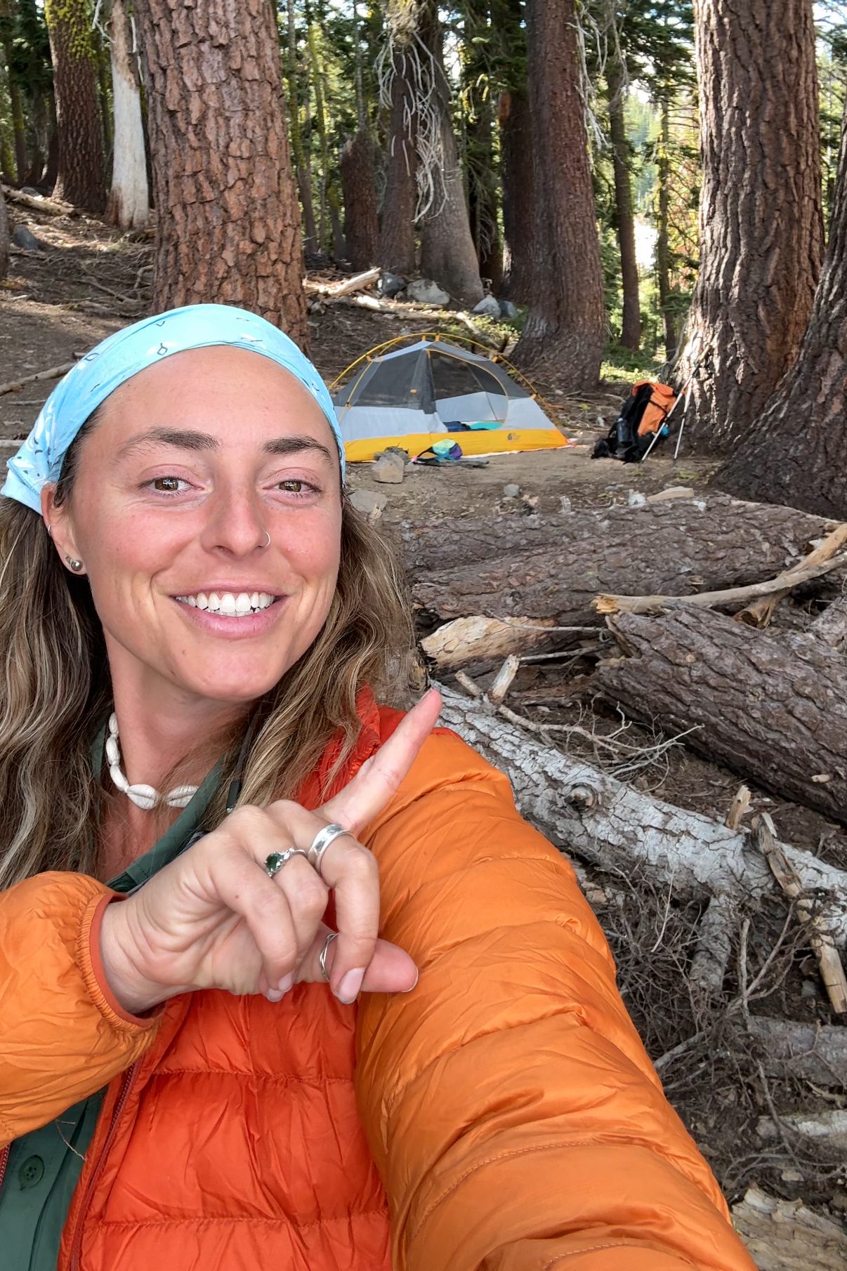
It was really beautiful hiking through the fresh snow, the way it clung to the pine trees and crunched under my feet, it was a winter wonderland! Once I made it past the snow sections, it was time to start looking for a campsite. Most of the sites were either covered in snow or already taken since it was getting close to sunset. I hiked a little further than I hoped, but I found a flat and dry spot at Lake Fontanellis before it started getting dark. I set up camp, then found a spot next to the lake to cook and eat dinner.

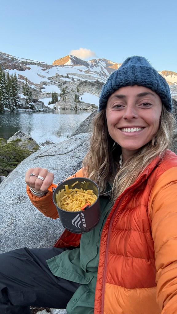
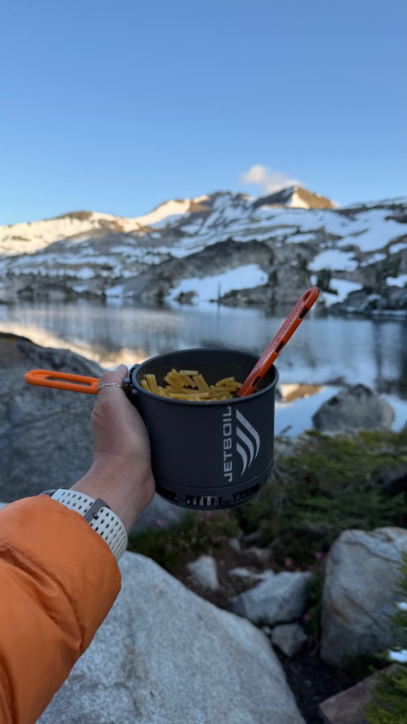
I had been saving my favorite meal for a hard day and today felt like that day, so plant-based Kraft Mac n’ Cheese it is! After my delicious dinner, I cleaned up, stashed my Bear Canister, and crawled into my sleeping bag hoping for a restful night.
Day 5: 18.2 miles

It had been the coldest night on trail so far. Not so cold that I was uncomfortable, but the perfect amount of cold that made my quilt feel cozy. I had the most solid night sleep so far on trail even though I woke up a few times to toss around. I woke up as the sun was rising. Some condensation had accumulated on my tent and I hoped the sun would evaporate it all as I prepared and ate breakfast. I made myself some instant coffee with oat milk creamer and arroz con leche as the sun spread over the landscape.
I left Lake Fontanillis and soon skirted around Middle Velma Lake which had several great campsites. If I had known about them, I probably would have pushed a little further the day before to stay there.


The trail continues down and about 8 miles into my day I exited the Desolation Wilderness area. About 2 miles after that, I came to Richardson Lake where I stopped to filter water. I saw a PCT hiker pass by and a little ways down the trail I noticed they stopped to look at something on the ground, picked it up, then moved on. Soon after another hiker came along, stopping at the same spot, exclaiming, “Hello there! Thank you!” When I hopped back on trail to investigate I was excited to find my first ever trail magic!
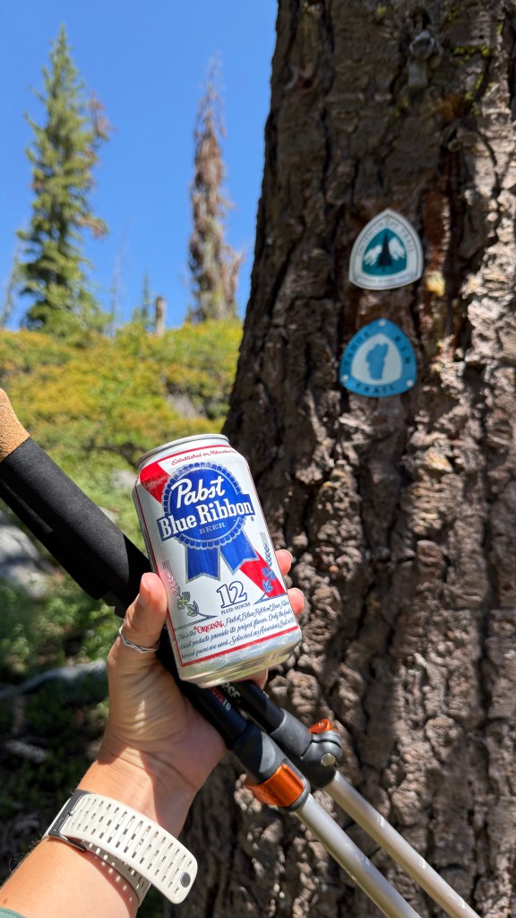
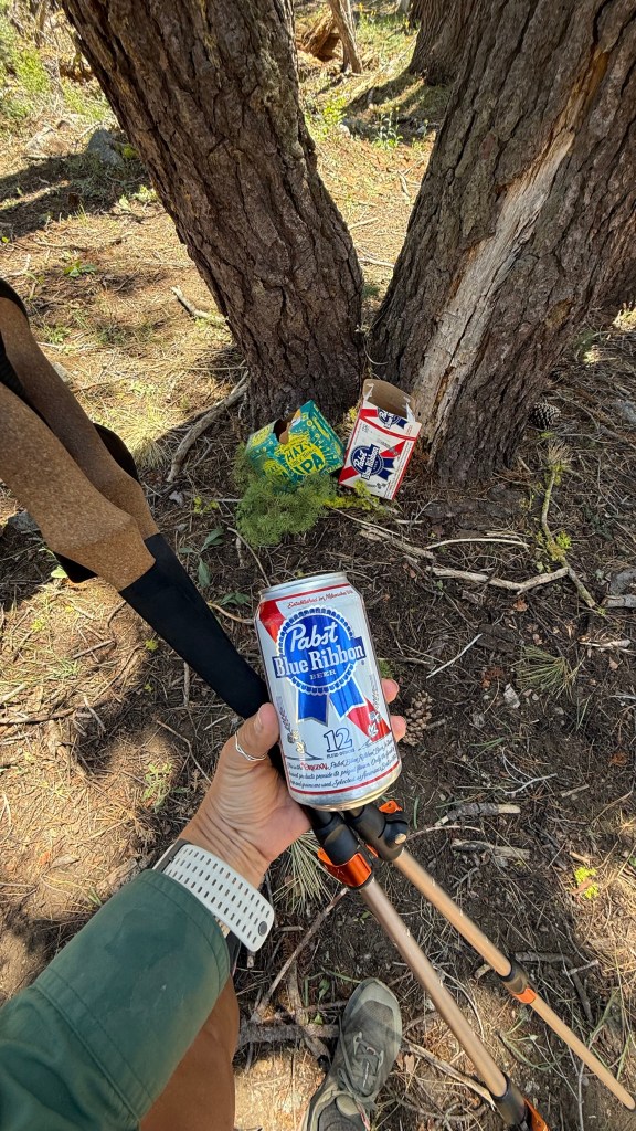
Trail magic is something usually reserved for thru-hikers on long trails like the PCT, and me still being on the section that overlaps with the PCT, it makes sense that I would find some here. Some trail angels set up at trailheads with yummy food, some offer rides to town, and some cache water, beer, and other beverages along the trail. This one was 2 cases of beer: IPA and PBR. I took a PBR and saved it in my pack for later to have with my dinner.

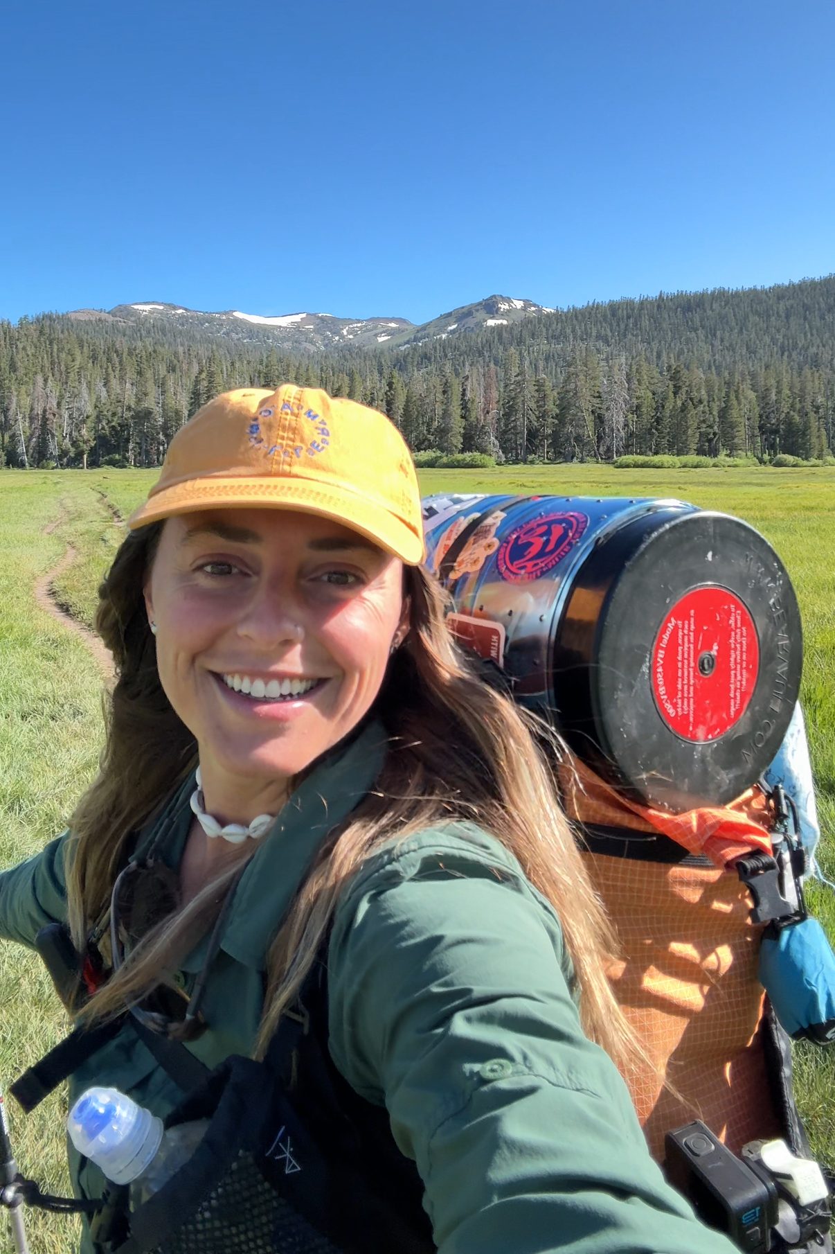
Today was a pretty ideal day on trail. I woke up in a beautiful place, the trail was easy with mild elevation gain, plenty of water sources, and now trail magic! Towards the end of my day I passed through the Barker Pass Trail head, then climbed up toward Barker Pass. There were some really beautiful sections of trail on the way up with volcanic looking rock and exposed trail featuring panoramic views.
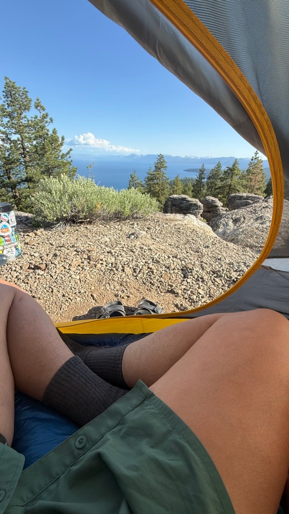
Just after the saddle junction the trail descended and on the way down, a campsite caught my eye. Even though I was hoping to get in a few more miles for the day, this campsite was just too good to pass up. It was perched near the edge of a basin with tree cover and a clear view of Lake Tahoe. This was one of my favorite campsites of the trip, and definitely was the best view!

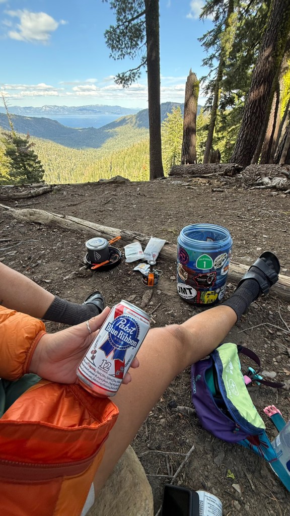

I set up camp, then sat on one of the log benches someone had placed facing the lake so I could cook with a view. I cracked open the beer I had been saving from earlier and prepared my other favorite backpacking meal which is spicy peanut noodles. I love mixing a packet of peanut butter into any of the Momofuku noodles. The trick to this meal is to only strain out half the water, and use the rest to mix with the peanut butter and spicy sauce packet.
As if the day couldn’t get any better, I was blessed with a vibrant sunset, lighting up the sky in shades of orange and pink. I curled up under my quilt and listened to the wind in the trees as I fell asleep.
Day 6: 15.3 miles
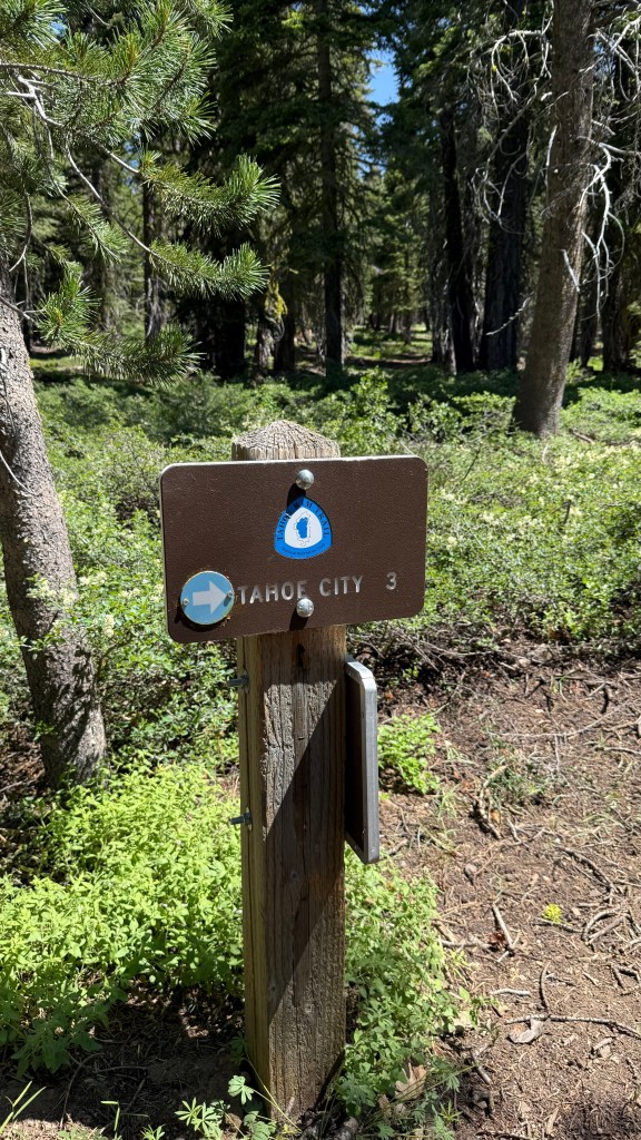
I woke up with energy today because today was a town day! In about 14 miles I would be hiking into Tahoe City where I had a hotel room and a resupply box waiting for me. Tahoe City is the most convenient resupply location on the Tahoe Rim Trail because the trail takes you right into the town where you can easily access food, stores, gear, and a place to stay.

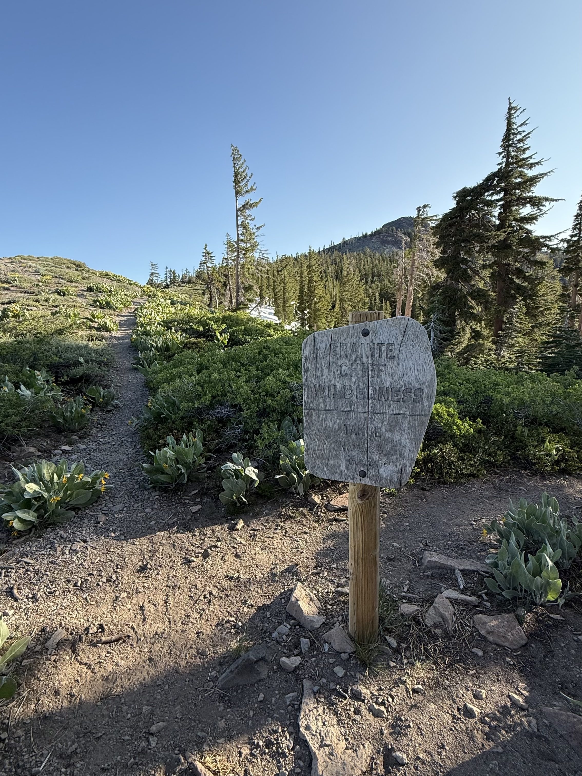
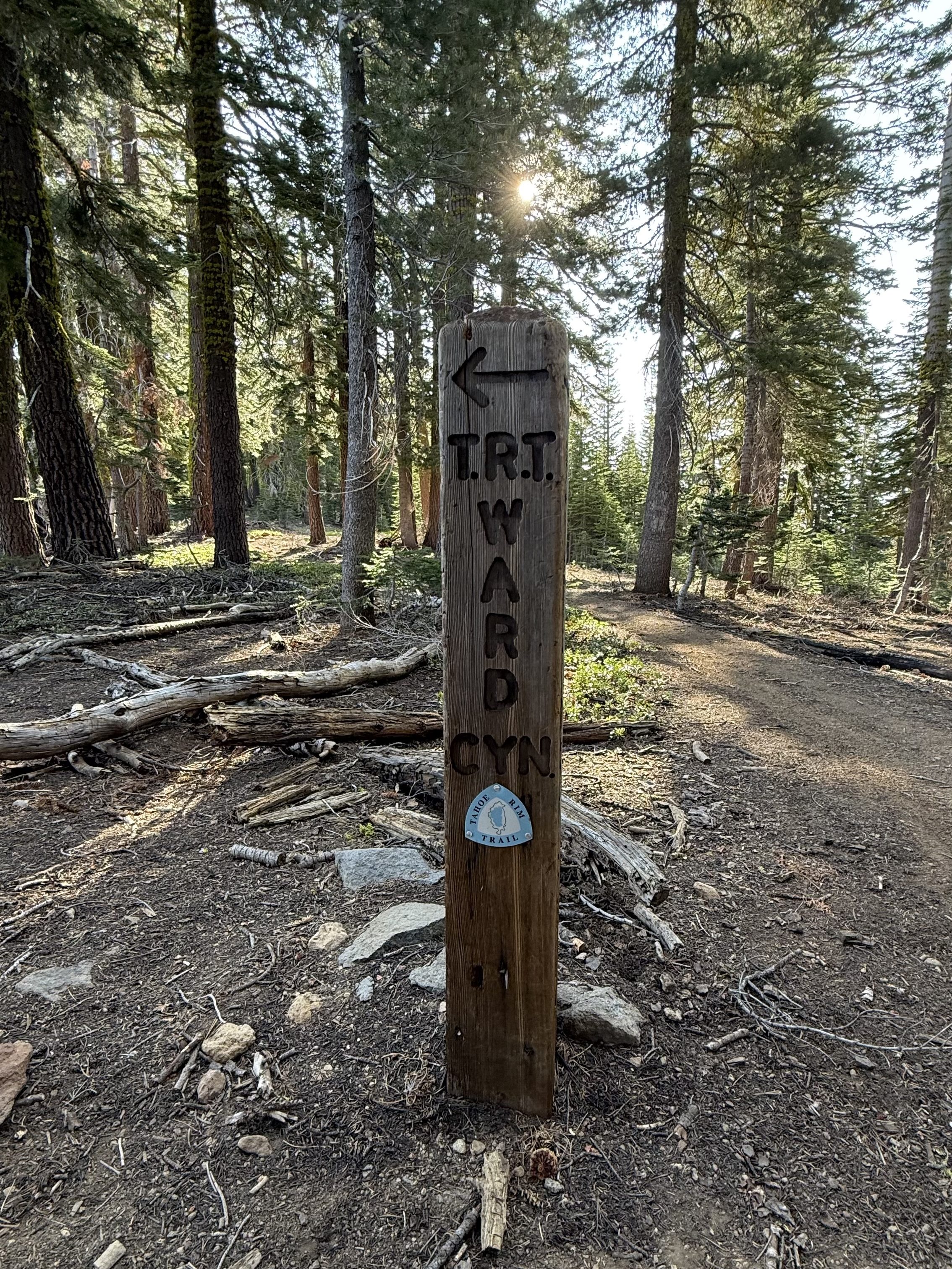
After a quick descent to North Fork Blackwood Creek, the trail climbed up and into the Granite Chief Wilderness, where the trail also split from the PCT. After passing the turnoff for the Twin Peaks Summit, the trail descends and follows Ward Creek. My achilles was bothering me today and I was thinking that maybe it was from the heel back of my shoes which had not fully been broken in before starting this hike. Walking along Ward Creek really felt like a drag with my injured achilles and I started to limp to accommodate. I ended up folding down the back of my shoe, so it was more like a slip-on than a sneaker, but it was helping to ease my achilles pain so I stuck with it like that for the rest of the day.


The trail climbs a bit up to Page Meadows before descending to the Truckee River and the highway crossing into town. Once I crossed the street into town, my spirit was rejuvenated and the stoke was high. Even though I was limping from the pain in my achilles, I made it to town earlier than I expected.

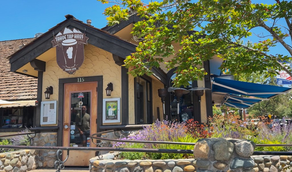
First stop, food! It was too early to check into my hotel room so I had a few hours to kill. Knowing how dirty and stinky I was, I wanted to make sure that whatever restaurant I went to had outdoor seating to spare the other patrons. I settled on Tahoe Tap Haus and enjoyed a plant-based burger and beer on their patio. My meal really hit the spot and was just what I needed. I got a few stares from tourists walking by on the sidewalk, whether it was because they were confused by my pack, smelled my stench, or saw the dirt on my face and legs, and the salt stains on my shirt, I’ll never know, but I did get a kick out of it.

I still had time to kill after finishing my meal, so I went for a walk around the town scoping out my options for dinner later, and to look for a good spot to take a dip in the lake. There was a bike path that goes right along the lake shore and past a small public beach. I posted up on the rocks beside the path and slowly got into the water. The water felt refreshing in contrast to the hot sun.
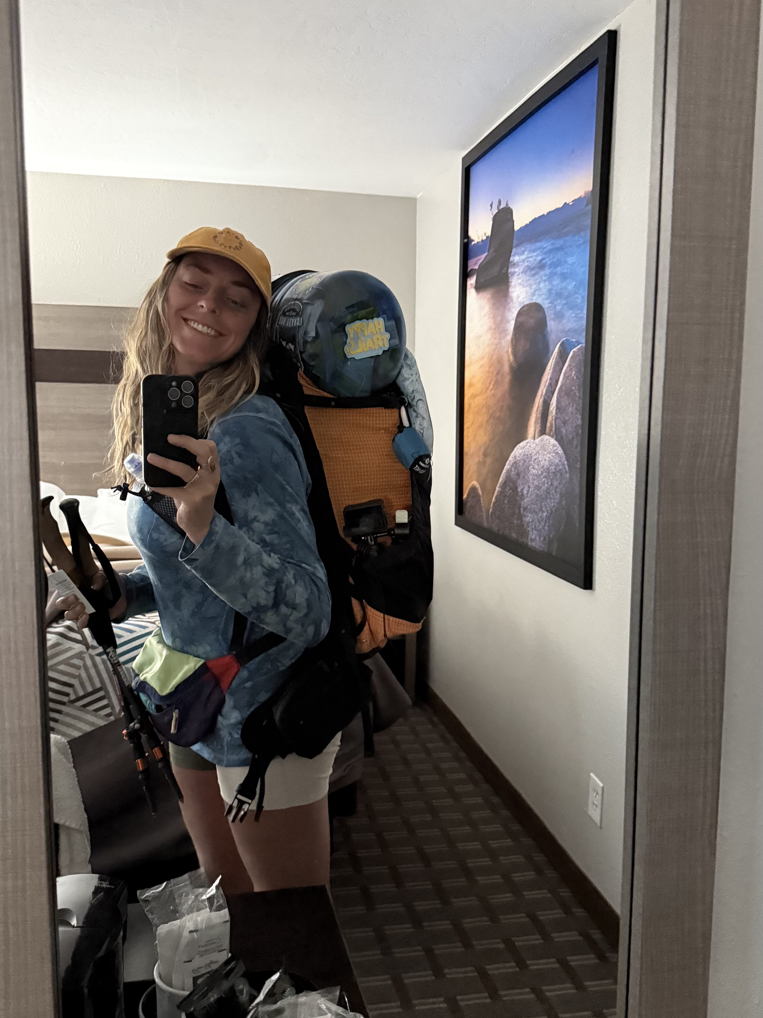
I laid in the sun for a bit listening to a podcast as I dried off. When 2 pm rolled around, I headed over to the Pepper Tree Inn. Luckily they let me check in a little early, and my resupply box was still there from when I dropped it off 6 days ago!
I checked into my room and immediately stripped down to take a real shower. Lake dips are nice but every once in a while I need a hot shower with soap! I watched the dirt mix with the soapy lather and drip down my body. I scrubbed my pits multiple times trying to get rid of the smell that has seemingly absorbed into my skin. And to help me feel extra fresh and clean, I even packed a disposable razor in my resupply box.
I also washed my hiking socks, sports bra, shorts, underwear, and hiking shirt in the shower, rinsing and ringing out each item multiple times trying to get the dirt out. I put on my rain pants and my base layer top then dumped out my resupply box to evaluate what my food for the next few days would look like.
I evaluated what was left in my bear can realizing I didn’t use as much fuel or eat as many of my snacks as I thought I would, and there was more in my box than I thought I needed to finish the trail, so I would have to leave some of it behind. I organized and packed 5 days, 4 nights of food into my bear canister and put the rest into the cardboard box that was my resupply.
I laid in bed and called my husband to check in and update him on my adventure. I also called my mom who always worries about me when I’m backpacking even though she lives on the other side of the country, but you know how mama bear’s are with their cubs, very protective!

After a couple hours on the phone it was time to venture out dinner. Conveniently, right next door to the Pepper Tree Inn is Fat Cat Bar + Grill where I decided to go for dinner. I ordered a 32 oz beer, fried pickles, and the Thai Chili Tacos that were so so good.
I ate everything on my plate, finished the beer, and paid my bill, looking forward to crawling back in the comfy hotel bed. I scrolled through my photos and videos from the trip so far, reliving the journey up to this point. I even started working on some recap reels to share when I finish the trail. (I always post my adventures on a delay for safety purposes!)
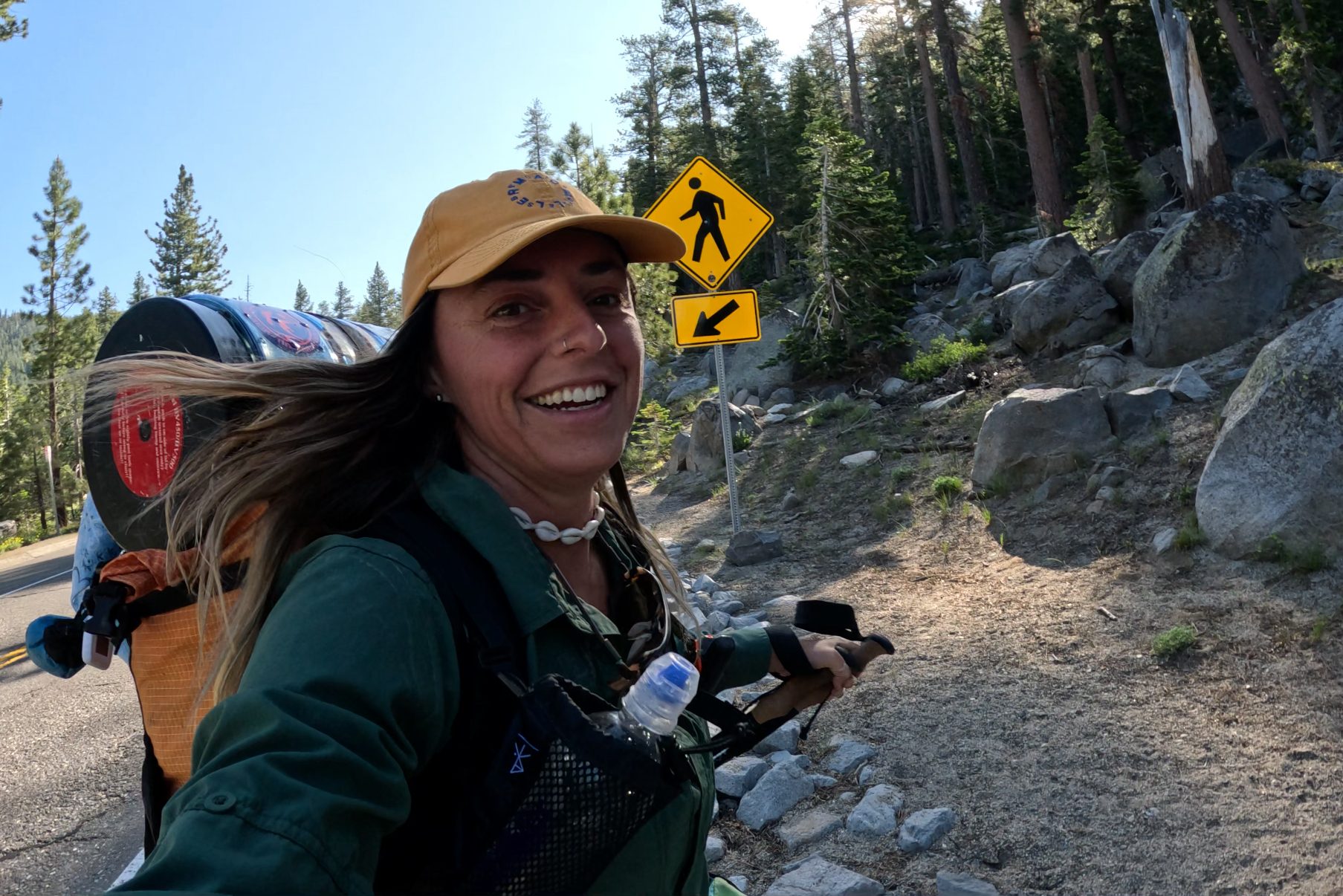
Day 7: 22.7 miles
I was not in any rush to leave the cozy hotel bed, but I was wide awake by about 6am and was ready to start hiking! I checked google maps for a coffee shop that was open early and surprisingly there weren’t many options. A little spot called The Dam Café was opening soon and was on the way back to the trail, perfect! I ordered a breakfast burrito and a dirty chai latte which I ate out on the patio, then it was time to hit the trail!

The trail climbed up out of Tahoe City and alternated between uphill and downhill the rest of the day. Heading North from Tahoe City, I knew I would have to start paying attention to water sources again. The first water source today would be Watson Lake, about 14 miles into the day and aside from a couple of streams just past the lake, it would be a 17 mile water carry to a reliable stream after Relay Peak the following day. I passed a couple of water caches left by trail angels and noticing I was running low, I helped myself to some (thank you trail angels!) And I passed a couple of bike packers who I chatted with for a while, and as I was leaving, they told me to check out their bear canister which had been scratched up by a bear the night before.

The trail passed several abandoned dirt roads and other hiking trails, winding mostly through forested areas. Tomorrow will be a big day climbing up to Relay Peak, the point of highest elevation on the Tahoe Rim Trail at around 10,280 ft.
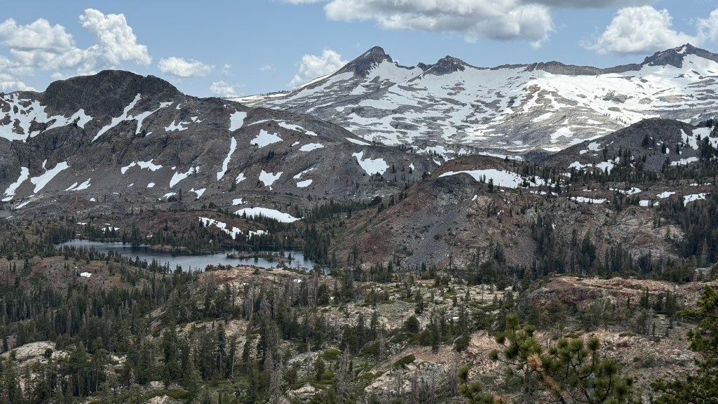
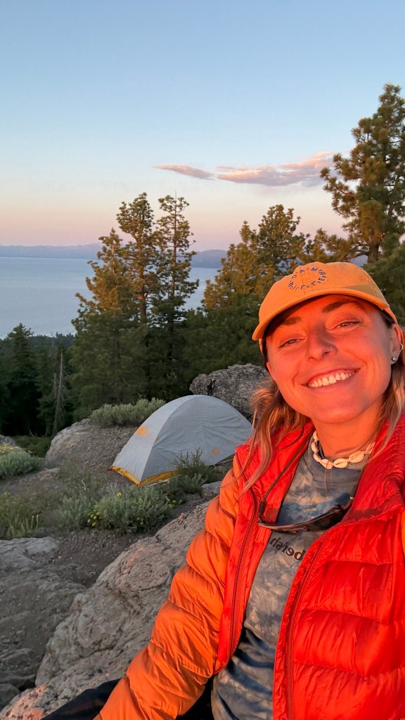
Shortly after passing the Brockway Summit Trail head I started looking for a campsite and was able to find an excellent one up by Picnic Rock Vista. This was another one of my favorite campsites of the trail because I had a panoramic view featuring Lake Tahoe in one direction and a snowy mountain range and turquoise lake in the other direction.
A thick cloud was forming and heading in my direction. I started to hear the low rumble of thunder and hurried to set up my tent in case it started to rain. My campsite was pretty exposed and probably not the best place to be when lightning strikes, but I crawled into my tent and waited for what was to come. The thunder grumbled overhead, but the rain never fell and soon it was clear blue skies once again.
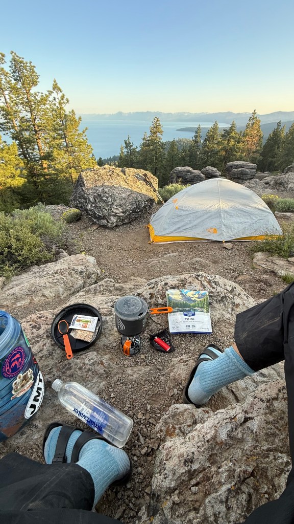
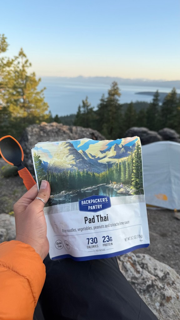
As usual, I prepared my dinner as the sun started to set. Tonight for dinner I had the Backpacker’s Pantry Pad Thai, a classic! Followed by Haribo Sour Streamers for dessert. A curious chipmunk circled me as I ate, but I know better than to feed them. So, I shooed it away.
Once the sun disappeared behind the mountains, and stars revealed themselves in the night sky, it was time for bed.

Day 8: 22 miles
I woke up to a beautiful sunrise over Lake Tahoe. I was in the middle of my longest dry stretch of 17 miles between water sources. It’s not a good idea to rely on finding water caches from trail angles, and I didn’t cache any water myself so I would have to rely on streams and lakes along the way. Knowing there would be several water stretches that were 10 miles or more, I planned to hike bigger mile days to ensure I would come across a water source every day.

To conserve water this morning, I skipped coffee and a cooked breakfast and snacked on a nature valley bar as I watched the sun rise over the lake. As I switched my socks, I noticed that my achilles was swollen and feeling sore. There was also a giant, but painless blister on the back of my heel. I took a couple of ibuprofen and put on my hiking shoes.
I packed up camp, then hit the trail eager to find the “reliable spring” about 8 miles ahead that would be my first water source of the day. I was also looking forward to crossing back over the California State Line into Nevada, and Relay Peak, the highest point on the Tahoe Rim Trail at about 10,300 ft elevation.


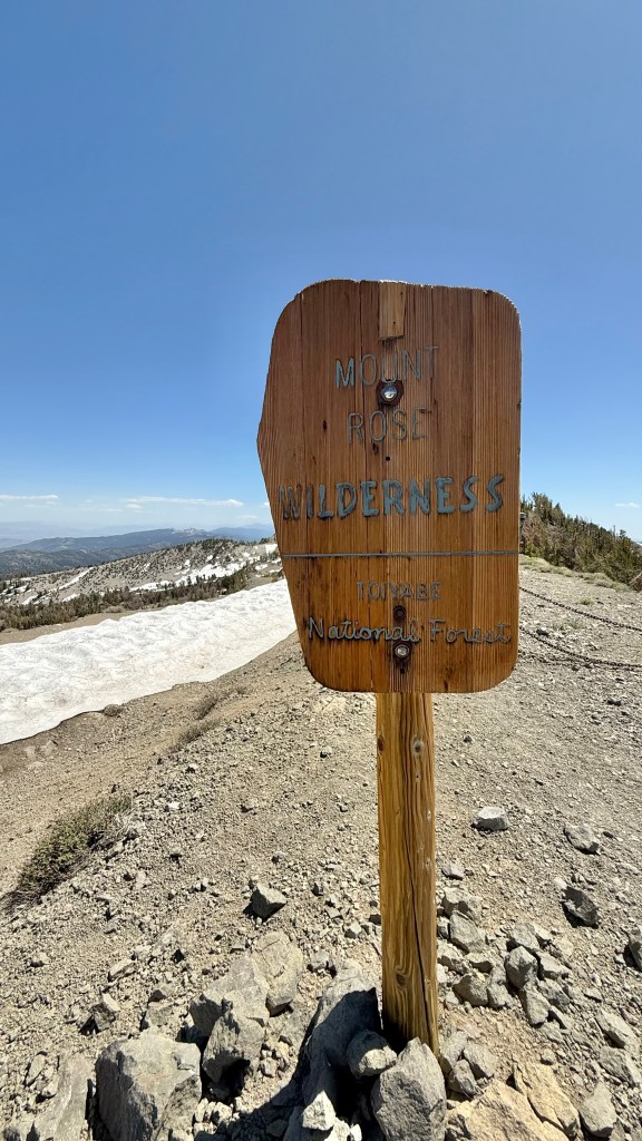

The views today were stunning. There were sweeping views of the lake and various bays and inlets along the shore. Wildflowers like lupine, paintbrush, and woolly mule’s ear coat the landscape on the exposed sections of trail. There were patches of snow covering the trail around the trail marker indicating the CA/NV state line. Several more patches of snow were closer to the top of Relay Peak.
I sucked on cherry Ricola’s to stave my thirst and keep my mouth from going dry. Finally I came upon the “reliable stream.” I took off my pack, filled up my water bladder and sat against a boulder to filter and drink until I felt rehydrated. I had some snacks as I “camel-ed up” for the rest of the day, not knowing how reliable the upcoming water sources would be.


Not too long after the water source, I reached Relay Peak. At the summit I took a moment to analyze the map and start planning my campsite for tonight. The Mt. Rose Campground was coming up in about 6 miles.
3 miles around the campground is a no camping zone. So, either I check if they have room for a walk up hiker and pay to stay at the Mt Rose campground for the night, or I have to push on past the no camping zone and dispersed camp for free. I always prefer dispersed camping to staying at a campground, especially if I am backpacking. But, making it past the no camping zone would mean a 22 mile day and I could feel that my achilles was angry with me.
After following a beautiful ridge covered in wildflower meadows, I quickly descended to Mt. Rose and hiked on past the campground. I walked through the beautiful meadow and stopped for water before the trail climbed uphill. I hiked until I found a viewpoint that was out of the no camping zone. Then I set up camp just before the sun began to set.

As I ate my dinner of vegan mac and cheese, I analyzed my remaining miles and realized I could make it back to Spooner and finish the trail tomorrow, making this my last night on the TRT! Which meant I would be finishing the trail one day ahead of schedule. I had cell phone service at my campsite and used it to reserve a hotel in South Lake Tahoe for tomorrow night beginning my weekend of rest and relaxation.
I was stoked! I only had 21 miles and one of the trickiest parts of the trail left on my longest solo thru hike yet.
Day 9: 20.7 miles

It was an exciting morning because it was my last morning on trail! I had extra food in my bear canister since I was a day ahead of schedule and tend to over pack when it comes to food anyway, so I ate a couple nature valley and Lara bars for my breakfast as I packed up and hit the trail. On the last 21 miles of trail it would mostly be exposed and dry, passing maybe one or 2 streams along the way.
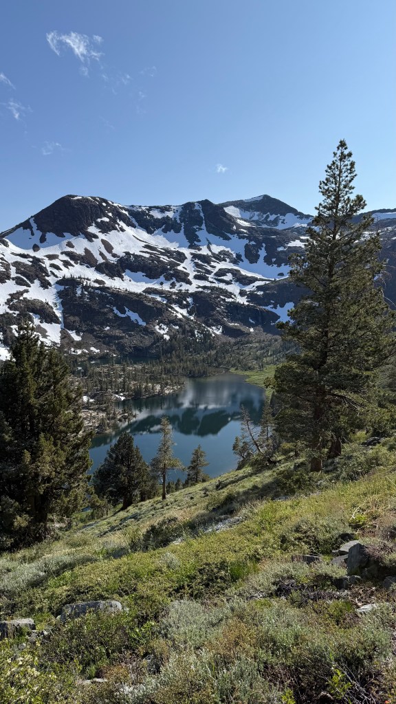
Today was another day of sweeping views, exposed trail, and beautiful wildflowers. The section of trail overlooking Marlette Lake with Lake Tahoe, and the Desolation Wilderness in the background was probably my favorite view on the entire trail and felt like a perfect way to be ending my solo adventure.

I soaked in the views and reminisced on the beautiful memories I made on trail, savoring the final miles of the TRT. Soon, I heard the sound of cars zipping up and down Highway 50. My mind starting filling with thoughts of cold beer, pizza, showers, and the crisp clean sheets of the hotel room bed that was waiting for me.
I would be coming up to the most dangerous and scary part of hiking the Tahoe Rim Trail, crossing highway 50 during rush hour on a Thursday evening. Cars zipped by in both directions on the 5- lane highway. I wondered how long it would take for there to be a long enough break in traffic to safely cross. I stood in the heat on the side of the road thirsty and tired, swiveling my head back and forth for half an hour. I shed a few tears of frustrating wondering if I would have to wait until dark for the traffic to calm down.
Finally there was a break in traffic that seemed long enough for me to sprint across. Sprint is a generous word for the max speed of someone carrying a 25 pound backpack after already hiking 22 miles that day. But I made it! Soon, the trail head with Felisha, my 2025 autumn green Subaru Outback Wilderness, was in sight. She looked exactly as she did when I left her 9 days ago. I was greatly relieved that no bear or person had broke in while I was away. I felt the weight and pride and satisfaction accomplishing my goal as I exclaimed, “I did it! I did it! I freakin’ did it!”
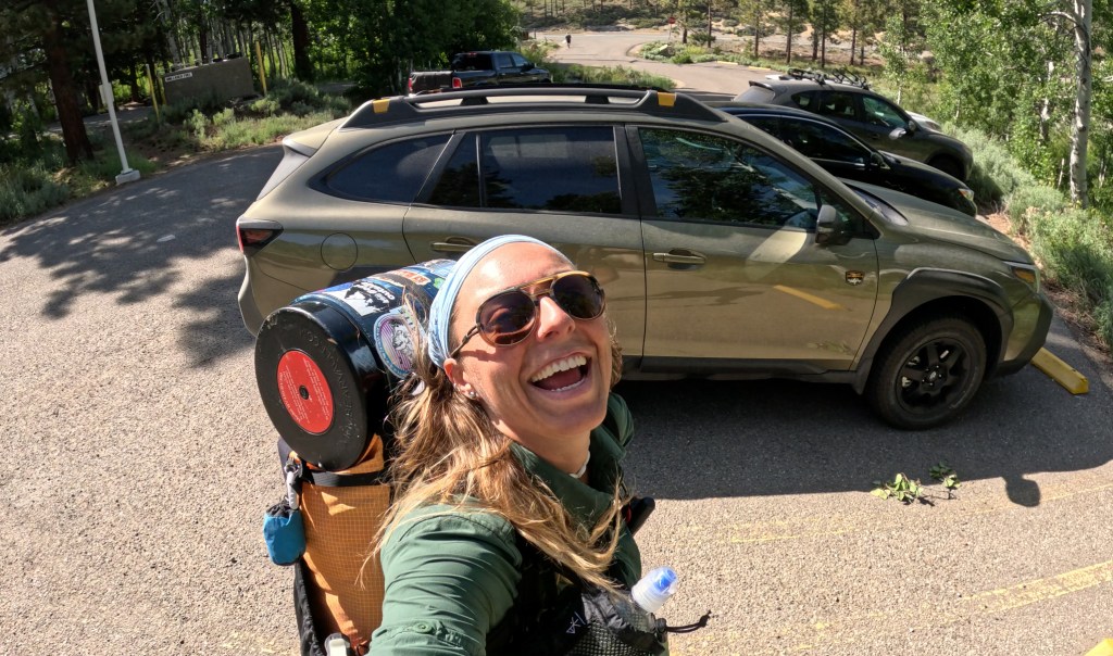
Oh what a great feeling it is finishing backpacking trip, especially when it’s your longest solo thru-hike so far! I checked in to my hotel, showered, then walked across the street for that beer and pizza I’d been dreaming about.


Happy trails!
