

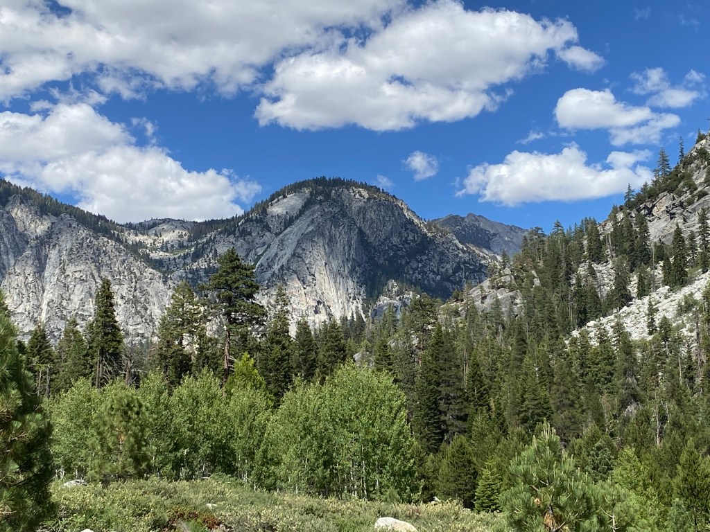
After hiking the John Muir Trail, I have been yearning to return to those magical Sierra Nevada Mountains. To swim in the alpine lakes, climb up and over mountain passes, and take in the unbelievable beauty of Mother Nature. The Sierras have beauty like I have never seen before, they are nothing short of absolute magic!
My sister and I wanted to hike the JMT together over the summer but we didn’t get lucky with the permit lottery so we decided to hike a small part of it instead: the Rae Lakes Loop, one of my favorite parts of the trail! It’s about a 40 mile loop in Kings Canyon National Park that takes you up to some beautiful alpine lakes like Dollar Lake, and Rae Lakes (lower, middle and upper), and up and over Glenn Pass, at 10,544ft.
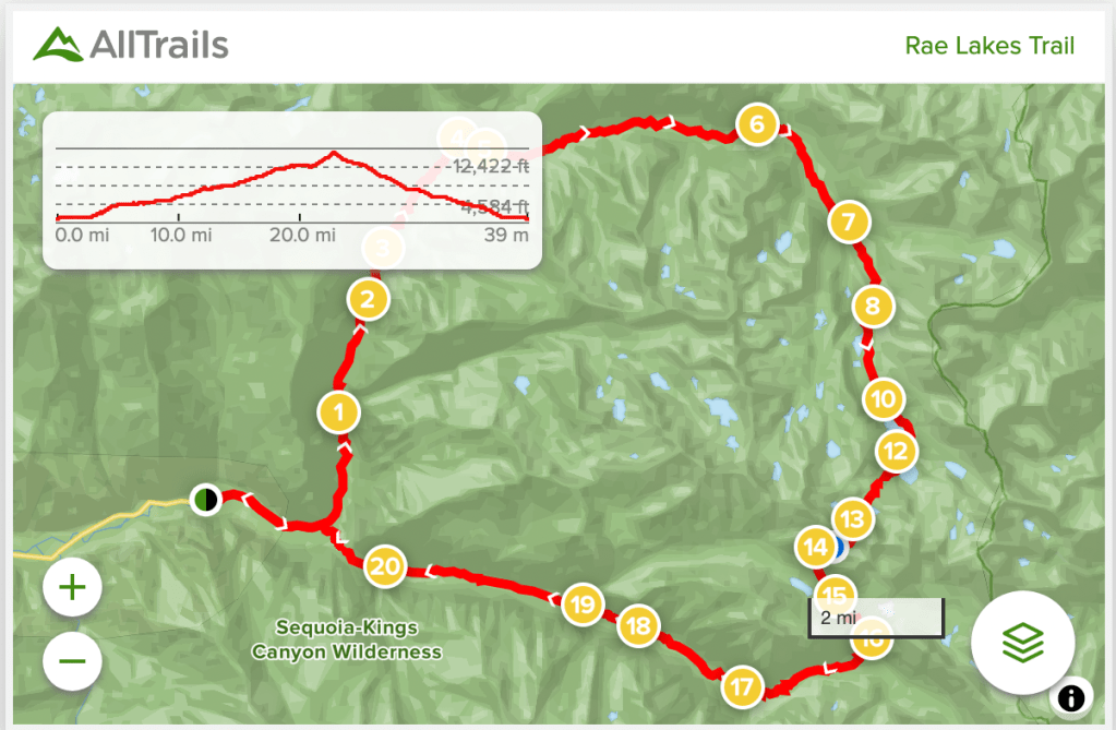
The first step on our journey was getting to Kings Canyon National Park and securing a permit. There are two trailheads where you can start the trail from, Woods Creek for clockwise or Bubbs Creek for counterclockwise, and you must pick up your permit at the trailhead, which in this case is Roads End Ranger Station. The Roads End Ranger Station is at the bottom of Kings Canyon. It’s a long way down, but just driving into the canyon is an incredible experience. Most hikers prefer to go clockwise on this loop because of the elevation profile, which is what we did.
In order to secure a permit for the trail, we either had to apply for a permit months ahead of time or try to snag a walk-up permit (there are only 5 available each day). To get a walk-up permit you need to reserve and pick up your permit the day before you plan to start. We made sure to get to the ranger station at Roads End super early so we would be one of the 5 people to get a permit. We got there hours before they opened and still weren’t the first ones in line. Some people try multiple days in a row, but we were lucky enough to get it on our first try!
After picking up our permit we had the rest of the day to explore the park before starting our journey the following morning!
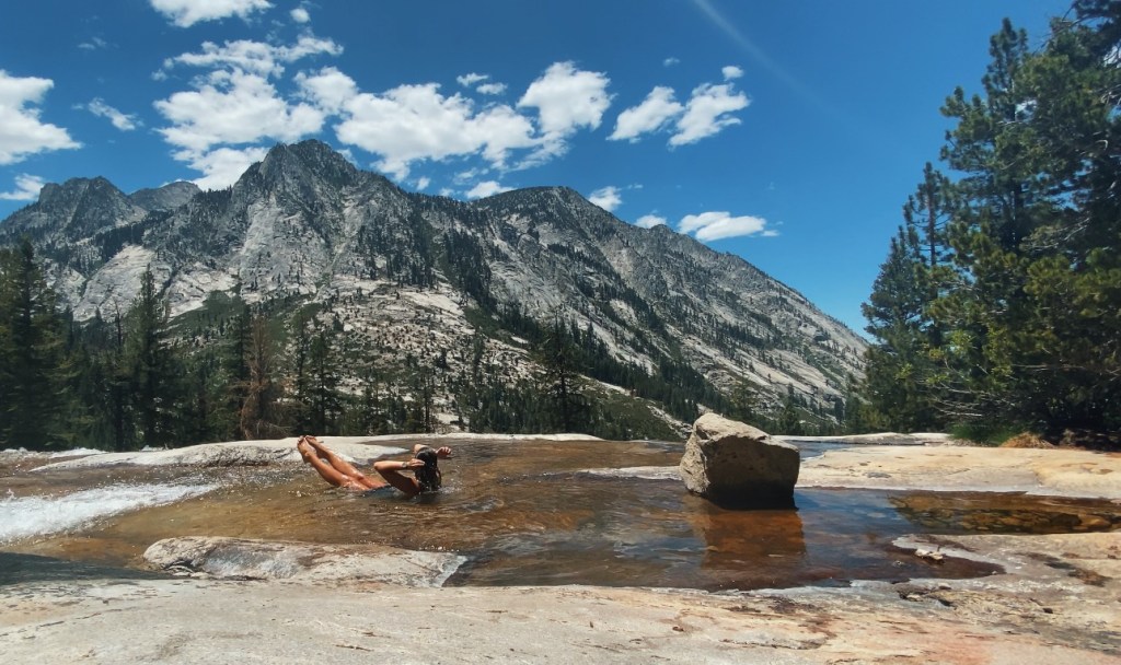
Around the Roads End area, I highly recommend taking a short walk to check out the clear and icy Kings River.
There is a popular landmark in this area, called Muir Rock, which overlooks Kings River. This iconic rock was where John Muir himself used to give talks to anyone who would listen to his wilderness ramblings.
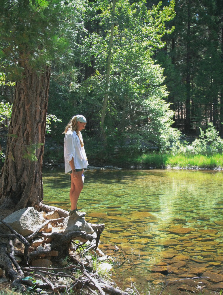
We found that there were a lot of people in that area, but if you wander a little upstream, you can have a bend in the river all to yourself. The water here was an unreal, crystal clear, green color.
After, taking an icy dip in the river and basking in the sun, we made our way up and out of the canyon. We had enough time to go check out some of the giant sequoia trees in Sequoia National Park (since the two parks border each other) before picking up some food and supplies at the Grant Grove Visitor Center.
There’s a little market, souvenir shop, grill, and information desk at the Visitor Center. If you’re vegan like me, I recommend the veggie and hummus wrap!
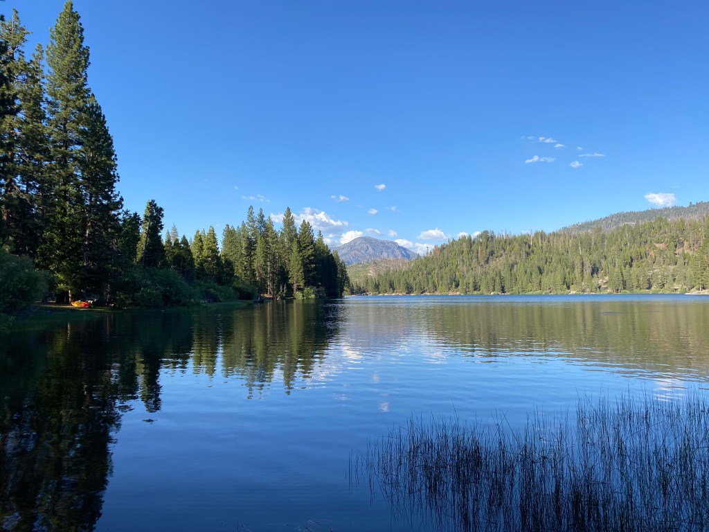
That night we had reserved a night at Hume Lake, which sits high above the canyon, about one hour from Roads End. It was a pretty crowded campground, with lots of families hanging out for the weekend or longer, and there were multiple bathrooms and access to running water. The lake shore was a short walk from our site, so we set up our hammocks, listened to some music, and relaxed. Our plan was to get a good night’s sleep and start our hike early the next morning. Little did we know, there was a Christian camp across the lake having a party and blasting music till about 11pm. It was a funny surprise.
In the morning we decided to go back to Grant Grove area to have a good breakfast before starting our 40 mile adventure. I enjoyed some coffee and hash browns from the grill.

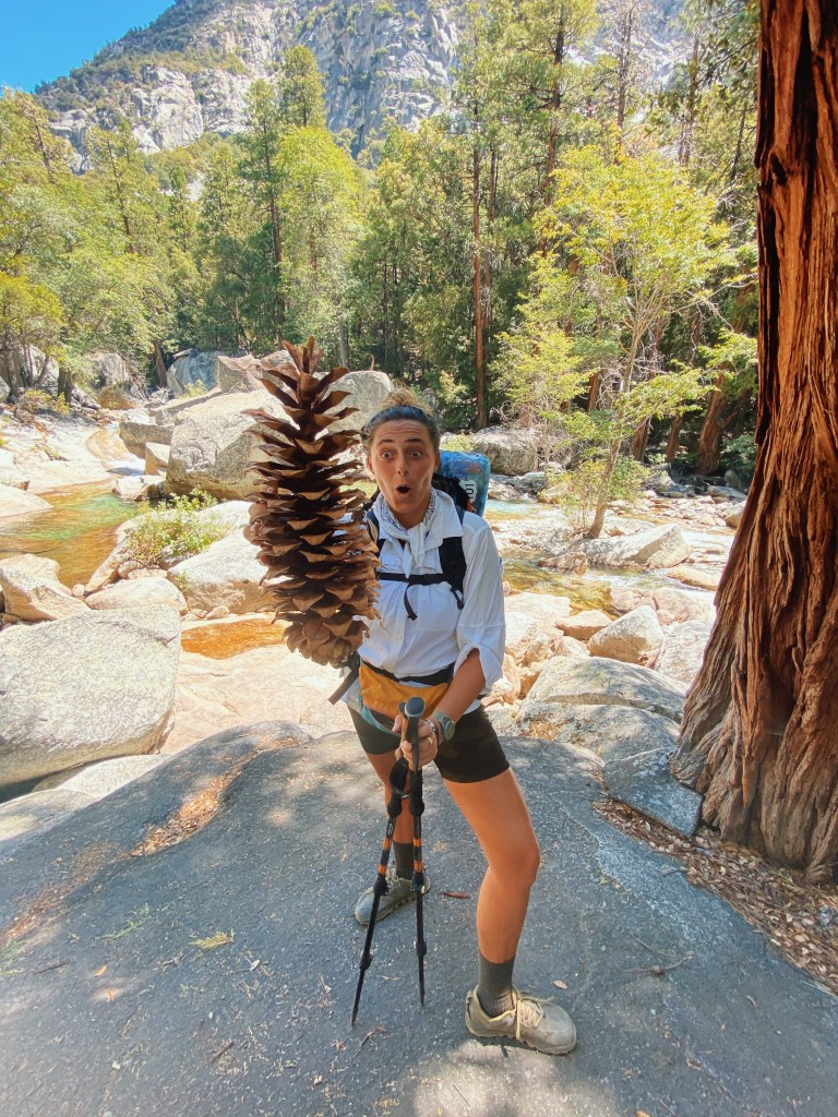
In case something happened to us, or we got lost, we took a photo of ourselves in the gear we would be hiking in and sent it to our loved ones. It’s always a good idea to let someone know your itinerary when backpacking or hiking.
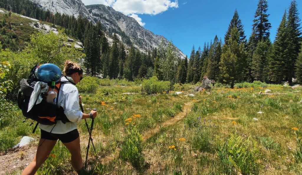
After a quick breakfast, we headed down to the Roads End area and parked our car. Luckily there were still spots available, it fills up fast! We waived to the ranger and were off on our way.

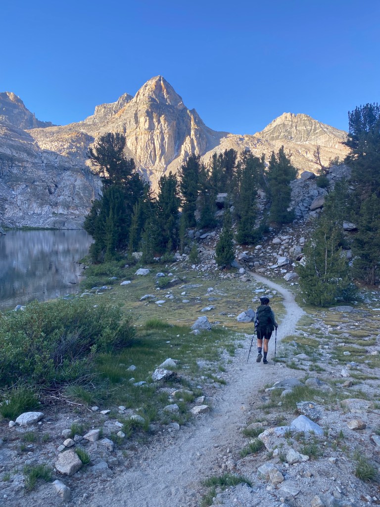
The hike started off flat for a mile or two, and then started to climb. One of the first attractions of the trail comes about 4 miles along the trail, Mist Falls. Its a beautiful waterfall, that you end up walking over to continue on the Rae Lakes Loop.


There is plenty of water pretty much all along the trail, but make sure you research the water sources before you go!
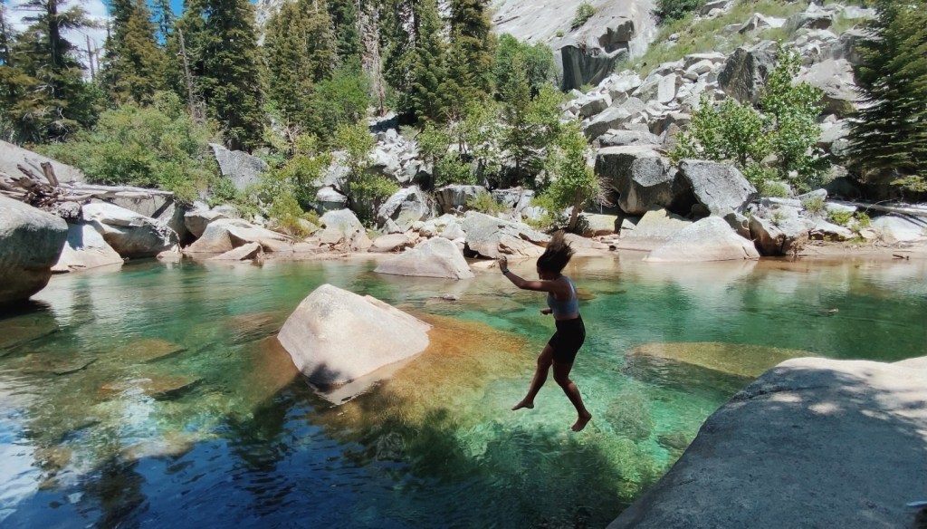
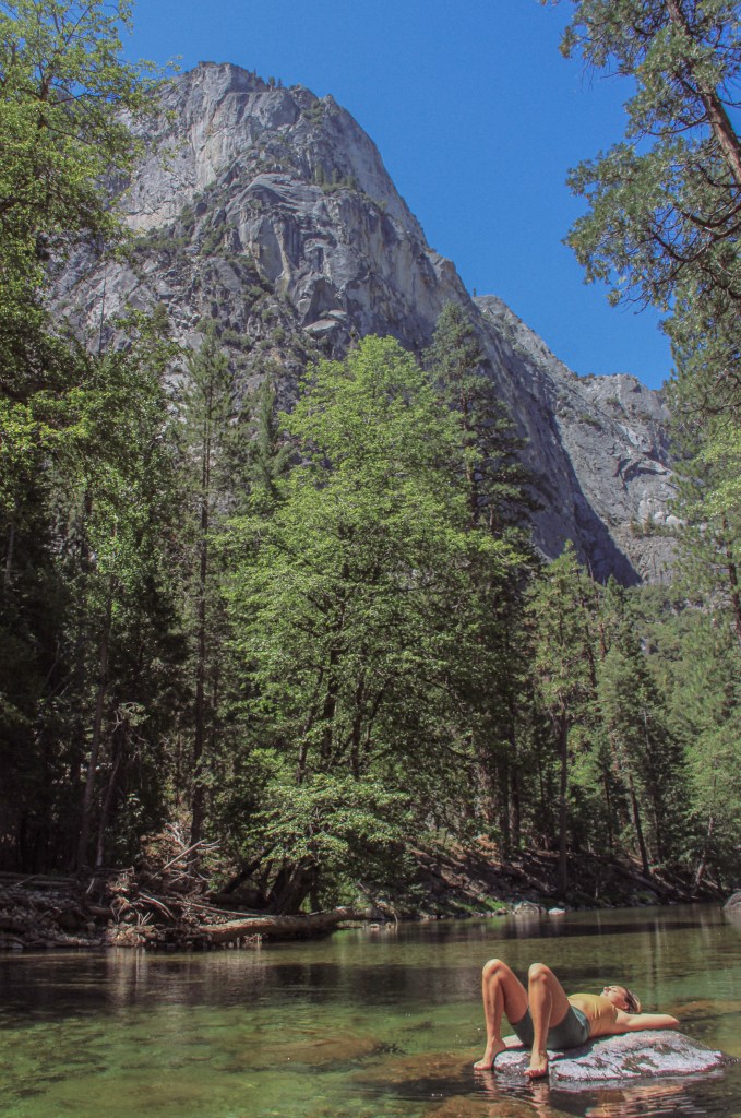
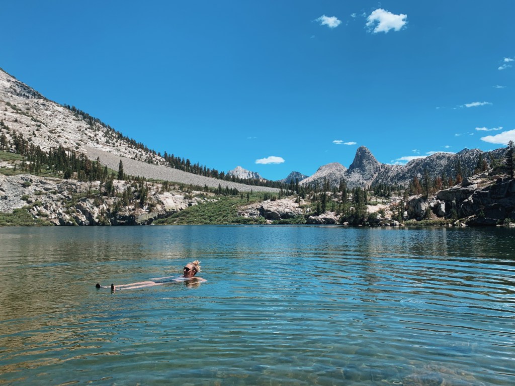
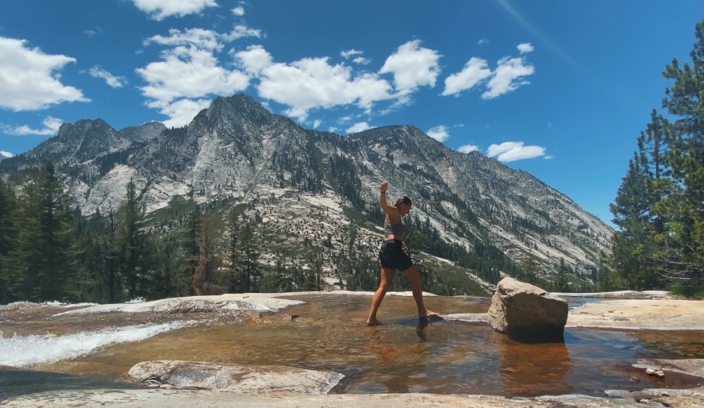
After hiking the JMT something I wish I did more of was swiming. I remember choosing not to take dips in every beautiful river, pool, and lake becuase I was afraid of being too cold, not drying off quickly enough, hiking in wet clothes and being uncomfortable… but I the few times I did jump in the icy alpine water, I felt so alive and joyous. Plunging into the cold water and feeling it on your sore muscles is like an awakening, a shock of rebirth. So long as I took enough time to dry off, or change out of my wet clothes after, I was okay.
On this trip, I decided I would go in all the most appealing water I saw and it was a wonderful decision.
Paradise valley is a common first-night camp spot for rae lakes hikers. We had planned to camp at upper paradise valley and ended up going a little beyond it, over the bridge at around 9 miles.
We met three other friendly hikers on the rae lakes loop and they ended up camping with us.
We got an early start the next day, excited to make it to rae lakes!
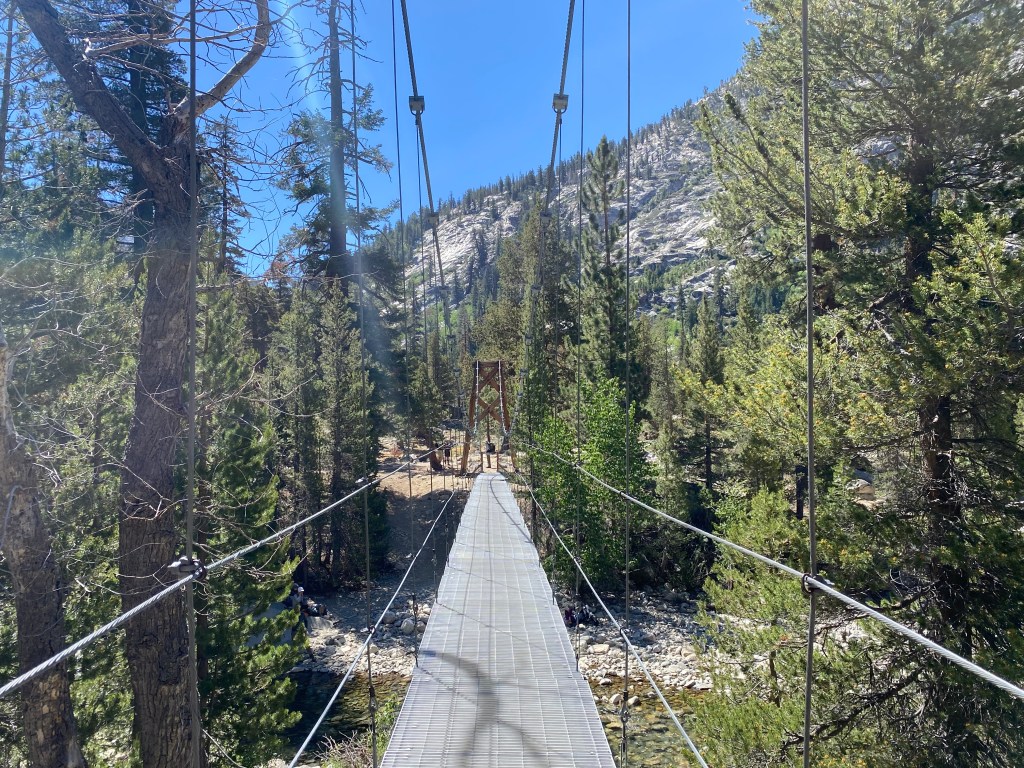
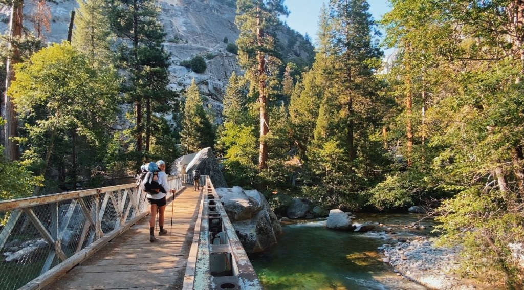
At about 12 or so miles into the trail, you will come across a junction with the PCT/JMT and will keep right to cross the iconic woods creek suspension bridge at around 14 miles. As we began walking across it, I noticed that one of the metal panels was loose and didn’t look like it could bear weight. I should have called down to the handful of people taking a break on the bank at the other side and asked if they crossed this way. But I didn’t, and nobody called up to me, seeing my hesitation to encourage me that it was secure enough. So, we ended up crossing through the creek instead. I was due for a splash of cold water anyway.

This sign on the other side of the bridge is a great reminder of some important leave no trace practices. These suggestions protect you, the wilderness, and the wildlife!
We stopped for a break on the bank of the creek. We had some snacks and soaked our feet. It was glorious, sitting there in the sun.
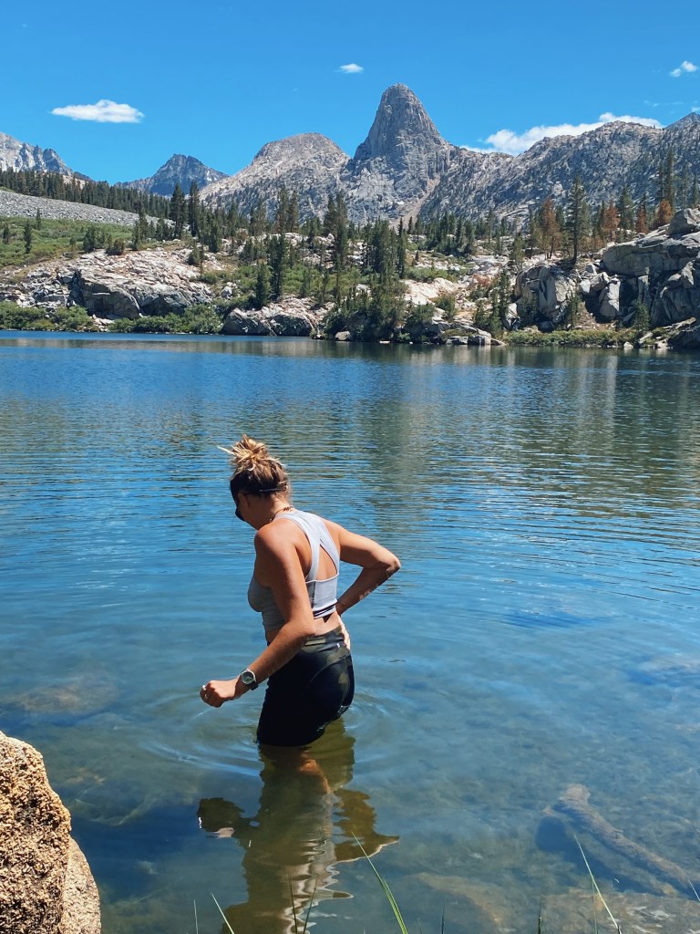
The trail begins to climb and at around mile 18.5 you come to the scenic dollar lake. When you finally come up on the view of dollar lake with fin dome in the background, you can’t help but smile. I could not wait to get in the water and soak it all in.
After a nice soak in the lake, we dried off on the bank and watched the hundreds of dragonflies zip around the tall grasses at the edge of the lake. In the water below them, there were little fish waiting for the right moment to snatch one out of the air. It was a pretty cool thing to watch.
It’s amazing the things mother nature will reveal to you when you just take a moment to be still, to observe, and be present.

Leaving dollar lake, we ran into a couple of our buddies from the day before. We discussed the mountains on the horizon and where we think the trail is going, and where glenn pass might be.
It’s so hard to guess where you think a trail will go up a pass, because you can never see a trail from below, you can only anticipate the direction of the switchbacks ahead.

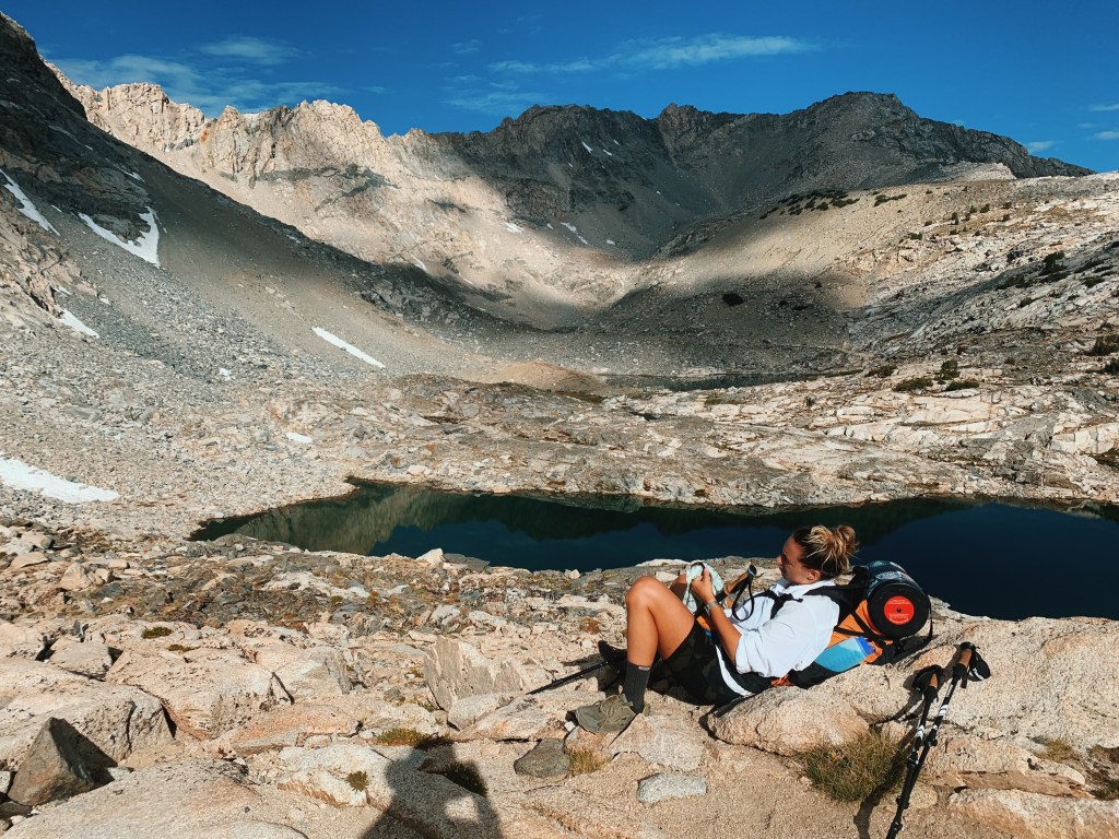
Finally we make it to the first of rae lakes! Lower rae lake with a perfect view of fin dome. The water was a clear greenish-blue, and was alive with fish.

The destination for camp was middle rae lake, at about mile 20-21, because there was a bear box there where we could store our bear canisters. The bears have been particularly active in this area thanks to irresponsible visitors. Please make sure to know your bear safety before venturing into bear country.
We heard from another hiker that a bear had come and scratched at their tent at night, and that they were speaking to someone else who had their backpack ripped into and dragged away. So, naturally, I was happy to follow every precaution.

We found the perfect spot with a gorgeous view and access to the lake. We used the Nemo Hornet 2 person tent and it was great for the two of us. I also use a cheap plastic ground tarp that I picked up at REI. It helps keep the tent clean and protects it from things that could poke holes.
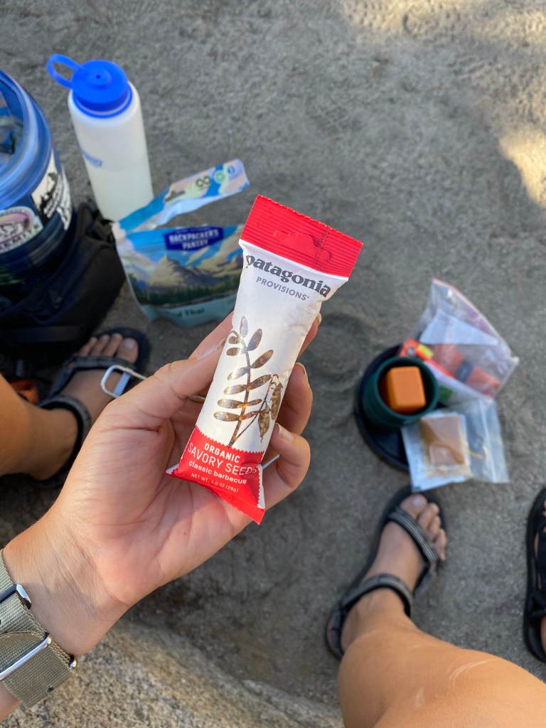
We cooked our dinner over by the bear box. It was funny to see that a couple of our snacks had inflated due to the elevation change.
I had the Backpackers Pantry pad thai meal and it was so good. It is easily my favorite pre-made backpacking meal. I’ve learned that it is very important to test and try your food before taking it backpacking with you. You do not want to try a meal for the first time in the backcountry and realize you don’t like it, and you’re stuck with the choice to either eat it all or carry it back out with you.

Considering the high elevation, we had been expecting it to be much colder than it was the last couple of nights. The coldest night we had so far was at hume lake. So it was a pleasant surprise to not be shivering after the sun went down.
The next morning we set off to climb the last 2 or so miles up and to glenn pass. There were lots of switchbacks and you are climbing the whole way up. The elevation makes it a bit hard to breathe, but at least we had time to become acclimated to it, so it wasn’t too bad.
Getting acclimated to altitude is another important lesson I learned while backpacking. The first 2 days on the JMT, climbing up Half Dome and out of Yosemite Valley, I was in so much pain from altitude sickness. I was nauseous and had a terrible headache. I even threw up at the end of the day. Then, again, in the Grand Tetons, my brother and I hiked the Teton Crest Trail, and the same thing happened to me the first day, headache, nausea, and vomiting. I guess the real lesson I learned here is to be careful when hiking with my bro because he likes to go fast and prioritizes accomplishments over safety.

As we got closer to the pass, we saw that there was still some snow lingering from the winter! We didn’t have to walk through any of it on the trail like I did last time I was here.

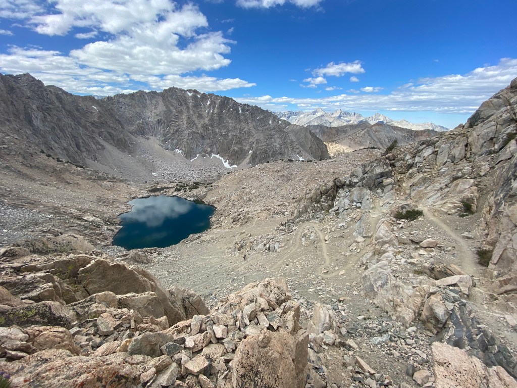
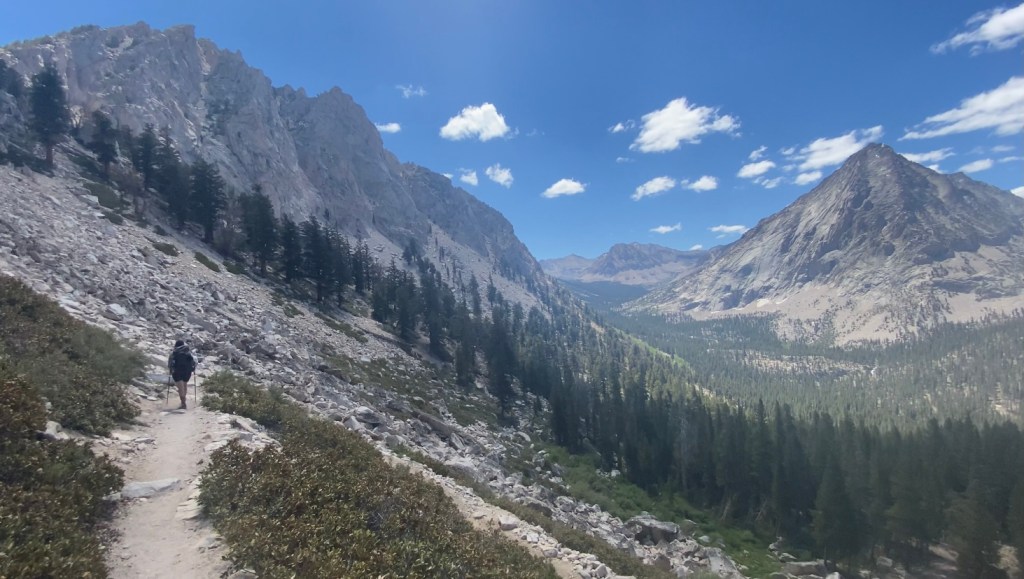
When you finally make it to the top, it’s a big sigh of relief followed by a wide-eyed gasp when you see the beauty that lies on the other side. A whole new pocket of the sierra is opened in front of you. You can see where you are headed next, following the endless switchbacks with your eyes as they wind their way towards Charlotte Lake and Kearsarge Pass.

It’s moments like these that draw me to backpacking. Perched atop the world, gazing upon a vast landscape. Blue-green alpine lakes fill the pockets in the stone, mountain tops peak on the horizon in all directions, and everywhere you look there is beauty. It’s a hard feeling to describe. Aside from the other hikers, there are no signs of civilization as far as the eye can see.
We hung out at the top for a bit, taking in the magnificent view, before making our way down the other side. We started to run into a lot more PCT hikers in this section. I always love seeing them and encouraging them on their journey.

We heard that the bear activity was especially high in the charlotte lake area. It’s a really beautiful green-blue lake with plenty of campsites and a bear locker if you wanted to spend the night.
Right around the charlotte lake junction, we met a ranger who was hiking her rounds. She stopped to talk to us and give us some news about the weather. She warned us that we are experiencing forest fire weather. She explained that temperatures were very high in the valley due to a heatwave (close to 100 degrees), and a lightning storm is projected for later in the evening. This combined with the heavy winds drastically increases the chance of forest fire.
Knowing that there was already a fire affecting the eastern side of the sierras, and lots of other places in California at the moment, we were already a little wary about being days away from civilization and the car with the chance of getting stuck in a fire.
We were planning on camping one more night along the trail and finishing up in the morning, but after talking to the ranger we decided that we would try and see how far we could get, and if we could make it back to the car with enough time before it gets too dark to find a campsite, we could finish the trail a day early.
Completing the trail a day early meant that we would be hiking from middle rae lake, back to the roads end ranger station, which added up to be about 20 miles. It was a long way, mostly downhill, and getting hotter and hotter the further into the valley we got.
We were making good progress getting down towards the valley, but it was getting very hot. The trail follows along the creek all the way back, so there are many opportunities to stop, fill your water bottles, or splash around and cool off, which is exactly what I did.
We made it back with some daylight to spare and had no issues with fire, lightning, or bears! Although, almost everyone we passed this day had a story about a bear they saw earlier.

All in all, this was an incredible trail, and an unforgettable experience. The sierras hold a beauty like no other place I have seen. Being deep in those mountains, ignites my spirit, and cleanses my soul. This trail is not easy, it was actually quite challenging and will have you pushing yourself. But being out on that trail, surrounded by nature, is an experience of peace and joy like no other.
I cannot wait to go back to those mountains and be entranced by their beauty once again.
See ya soon Mother Natch! ❤
Happy trails my friends!
-Bee

Great story and pictures of your adventure. I’m sorry I didn’t get to see your sister in any of the pictures but I guess someone had to take your picture lol.
Thank you for sharing Ms Bee
LikeLike
Thanks for reading my post and leaving a comment! My sister prefers to stay anonymous on social accounts, which I totally understand.
LikeLike
You’re very welcome Ms Bee….I can’t to check out more of your upcoming
hikes…..Happy Hiking
LikeLike