

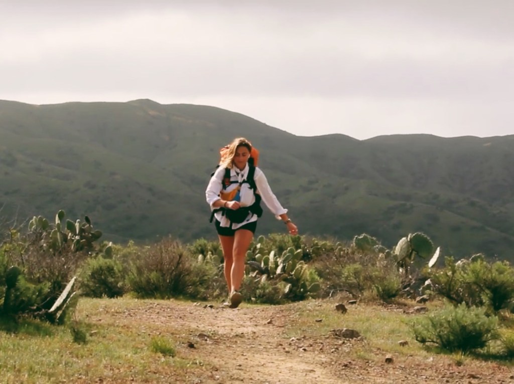
2.5 days, 40 miles
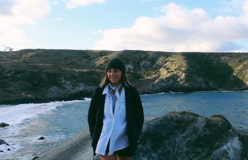
I found out about the Trans Catalina Trail about a year ago, shortly after I moved out to San Diego. I had been doing some research on trails in the area and found this 40-mile thru-hike of an island off the coast of LA. I saw photos and videos of beautiful rolling hills, cliffs that drop off to the sea, ridgeline trails, turquoise clear water, beach-side camping, and bison, I knew I had to go out there and see it for myself.

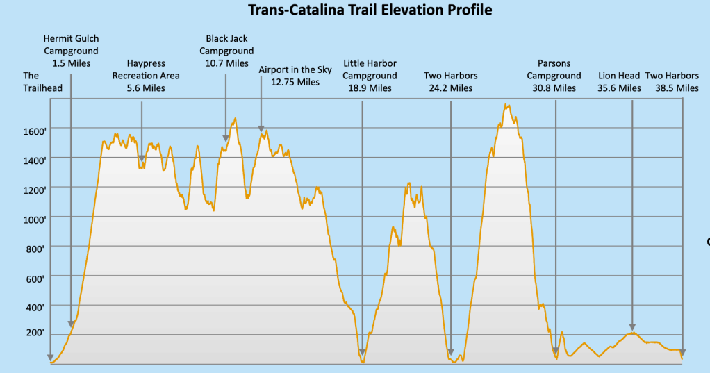
The elevation profile looked a bit intimidating, but in the end, I came up with a plan that was challenging and allowed me to get what I wanted out of the trip.
Links:
History of Catalina Island:
Santa Catalina Island has been inhabited for 7,000+ years. This island is off the coast of Los Angeles, California, and is most recently known as a popular vacation and filming location. In fact, back in the 1920s, 14 bison were transported to the island for a film. They ended up leaving the bison on the island and they are now one of the island’s inhabitants. The rangers monitor and control the herd, using non-hormonal birth control. If you come across one on the trail, make sure to leave plenty of room between yourself and them. A bison will charge you if you get too close! Bypass the herd by leaving the trail or wait if you must, but don’t bother those beautiful beasts!
The Plan:
Getting to Santa Catalina Island
- Park car at San Pedro ($20/day)
- Ferry from Dana Point to Avalon
- Leaves @2:45pm
- Check out the town
- Hike 1 mile to Hermit Gulch Campground
- SITE: HG30
- Water spigot
Day 1: 16 miles
- Wake up ~6:00am
- Hike 10 miles to Airport
- Have lunch at DC3 Gifts & Grill
- Refill Water
- Hike 6 miles to Little Harbor Campground
- SITE: LH11
- Water spigot
Day 2: 12 miles
- Wake up whenever
- Hike 7 miles to Two Harbors
- Have lunch at Harbor Reef Restaurant & Bar
- Refill Water
- Hike 7 miles to Parson Landing Campground
- SITE: PL07
- Firewood and water jug
Day 3: 7 miles
- Wake up ~6:00am
- Hike 7 miles to Two Harbors
- Ferry to San Pedro
- Leaves @11:45am
Trail Journal
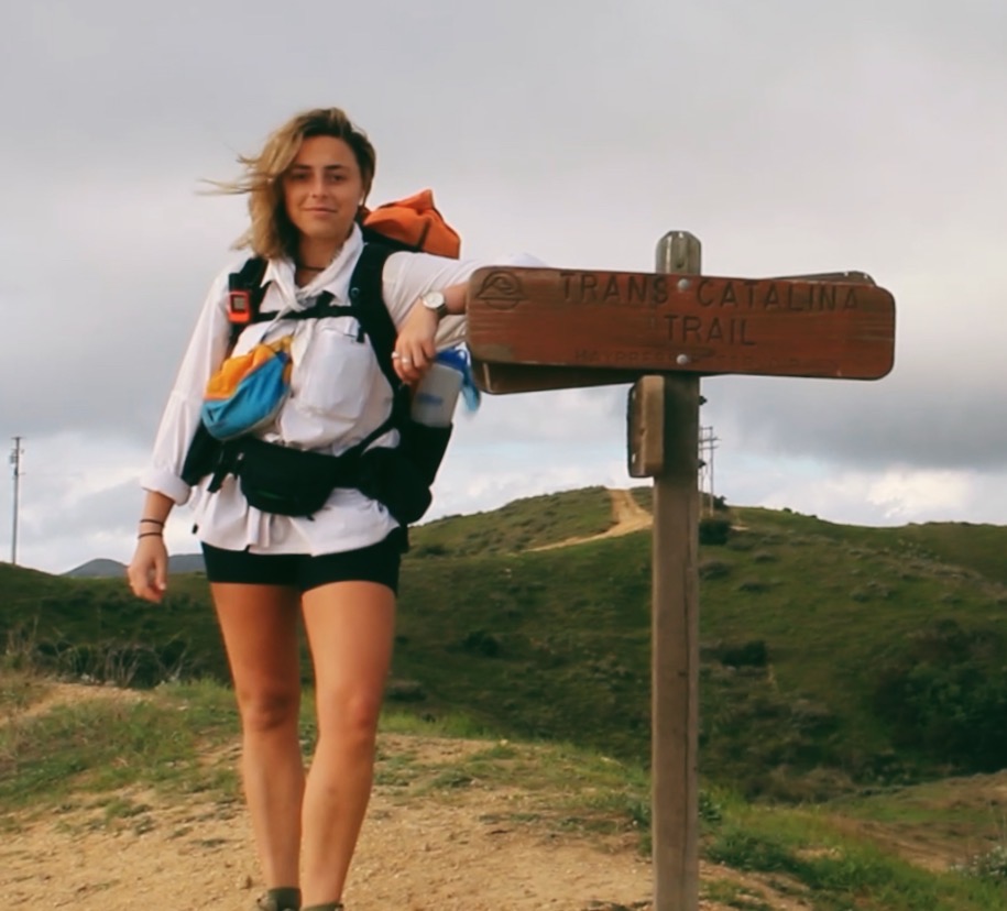
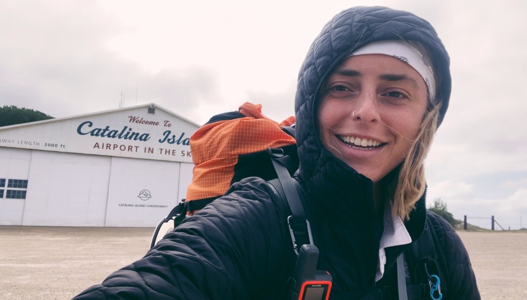
Sunday, February 20, 2022 / Getting to Santa Catalina Island
My morning started with a drive up to San Pedro where I will leave my car and end the trip. I reserved tickets for the Sunday, 2:45 pm ferry from Dana Point to Avalon as well as the Wednesday, 11:45 am ferry from Two Harbors to San Pedro. I would leave my car in San Pedro and catch a ride down to Dana Point, which kinda worked in my favor since the overnight parking was cheaper in San Pedro. The drive up there was about 2 hours from home and I decided to break up the drive by stopping for a late breakfast along the way. I found Breakfast Republic in Irvine and had their Vegan Breakfast Burrito, which was delicious, but so much food. Conscious that I would be on a ferry for an hour and a half, I was worried about having a full stomach. I eventually make it onto the ferry and choose a seat in the back, on the top, wanting to sit outside and enjoy the view. Plus it was a beautiful day, the sun was shining and it was warm. The ride was windy but smooth. We arrived at Avalon in about an hour and 20 minutes.


The town of Avalon is very cute, with lots of little shops, restaurants/bars, and boutiques. A nice place to spend an afternoon. People do live on the island and typically use golf carts to get around, the streets are lined with them. I stopped into the supermarket, Vons, and picked up a bag of chips and a beer then started walking up the street toward Hermit Gulch Campground, about 1.5 miles away from town. I checked in with the ranger and headed to my site. I had HG30, towards the back, near a bathroom and the start of the trail. The campground is quite crowded with the spots very close to each other but luckily, there weren’t too many people set up around me. Each spot has a picnic table and grill, and I happened to be near a bathroom with a water fountain which was nice.

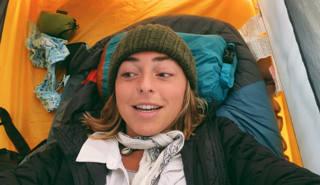
I sat at the picnic table to cook my dinner. I went with the Louisiana Red Beans and Rice from Backpackers Pantry. It wasn’t bad, but I should have saved half of it for another night, it was a lot of food. I went to bed early since I would be waking up early, my alarm was set for 5:30am and I had a long and strenuous day ahead of me.

Monday, February 21, 22 / Hermit Gulch to Little Harbor / 17 Miles
I woke up this morning at 5:30 am and packed up camp without having breakfast, I decided I would eat during my breaks. I set off on the trail, which was immediately uphill for a few miles. The plan was to make it to the Airport for lunch (hopefully before 11:00 for the veggie burrito), then head to Little Harbor Campground for the night, which is a total of about 17 miles.
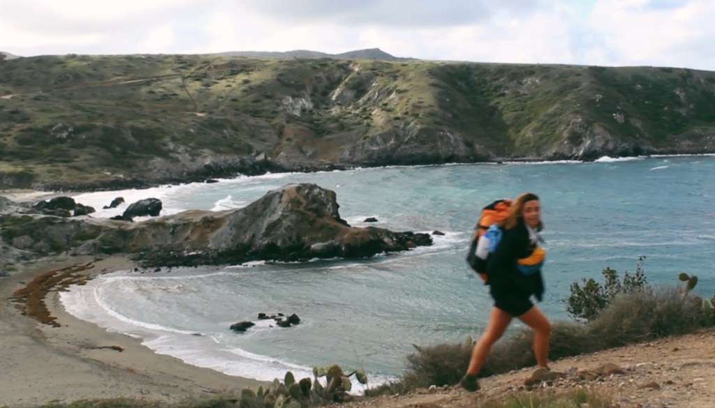
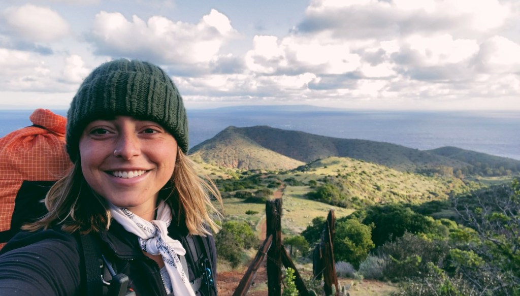
What’s nice about hiking the trail in this direction is that the trail and the views get more and more beautiful as you go along. So the trail up to the airport wasn’t anything too special. The highlight of this section was definitely seeing the herd of bison.
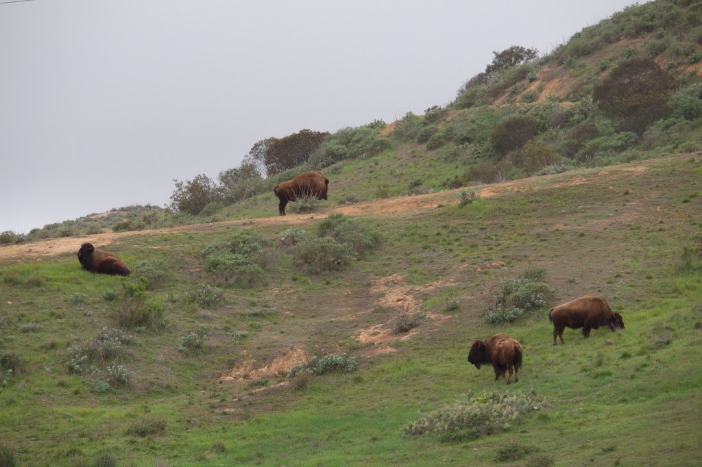

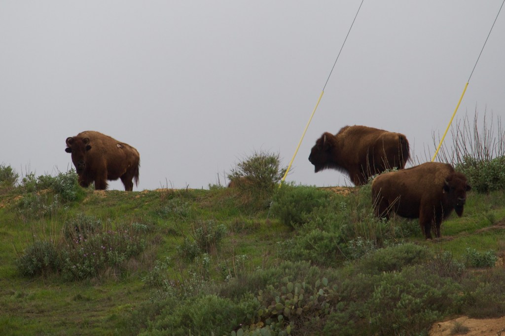
As I came near, hikers in the other direction warned me that the herd was blocking the trail so I would have to skirt around them. They mentioned that a ranger was there and could help me if needed.
I spotted the herd and the ranger’s car on a road that crosses the trail, where the bison were hanging out. I was still about a half-mile away when I saw the ranger do something that scared the herd, making them run away from the trail. By the time I got to that spot, the trail was clear and the bison were happily grazing a safe distance away.
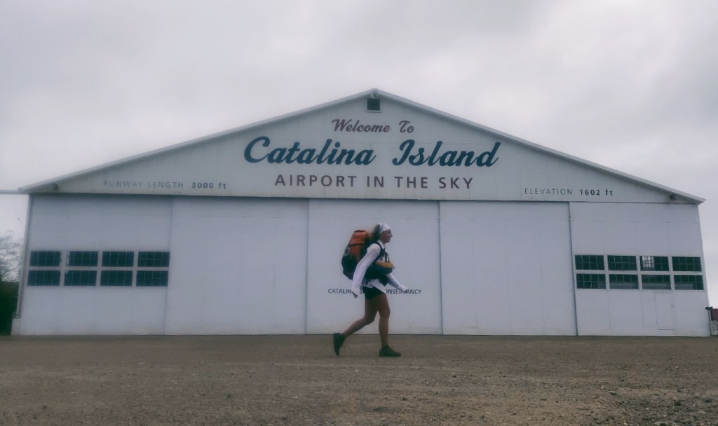
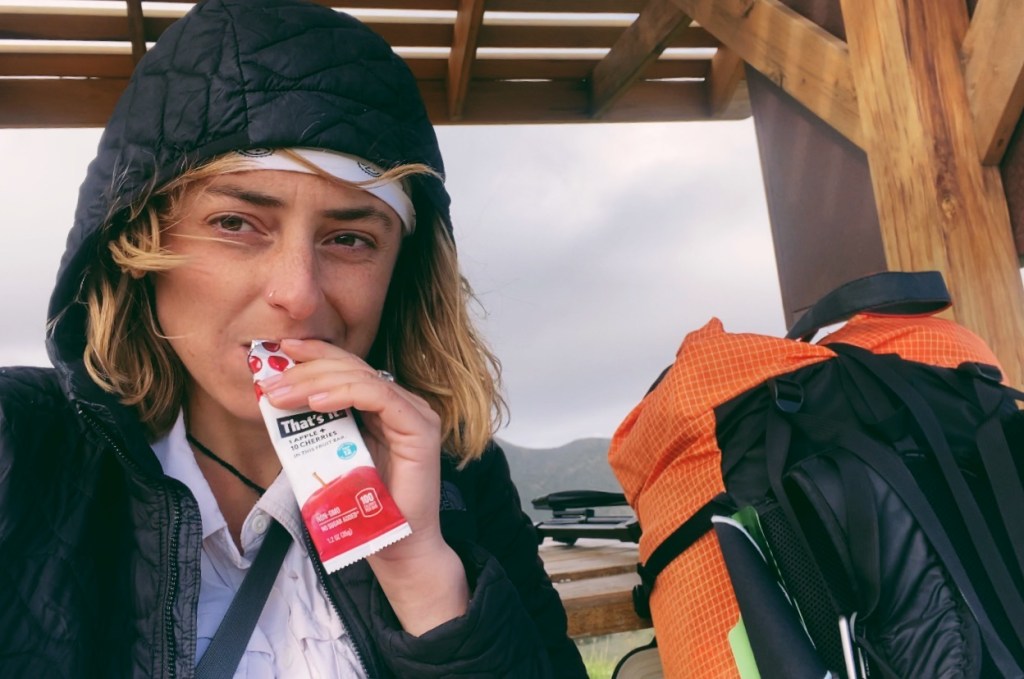
I arrived at Airport in the Sky at 11:45 which was too late for the burrito I wanted, so settled for Gatorade and the snacks in my backpack in an effort to start lightening the weight. While I was sitting outside, enjoying my break, I overheard a group of backpackers talking about the weather report. They said that the forecast calls for 30mph winds with 40mph gusts and they were debating bailing on the rest of their trip. I heard this and, at first, was a bit concerned because 30pmh winds are strong, especially for camping on the beach, exposed. But I had definitely experienced worse weather on trial, so this is probably nothing. Plus, if people bail on their trip, I might have the campground all to myself!
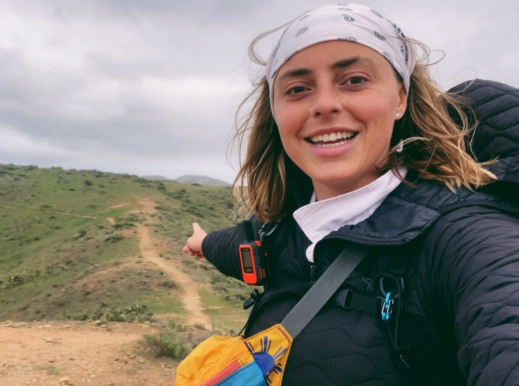
I left the airport and continued along the trail. After the airport, the trail gets a lot more beautiful, and a bit less strenuous. You can start seeing the coastline of the western side of the island now and it’s a nonstop panoramic view.
After a long day of hiking, I made it to Little Harbor Campground, and what a beautiful campground it was! I reserved site LH11, which is pretty much right on the beach! When I got to the site, there was a group already set up in it! It looked like they had been there a while with all their scuba and fishing gear splayed around. This ended up working out in my favor, however, because the site next to it, LH12 was empty so I took it for myself.

This site was the one that I originally wanted, it’s at the end of the row and is the most private, but it was already reserved at the time that I booked my trip, so I was happy to see nobody was set up in it now. My site had a shade canopy, two picnic tables, a food locker, a fire pit with a bench, a water spigot, an outdoor shower, and portapotties close by. This setup would have been perfect for a warm and sunny day where I could go swimming, but a thick layer of clouds was rolling in on the horizon and the wind was picking up.
For protection from the wind, I set up my tent between the two picnic tables, and under the awning. It was a struggle setting up the tent with the non-stop wind, but once it was up and I put my things inside it seemed sturdy enough not to blow away. My body was feeling tired and sore so once I had everything set up I took a solid 30 minutes to myself just to lay in my tent and rest my feet and body before getting up to explore the area.
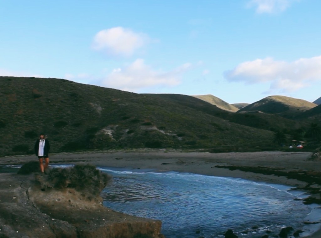
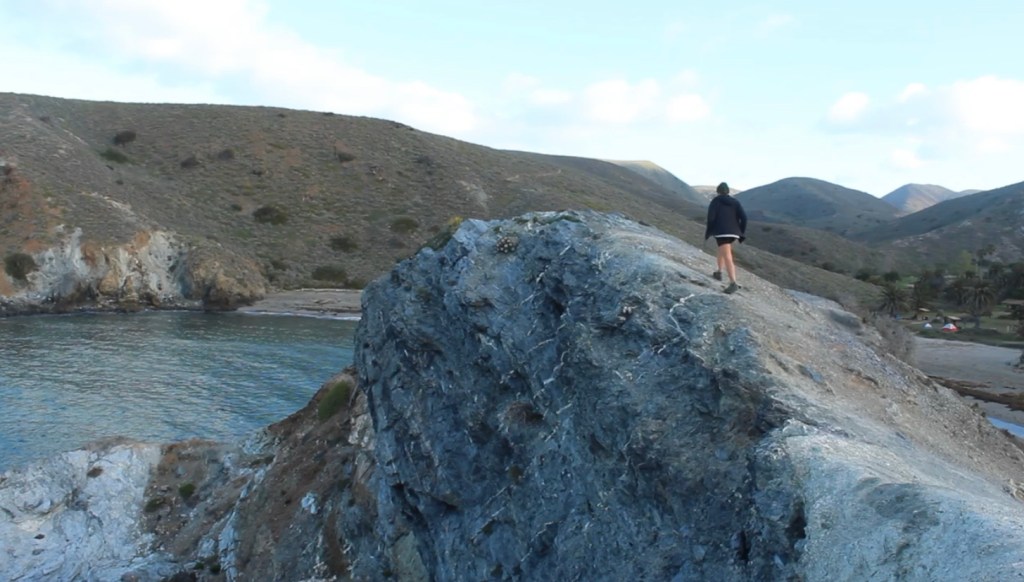
There is a short trail that leads up a little hill next to my campsite. It leads to the landmass that separates Little Harbor and Shark Harbor, it’s called the Whale Tail. It would be a beautiful spot for the sunset, but it was too cloudy to see it.
After the sun went down, I made myself some dinner, vegan mac and cheese with a side of veggie straws and fruit snacks, then fell asleep. Surprisingly, with all the wind shaking my tent, I only woke up once that night. I think my body was just so tired from the 18-mile roller coaster of a trail and needed every moment of precious sleep to recover.
Tuesday, February 22, 2022 / Little Harbor to Parsons Landing / 12 Miles
I didn’t bother setting an alarm last night because I wanted to give my body as much rest as it needed. When I awoke, the sun was rising and it was around 6:30 am. I had another pretty big day ahead of me to get to Parsons Landing, about 12 miles with plenty of elevation gain and loss.
The clouds were clearing up, the sun was peeking out, and I was feeling good. I decided to walk around the campground and explore the Whale Tail one more time before hitting the trail.
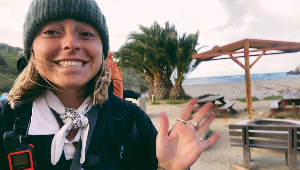
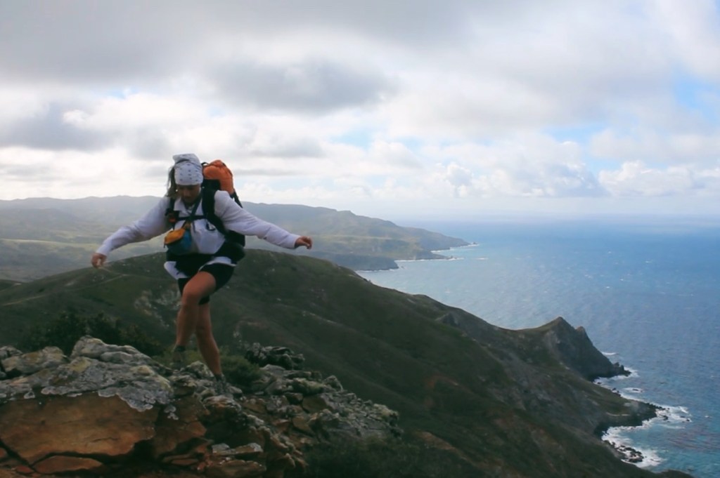
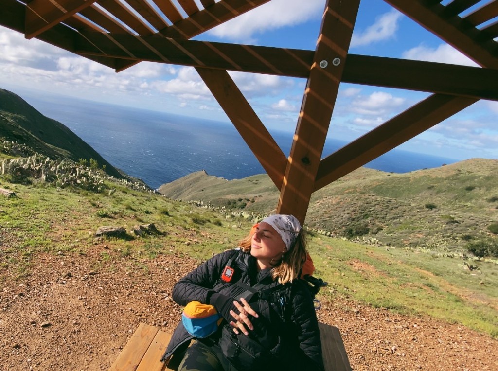
The plan was to hike to Two Harbors, where I planned to have lunch and pick up the locker key for the firewood and water I reserved at Parsons Landing Campground where I would spend my last night. The views on this day were incredible and the trail was tough and steep. The elevation profile shows a 1,200ft climb and descent into Two Harbors and another 1,650ft climb and descent into Parsons landing over the course of 12 miles.

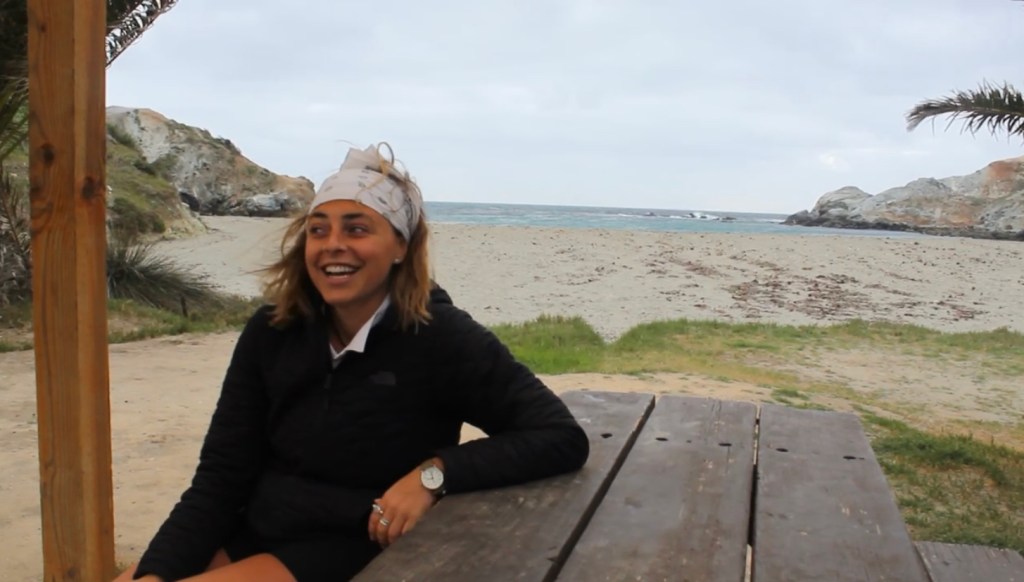
Climbing to the top of the first ascent was no problem, I actually much prefer uphill, but the super steep descent into Two Harbors wrecked my knees and I was practically limping into the town. I stopped by the office to pick up my locker key and was informed of a temporary fire ban due to the high winds, so I would not be provided wood tonight. This was disappointing but understandable. Adding to my disappointment, the restaurant was closed, and I missed my second opportunity for a burrito. The market was open, so I picked up a couple beers and sat by the harbor watching the palm trees blow in the wind and the boats bobbing in the waves. I gave myself a good hour and a half to relax, have a meal of granola bars and beer, and use the service to check in with my loved ones.

I knew I wasn’t going to make it up and over the next hill to Parsons with the way my knees were feeling, but luckily this part of the trail is a loop, and going counterclockwise meant that the trail would be mostly a flat road walk the rest of the way to camp. I figured that I could decide in the morning if I was feeling up to the climb along Fence Line Road, or if I would take the same flat road back to Two Harbors. I was very satisfied with this decision. The road walk was not bad, mostly because it skirted the eastern side of the island which was significantly less windy. I was happy to be giving my knees a rest and was enjoying the warm sun on my skin. Things were calmer on this side, and I even spotted my first Osprey! The hike started out sunny and warm, but as the miles accumulated, clouds rolled in thicker and darker and the wind was constant and strong.

Parsons Landing was finally in sight, and despite the weather, it was beautiful. At the front of the campground, there are lockers for firewood, shelves for water (campsite reservations come with 2.5 gallons of water), and two pit toilets. I walked down to the sand where the campsites are and found PL07, my home for the night. Once again, setting up my tent was a struggle with all the wind. This campsite provided very little protection from the elements, with only a 2ft high rock wall semicircle around each tent site. The wind was so strong now that I was afraid my tend would blow away if I wasn’t sitting inside it.
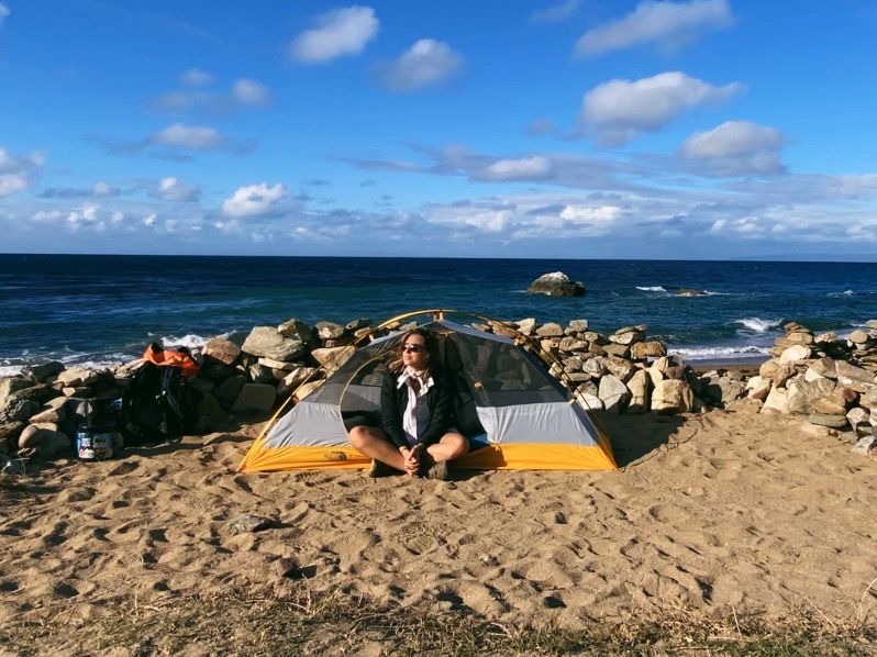
I cooked up a dinner of vegan mac n’ cheese (again) as the sun began to set. A light rain started as I was eating my meal so I brought everything into my tent to keep dry. The rain and the wind kept getting harder and stronger. Raindrops smacked my tent like bullets falling from the sky, and the wind whipped my tent around so hard I thought my tent poles might snap. I figured that if things got really bad, I could go take shelter in one of the toilets, but I was too tired and not concerned enough to leave my tent. I was able to sleep in short increments between the wind and rain spells. It was comforting to know that I was not alone at this campground. That at least three of the other campsites were occupied and they were doing just fine.
Wednesday, February 23, 2022 / Parsons Landing to Two Harbors / 7 Miles
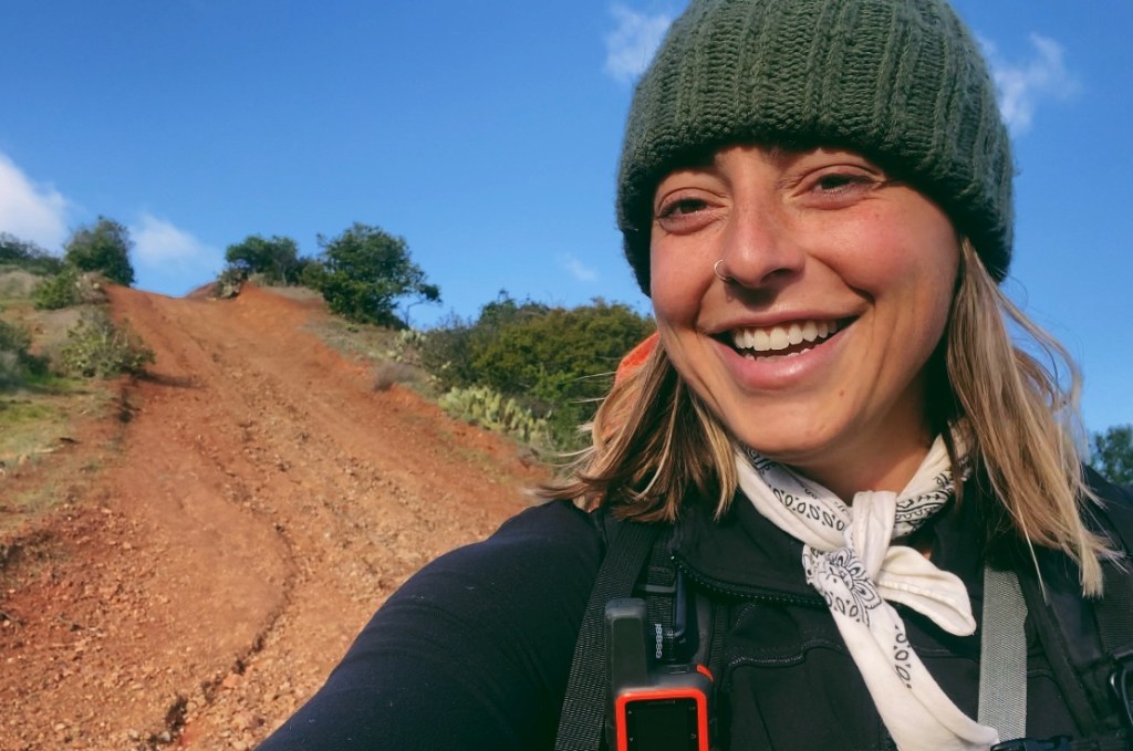
The wind was still going strong when I woke up, but thankfully the rain had stopped and all of my belongings, including myself, managed to stay dry. The sunrise gave the clouds a beautiful pinkish glow as I emerged from my tent around 6:30. I didn’t have much time since I had to catch the 11:45 ferry in Two Harbors by hiking the 8 miles of flat road (the way I came) or 7 miles along Fence Line Road (a very steep climb). Feeling kinda bummed about my bad luck with the weather so far, I decided I would try to make the most out of my last day on Catalina Island and this little bit of morning sun and go for the more strenuous option to complete the trail.
And so began my hike up up up Fence Line Road.
Geez. I cannot believe how steep that trail is. I heard that this section was steep, but if I had known how steep it truly was, I probably wouldn’t have done it given the state of my knee. In the end, I am very happy with my decision, but I definitely paid for it with the downhill back into Two Harbors. The last mile of downhill my knees just couldn’t take it anymore so I had to walk backward the rest of the way.
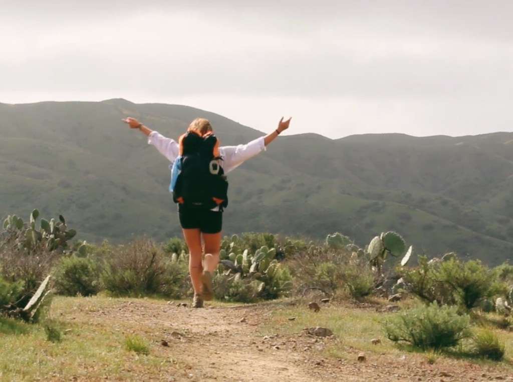
I made it with an hour and a half to spare before boarding the ferry. Sitting on a bench overlooking the harbor, I reflected back on my trip. It was a tough trail, and the weather definitely added to the challenge, but it was incredible, and just what I needed. I hope to come back and do it again one day and hopefully have much better weather!
Thanks for hiking with me!
Happy trails!
-Bee
Gear List:
Basics:
- ULA Circut Backpack
- The North Face Storm Break 1p Tent
- Kelty Cosmic Down 20 Sleeping Bag
- Klymit Statik V Sleeping Pad
- Ground Tarp
Electronics:
- Anker Power Bank & Wires
- Diamond Head Lamp
- Solar Power Lamp
- Garmin inReach Mini
- Airpods
- iPhone
- Tripod
Clothing: in dry-bag
- Cotopaxi Fanny Pack (worn)
- Ombraz Sunglasses (worn)
- Shorts X2 (worn)
- Injinji Toe Socks X2 (worn)
- Bra-top X2 (worn)
- Sun shirt (worn)
- Bathing Suit
- Lululemon Baselayer
- Smartwool Longjohns
- REI Rain Pants
- North Face Thermoball Puffer
- Knit Hat
- Bandana
- Poncho?
Toiletries: in Bear Can
- Toothbrush & tooth tabs
- Wipes
- Hand Sanitizer
- First Aid (bandaids & Neosporin)
Miscellaneous:
- Yoga towel
- Book: Thirst
- Journal
- Lighter
- Plastic baggies for trash
Food: in Bear Vault Bear Cannister
- Breakfast:
- Maple Brown Sugar Oatmeal X3
- Lenny’s Complete Cookie X2
- Snacks:
- Motts Fruit Snacks X4
- Nutrigrain Bars X6
- Aloha Protein Bar X2
- That’s It Fruit Bar X2
- Fruit Leather X2
- Dandies Marshmallows
- Propel Packets X8
- Starbucks Instant Coffee
- V. Hot cocoa
- Dinner:
- Mac n Cheese X2
- Rice and Beans


Great hike I did it a few years ago, but took 5 days to enjoy the area, camped at Parsons, Two Harbors, Little Harbor and Black Jack
LikeLike
Thanks for the detailed blog!! Can’t wait to go back and try to spot an Osprey now 🙂
LikeLiked by 1 person