

Day One: Lake Quinault
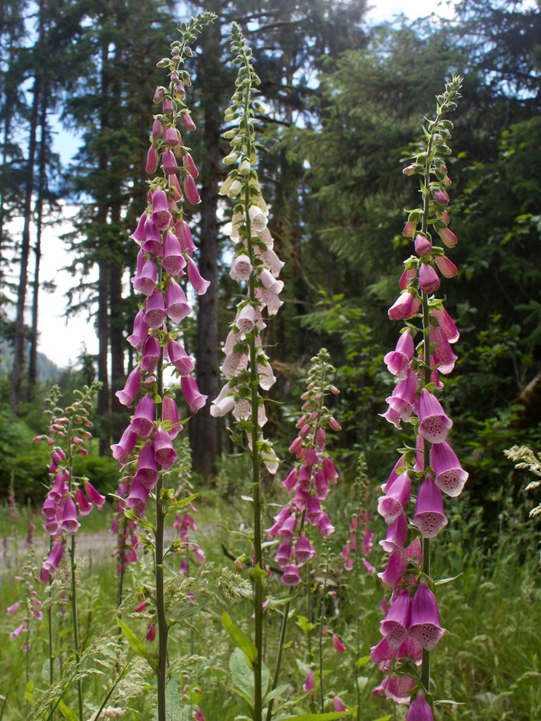
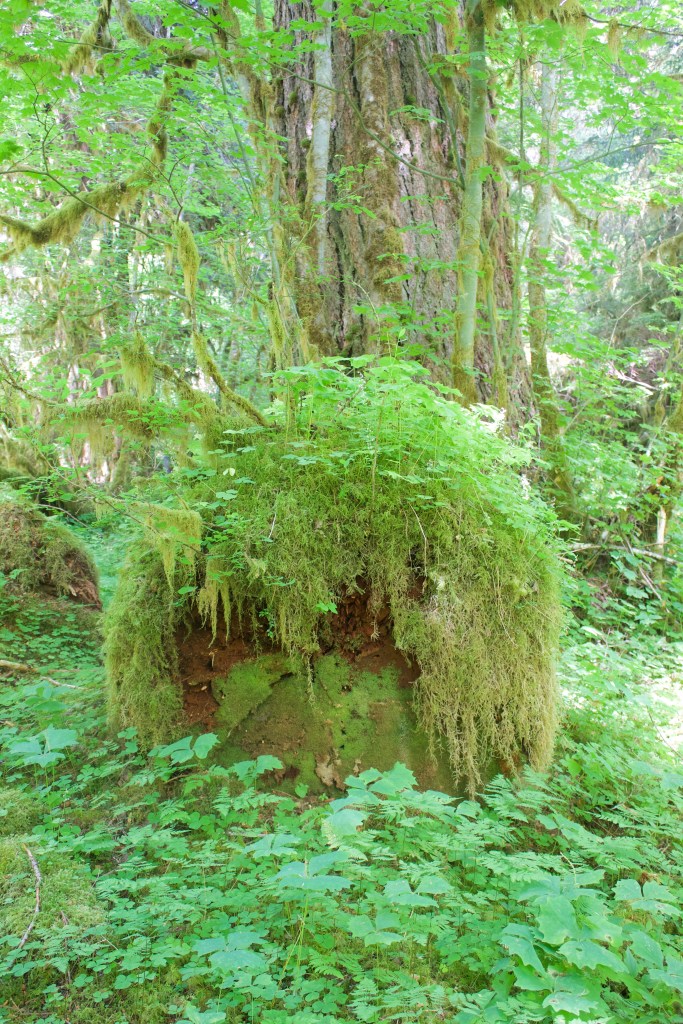
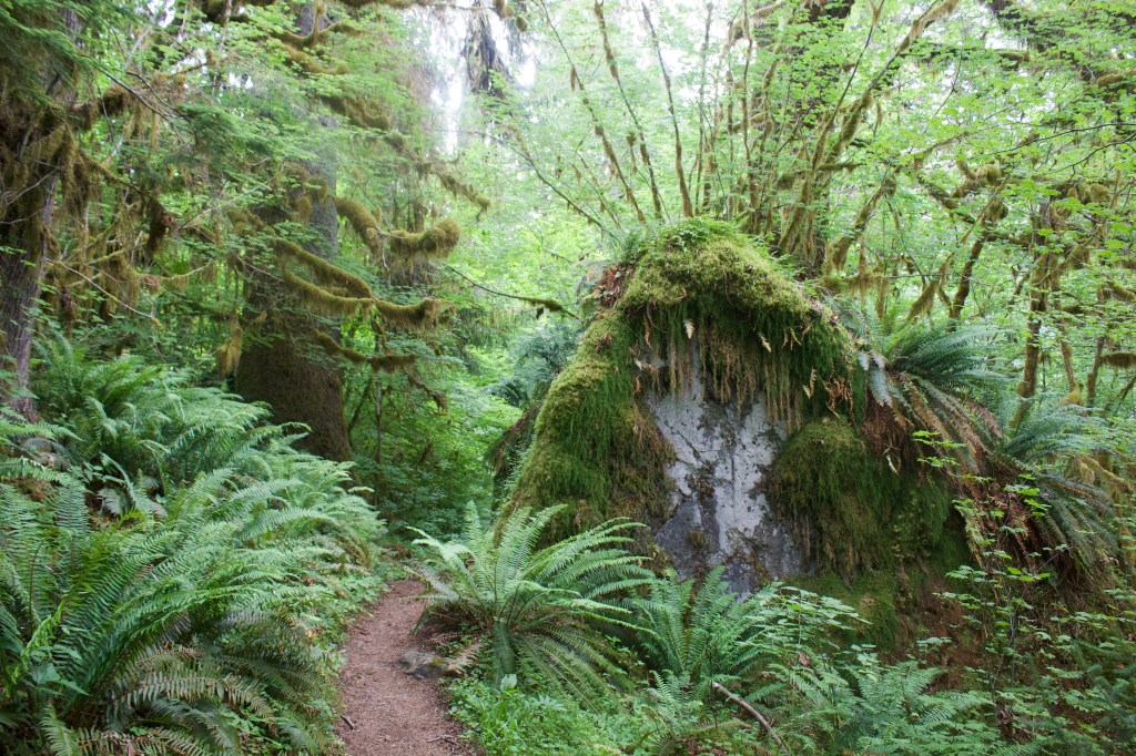
I flew into Seattle last night and stayed in a hotel near the airport. After breakfast this morning I started driving towards the Olympic Peninsula. The drive got increasingly scenic with tall pine trees lining the highway, packed together and stretching tall, and the highway was lined with pops of color from the purple and white foxgloves growing like weeds everywhere. The misty, grey, and cloudy atmosphere really set the vibe. The electric green moss grew thick on the trees and hung from the branches like curtains. By the time I started to see signs for Lake Quinault, I was itching with excitement to get out of the car and explore. I constantly found myself driving below the speed limit because I was trying to take everything in and savor my first moments in this lush old growth rainforest.
I pulled into my parking spot at Falls Creek Campground. My plan was to set up camp, explore the campground a little, and then drive around to explore the area some more. There was a short path from my car to my campsite that passed a gazebo with 4 picnic tables under it. I figured it would be good protection if a storm rolled in, considering how much it rains on the Olympic peninsula, (100-170 inches each year). I set up my tent and secured the rain cover tightly. I haven’t had to use my rain fly in a long time. Since I’ve been living in San Diego, most of my trips have been to the desert where I can usually cowboy camp without a problem.
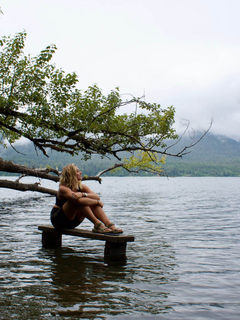
I followed some of the social trails by my campsite to see where they lead. A couple of them led to benches along the water’s edge, one of them was even in the water! After filling up my water bottle from the spigot near the gazebo, I hopped in my car and drove around the campground and back to the road.

Maybe a mile or two from the campground there was the first of many waterfalls, Merriman Falls, right along the side of the road. There are only a couple spots to pull over, and the falls aren’t marked, so you have to keep an eye out for it, but you’ll hear it before you see it.
When I arrived, I was the only car there, meaning, I had the falls all to myself, so I climbed up the slippery rocks to get a closer look at the falls and ended up taking a cold rinse under it which felt wonderfully refreshing.


Further along the road there are more waterfalls, one of them Bunch Falls, (I think) was also worth pulling over and getting out of the car for.
I wanted to make it to the end of Graves Creek Road which is a 6+ mile dirt road, riddled with potholes, that continues after South Shore Road ends. it’s a dead end road that ends at Graves Creek Campground and a trailhead that leads into the Enchanted Valley. I don’t have a reservation for tomorrow night so I was scouting out areas where I could snag a first come first served campsite. I found that I really liked the Graves Creek Campground. So, my plan is to go back in the morning to claim a site, then head off on a day hike up the river to enjoy the rainforest.
On my way back to the campsite, I stopped along the way to buy some firewood from someone selling it in their front yard. I also stopped at a market to pick up snacks and beer. There was a short trail across the street from the market that leads to the world’s largest sitka spruce tree so I checked it out before returning to my campsite, and I have to say, it was not as impressive as General Sherman in Sequoia.
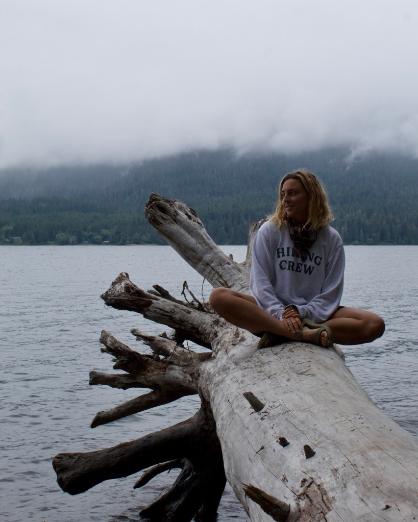
When I got back to my campsite I made myself a dinner of Spanish Right Rice with Taco Plant-based Crumbles and it topped with lays potato chips. Yum! Then, I explored around the campground a bit and hung out on one of the benches by the water until it started to get dark, which I learned doesn’t happen until like 10pm here.
Day Two // Graves Creek and the Enchanted Valley
After breakfast by the lake, I set off down the road to start the day’s adventure. I made it to Graves Creek Campground by 10 am and was surprised to find it mostly empty, which meant I had options to choose from. There is a self-check-in board at the entrance that lets you know which sites have been claimed, so I drove around the loop twice trying to decide which site I wanted for the night before I filled out the permit and attached it to the board, set up camp, put on my hiking shoes, and packed a day bag.

After locking my car and making sure I didn’t leave any food out, I walked up the road to the trailhead to begin my hike. The parking lot was pretty full and a few of the cars had backpackers who appeared to have just returned to their car or were packing their bags and getting ready to set out. I said good mornings as I walked past the cars then paused to read the information and study the map on the boards at the trailhead, before setting off into the wilderness.
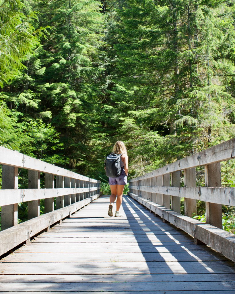

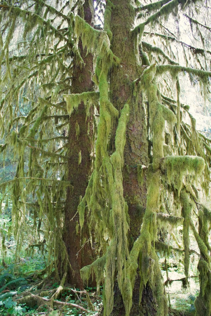
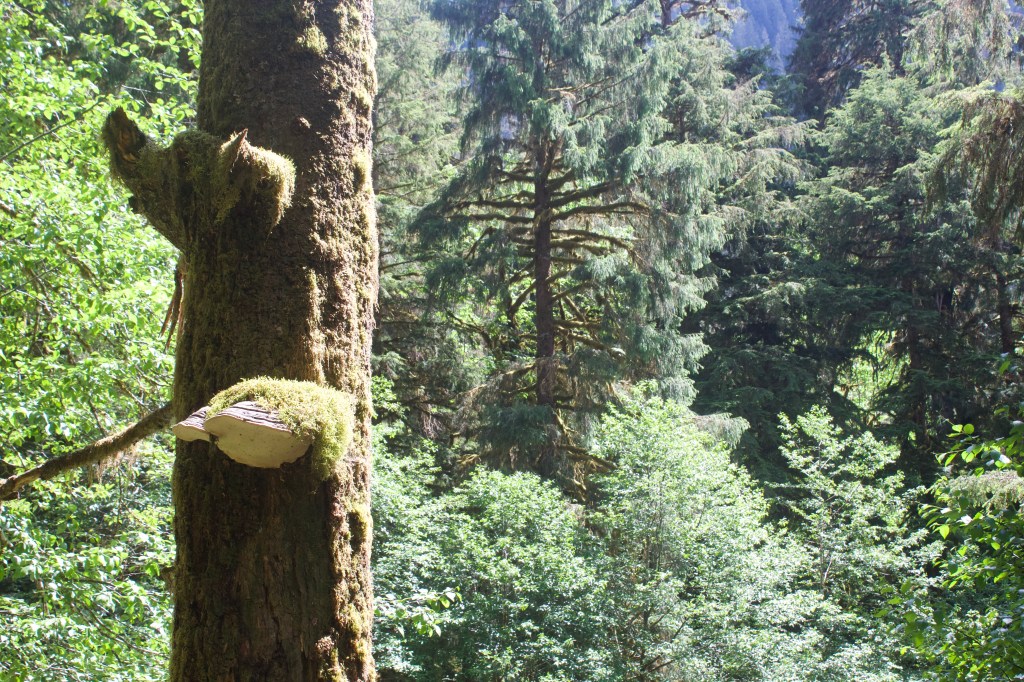
The trail follows the Quinault River into the Quinault Rainforest and the Enchanted Valley. The river is an incredible shade of glacier blue and because it is fed by glacial runoff, it is unbearably cold. I observed many new species along the trail. There were many types of mosses, fern, trees, and fungi. Oh, and lots of slimy banana and black slugs!

Once I reached my turn-around point, I stopped and had some lunch and then tried to go for a dip in the river, but oooweeee! it was cold. Overall it was a lovely hike with beautiful wildlife and scenery. I ended up hiking about 12mi with 1,800ft elevation gain by the time I made it back to my campsite.
I went down to the river by my campsite to rinse off the dirt and sweat from the day. I brought a couple of cans of beer down to the river with me so I could chill them in the water while I rinsed. It was nice to slip into my wool base layers after my ice bath.
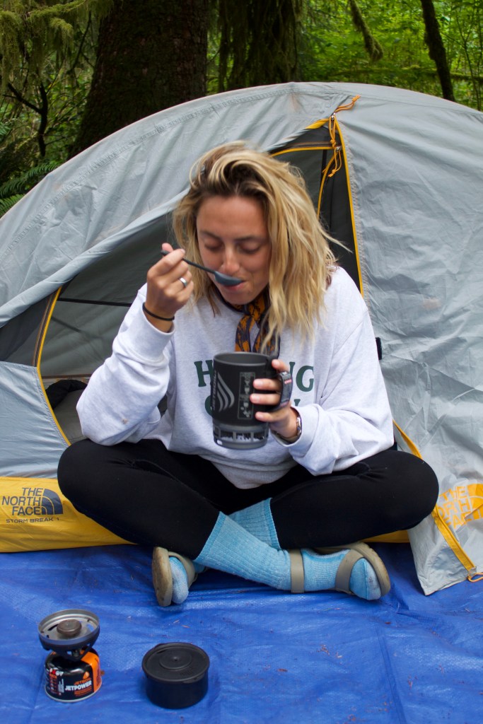
I cooked myself a dinner of spicy peanut noodles (check out my IG or TikTok for the recipe) then sat around my first campfire of the trip, sipping beer, and studying the map until it got dark and was time to go to bed.
Day Three // Hoh Rain Forest
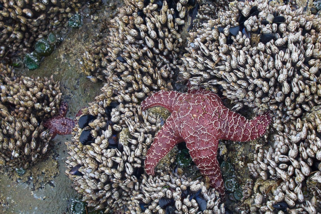
After my morning coffee, I packed up camp and started driving towards the Hoh Rainforest, my destination for the day. The drive brings you along the western shore of the peninsula and through an area called Kalaloch where there were many places to park for beach access. I stopped at Beach 4 which had a bathroom, and a long staircase down to the beach. I walked a mile or two along the shore exploring the tide pools and observing the sea life. I don’t think I have ever seen a Sea Star in its natural habitat before and I couldn’t believe how many there were! Bright purple and orange Ochre Sea Stars filled every tide pool, and even more abundant were the Giant Green Anemones that were the color of mountain dew.

After a couple hours on the beach, I hopped back in my car and drove the rest of the way to the Hoh Rain Forest. There was a long line of cars at the entrance where they check everyone’s permits and there is only one lane to get in. Usually, there’s two lines at the entrance to a National Park, one line for people with annual national park passes and another line for people who need to buy one, but that was not the case here. Everyone waits in the same line which requires some waiting especially if all the parking spaces are full at the visitor center. Luckily I had a reservation at the Hoh Campground so I didn’t have to worry about finding parking.
I parked my car at the campsite, then walked over to the visitor center to check out the information boards and look at their maps. I hiked the short 0.8mi trail appropriately named the Hall of Mosses which is the most popular trail in the are. While coming up to a viewpoint, I overheard the conversation of the family ahead of me. One of the kids complained, “we waiting in that long line for this?” to which his mother replied, “well, we better get a picture so people know we saw some mossy trees.” I was shocked with how unimpressed they were considering how blown away I was! I felt like Mother Nature was on full display for me, showing off all her lush and juicy beauty. I enjoyed every moment of the trail and took every opportunity to pause and take in the beauty all around me, feeling the moss between my fingers, running my hands along the rows of ferns, and stooping down to observe the slugs and snails at my feet.


When I made it back to the campground, most of the campsites were occupied. A few sites away from me there was a big family with at least 8 parents and 4 kids. The parents decided to let the kids have their own campsite which happened to be the one right next to mine. Ironically, the Hoh Rain Forest is home to the quietest place in the united states, but with a bunch of kids camping out next to me, it was certainly not a quiet night. At first I was a bit annoyed, but as I was having dinner in my hammock, one of the adults came over with a ukulele to sing songs with the kids. It was really sweet listening to them all sing along so happily. I recorded their voices so I could listen back later and figure out what song they were singing.
I found out the song was Lava from the Pixar short film of the same name if you were wondering… it makes me want to pick up my ukulele and learn how to play again.
https://www.youtube.com/watch?v=uh4dTLJ9q9o
Day Four // Hoh River Trail, Day 1
Today is the start of my backpacking trip along the Hoh River, so I got up early, eager to start my day. I had reserved two nights at backcountry sites along the Hoh River trail and planned to hike all the way to Blue Glacier if the trail conditions and weather permitted it. I figured I would go as far as I could and if things got too sketchy, I could just turn around.

There were several signs that warned about a cougar frequenting the area as well as some aggressive elk. The signs advised against hiking alone, especially in the morning or late in the evening. I didn’t listen to any music on my hike so I could be more aware of my surroundings and listen for any stalkers. I didn’t end up seeing any mountain lions on my trip, but I did see a herd of elk and lots of momma deers with their babies.


I had hiked 12 miles to my first campsite, Lewis Meadow Camp, and it was barely 11am. I found an open designated site that I liked, set up camp, and took a little nap in the sun. Since it was still early in the day I felt like I could squeeze in a day hike before it got dark, so I pulled out my map to consider my options.
I had passed a few people carrying climbing gear such as ice axes, ropes, helmets, spikes, etc. which made me think that hiking all the way to Blue Glacier was probably unrealistic for me who did not have that kind of gear. Looking at the map, I could see that up ahead there was a lake called Elk Lake maybe another 5 miles ahead. It would be a climb to get there, but without my pack it would be easy, so I set out for the lake.

When I was picking up my rental car at the Seattle Airport, I met a very kind man who was the previous superintendent of Olympic National Park and is the current superintendent in Mojave, so he had a lot of recommendations and knowledge about the park. I went over some of my plans with him and he told me that even if I don’t make it all the way to Blue Glacier I have to at least get a view of Mount Olympus. Looking at the map, I was pretty sure that Elk Lake would be the first good view.
I was disappointed to find that the trail doesn’t actually take you to the edge of the lake and there was no clear opening with a view of the mountain, but you could see the snowy mountains if you peeked through the branches and trees. I was able to find a little side trail that led down to a tree that had fallen over the lake. I walked out on the log to get a clearer view of the mountain and take some photos before heading back to camp. On my way back I stopped to chat with some of the hikers who were carrying climbing gear and found out that the end of the Blue Glacier trail is a ridge that overlooks the glacier and there is an option to scramble down and then climb up the glacier which requires climbing gear. Great! I thought, I guess I will be able to hike to the end like I had hoped.

When I made it back to camp there were a lot more people at the campground, definitely more people than there were designated sites. This meant that people were not following their permits or they didn’t have permits at all, and there weren’t any rangers around to enforce it. I was glad I claimed my spot when I did otherwise I would be scrambling to find a site now.
I took my bear canister a little way down the river to cook and eat my dinner. For proper bear safety, it is recommended that you do not eat or cook near your tent because the smells could linger and lead unwanted visitors to your campsite. I could still see my tent from where I was set up and as I was eating my Backpackers Pantry Pad Thai (the best pre-packaged backpacking food, hands down), I noticed a couple hikers walk into my campsite and circle my tent. Wondering what they are up to, but also not wanting to go over and talk to them, I watch to see what happens.
I guess they were desperate for a campsite because they decided to set up camp less than 10 feet away from me and not in a designated spot. They then proceeded to cook and eat their dinner right in their campsite. That made me a bit upset because, not only are they camped unreasonably close to me and not in a designated spot, but now their actions are inviting wild animals into our campsite with their food.
I am careful to follow the principles of Leave No Trace because they protect the environment, the wildlife, myself, and other hikers. When wild animals learn they can get food from hikers they will teach others, or they may become aggressive. And one solution for aggressive animals is killing them which is terrible and irresponsible because humans are to blame.
When I was backpacking the Rae Lakes Loop with my sis there was a lot of bear activity reported in the area and bear canisters were required, and using the bear lockers located in each campground was highly encouraged. When I confronted someone about sleeping with their food right outside their tent, they laughed at me and told me I was overreacting; they were on the PCT and haven’t had any incidents, which according to them, meant they knew better than me. But just because it hasn’t happened to you doesn’t mean it never will!
Anyway, bringing it back to the Hoh, I did not end up saying anything to the people next to me although, looking back I really wish I did because giving them the benefit of the doubt, they could just be ignorant of proper camp etiquette and by talking to them I could help them stay safe on future adventures. I still put all my scented products in my bear can and placed it away from my tent, hoping they would notice what I was doing and follow along. Then I crawled into my tent and went to bed trying not to think about the possibility of a bear coming through my camp to check out the neighbors.
Day Five // Hoh River Trail, Day 2 -Blue Glacier
I had some thinking to do this morning. My thoughts were the following:
- There are so many people camped at this campground, more people than designated sites, so if I move to the other site I reserved there is no guarantee that I will even find a spot.
- The people next to me slept with their bear cans and dishes right outside the door of their tent and I do not want to camp near them again.
- It’s a 9 mi climb, possibly through snow, up to Blue Glacier, so 18ish miles total.
- It’s supposed to rain today
So what did I decide to do? Leave my setup, pack a day bag, and hike however far towards Blue Glacier as feels right, then come back to camp. Through my backpacking and hiking experience, I have learned the importance of listening to my body and the consequences of going beyond my limits. For me, the mental challenge is sometimes more difficult than the physical when it comes to hiking and I tend to push myself to my limits. My mind thinks my body can handle more than it is capable of.
Pretty early into my hike, there were a couple of hikers ahead of me moving at a slower pace, so I asked if I could pass them and as I came out in front, they struck up a conversation. I learned that they were father and son from Idaho, the father was in his 60s and the son was in his 40s and they are originally from Czechoslovakia. They were pretty impressed by my hiking portfolio, suggesting I was a ‘professional hiker’ and had a lot of questions. I also had questions about Idaho and the Sawtooth Mountains which I learned wasn’t far from where they live. I hadn’t had a conversation in a few days so it was nice to have their company. I decided I would hike with them for a bit while the conversation flowed and eventually I would break off ahead when they needed to stop for a break. It was easy hiking with them because it made me slow my pace. I’m often told how fast I hike by others when I pass them, like I said, I tend to push myself. I hike fast when the trail is hard to get the suffering over quicker, or when the trail is flat or down hill because the trail is easy and I can. But also because I’m excited to get to the main attractions and have that oooo ahhh moment.
Anyway…
There was a rockslide that took out a section of the trail, so the rangers installed a ladder as a detour. I had read and heard from other hikers about the ladder, but when I got to that section of trail, what I saw was not what I was expecting. The ladder was very long and on a steep section of crumbly rocks. As hikers went down, rocks would come loose and tumble down the hill. I was told by a couple rock climbers that it’s better to go one at a time because the loose rocks could hit the person below you, like one hiker I saw who had a bloody slash in his shin from falling rocks, but also because you have less control of the rope.
If I had been there alone and there weren’t other people climbing up/going down the ladder before me I don’t think I would have done it. But watching others do it without any extra gear made me feel more comfortable. Plus, once I actually got on the ladder it wasn’t as bad as it seemed. The trick, at least for me, was to go down just using the rope and walking backwards, and then, on the way back up, climbing the ladder.

After the ladder, you climb above the tree line into a lovely alpine meadow that was covered in Avalanche Lilies and above that, a few big patches of snow covered the trail. When I made it to the ridge line it was so foggy, it felt like I walked into a cloud. The air was thick and moist, my skin and hair were dripping wet even though it wasn’t raining. The visibility was minimal, so I didn’t get the gorgeous view I was expecting and I couldn’t really see the glacier either, but regardless, it was an excellent hike and standing on the ridge in the clouds felt like an accomplishment.

The forecast called for rain this evening, so I figured the weather will only get worse and I didn’t want to be exposed in a storm so I didn’t spend too much time at the top before I heading back to my campsite to have dinner and lay down for the night.
I flew down the trail back to the campsite enjoying the ease of going downhill and arrived back at camp around 6pm. In total, I hiked about 19 miles and when I finally sat down, my legs were throbbing and I was so tired that I didn’t feel like cooking or even eating, but I forced myself to eat a protein bar then fell asleep before it got dark sleeping right through to the morning, not even noticing that it had rained during the night.
Oh and remember my very close neighbors who were not following bear safety? They also stayed a second night… but luckily there were no issues with wild animals.
Day Six // Hoh River Trail, Day 3
I was up pretty early the next morning and had 11 miles to get back to my car. I figured I would make it there by noon giving me plenty of time to drive north to Port Angeles, have a good meal, then head to my cabin for the night! I was really looking forward to the cabin I had reserved not only because it was right on the beach but also because I could take a real shower!
I ended up making it back to my car by noon like I expected, and started driving north. As I got close to the town of Forks (A very small town with one main strip), there were detour signs directing drivers away from the main street due to a parade through the center of town. That’s when I realized it was the 4th of July. I did not want to deal with all of the parade festivities, so i just drove on past and went straight to Port Angeles.
The town of Port Angeles is very cute with lots of cute shops and restaurants and being that it’s a port, it’s right on the water! I found a brewery where I sat at the bar, drank some tasty kombucha, and ate a good meal. When I was younger, the thought of going to a restaurant, let alone a 10 day trip by myself, seemed scary, but hiking, camping, and backpacking have made me independence and comfortable with being alone. Even sitting in a crowded bar on a holiday weekend by myself I didn’t feel uncomfortable or embarrassed. I felt at ease, enjoying my own company.
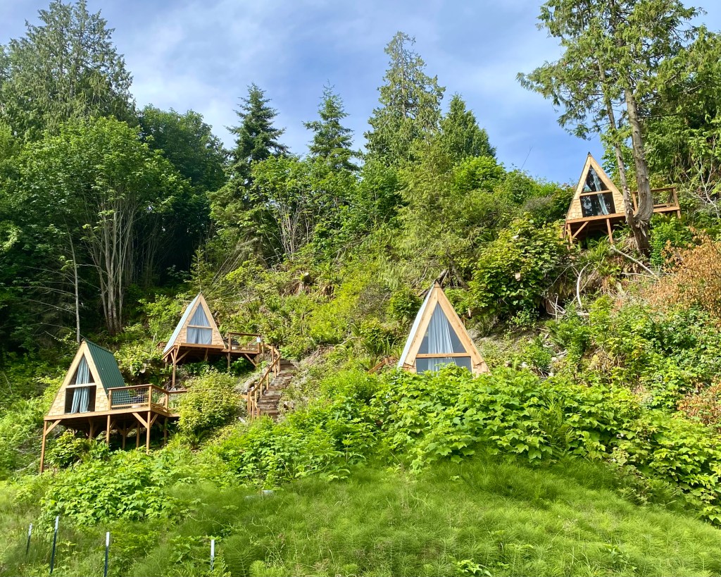
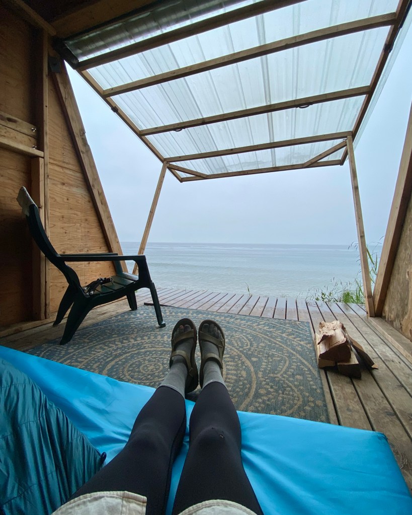
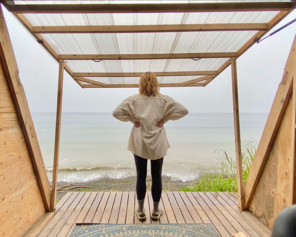
Finally, it was time to check-in to the cabin. It looked just like the photos and was truly a dream come true. Driving into the campground, there were A-frame cabins all along the hillside and lining the shore. My cabin was a little different than all the others because one of the walls opens up to the ocean, creating a kind of sheltered deck. The campground also had a bathroom with running water and a hot shower! oh, the luxury!

After taking a hot shower, and using a sweatshirt and bandana as a towel, I put on some clean and dry clothes and walked back over to my cabin. The camp host let me know that since it was the 4th of July there would be a fireworks tonight. I was surprised fireworks were allowed in the area, being so close to a national park. When it started to get dark, I moved over to the fire pit and got a fire started just before the fireworks began. Luckily they didn’t run too late so I went to sleep undisturbed by explosions.

Day Seven // Crescent Lake
I decided to have a leisurely morning, soaking in every moment in my lovely little cabin. I sat with my coffee and studied the map for a while, planning today’s adventure. I had a reservation at Fairholme Campground on Lake Crescent tonight which wasn’t too far away and there was plenty to do in the area.
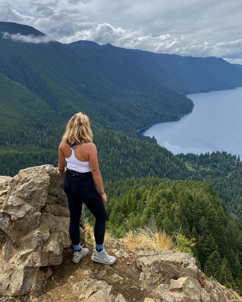
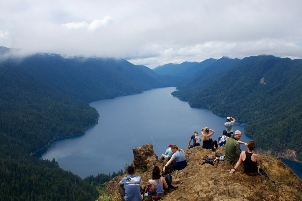
One popular hike in the Lake Crescent area is Marymere Falls and Storm King which both branch from the same trailhead on Lake Crescent. The hike to Marymere Falls is only about one mile and to Storm King, another 2 miles with a little over 2,000ft elevation gain… in other words, a lot of switchbacks.
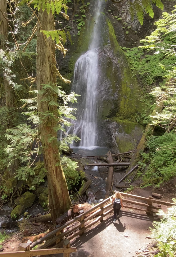
It was a cloudy morning, but felt like the sun wanted to come out from the clouds. I could feel it peaking through the trees as I climbed up to Storm King. The last section of trail was very steep and required the use of ropes, which made some people turn around, but after climbing that ladder on the Blue Glacier trail, these ropes were a piece of cake! When I got to the top I was happy to have a clear view of the lake and surrounding mountains. With this clear view, I could see some dark clouds making their way in.. which meant rain was on the way.
After climbing down from the summit, I decided to head back into Port Angeles for a good meal before heading to my campsite at Fairholme Campground. I found a sushi restaurant and sat by the window. As I was eating my veggie rolls, it started to rain. Oh joy, looks like I’ll be setting up my tent in the rain!
Luckily the rain stopped long enough for me to find my campsite, set up camp, and get a fire going before it started again. It rained pretty hard that night which woke me several times, and even after the rain stopped, the slap of drops falling from the trees onto my tent would was startling enough to wake me. Needless to say, it wasn’t a very restful night.
Day Eight // Hurricane Ridge and Rocky Brook Falls
I woke up a bit grumpy from the restless night of sleep I had. There was a hole in my sleeping pad, so I woke up on the ground and some water got into my tent so all my stuff was wet. Rather than pack everything back into my backpack, I tried to lay everything out in the back of my rental car so it would have a chance to dry throughout the day.
I was supposed to drive out to Cape Flattery and stay at a campground right on the beach which I was looking forward to, but after considering the weather report that called for another night of wind, rain, and lots of fog, plus the wet night I just had, I thought that might not be my best option. So, I decided I would treat myself to a hotel instead so I could take a warm shower and sleep in a real bed.
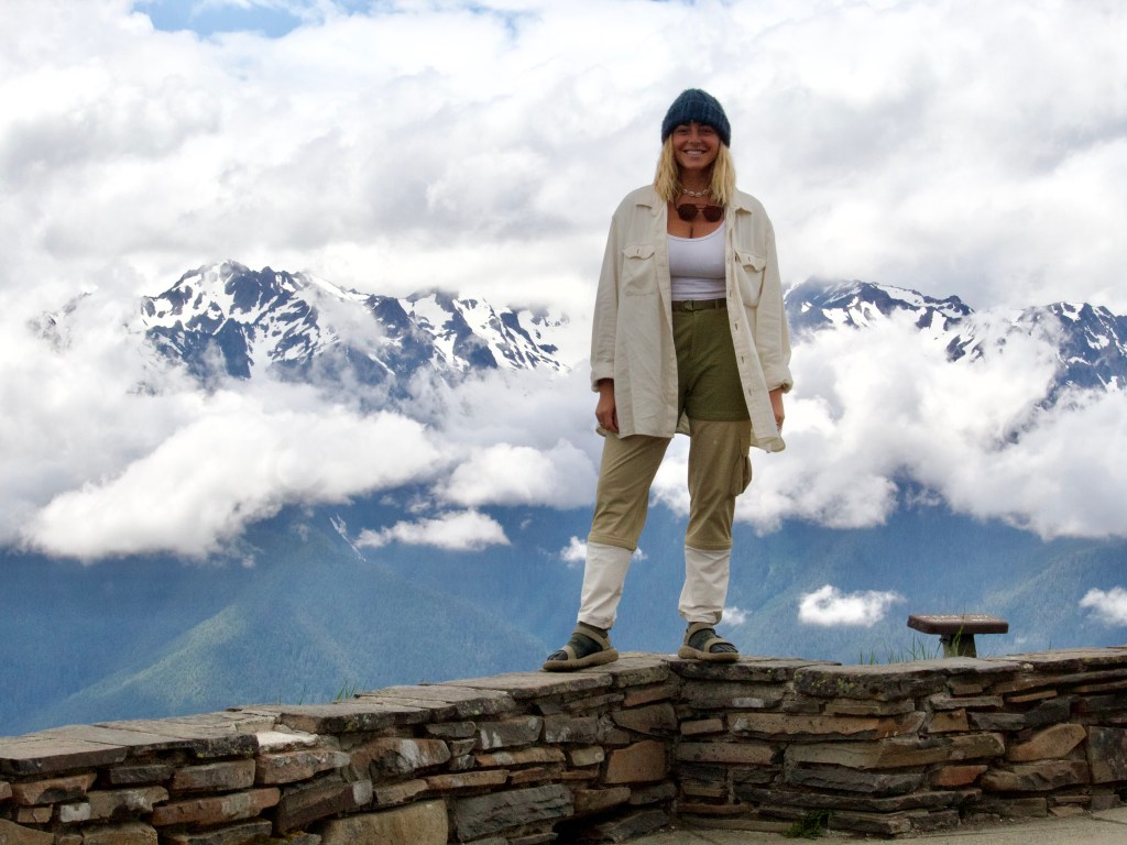
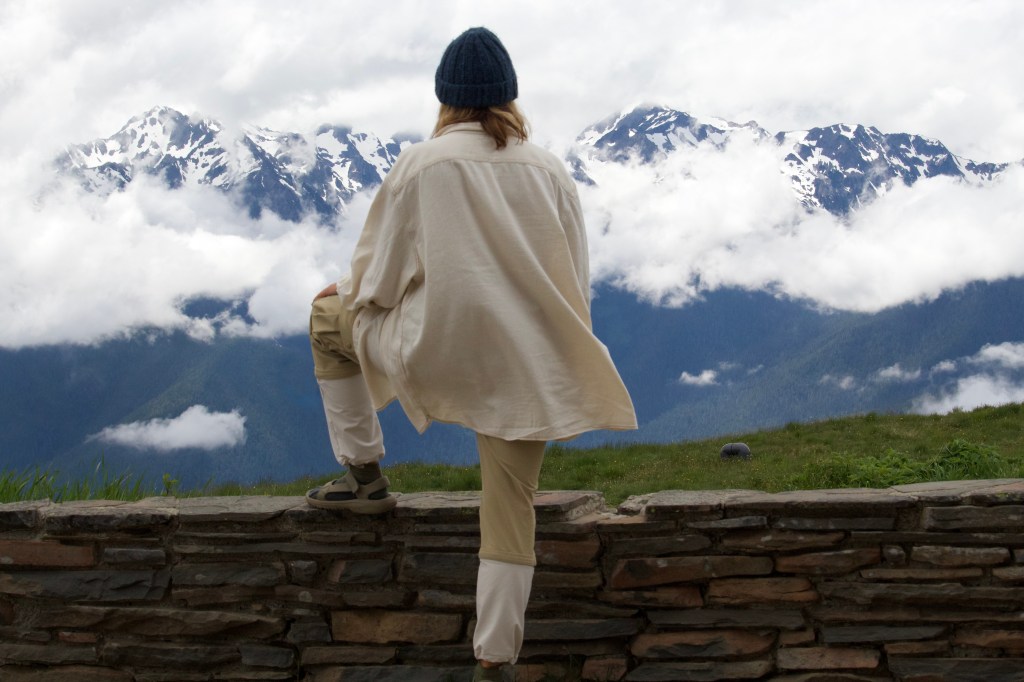
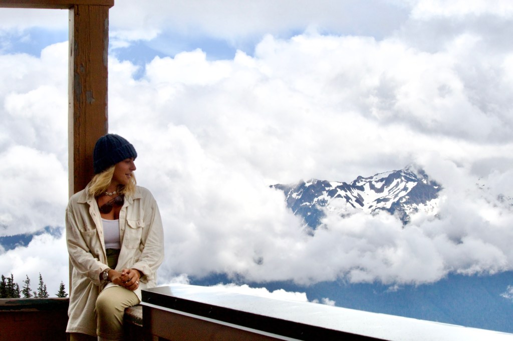
I improvised my plans for the day, and set off for Hurricane Ridge, just outside Port Angeles. Driving up the road, I ascended into the clouds, and almost came out on top of them as I pulled up to the Hurricane Ridge Visitor Center. The view was obstructed by all the clouds, so I went into the visitor center to see what trails were in the area. I wandered down some of the short trails in the area and after an hour or so the clouds cleared up enough that I had a beautiful view of the snowy mountain range, including Blue Glacier, and Mount Olympus.

After taking some photos and enjoying the view, I got back in the car to head to my next stop. Looking at the route to the hotel I would be passing a place called Rocky Brook Falls which I decided to check out. I almost skipped it because I had already seen so many waterfalls, but I’m glad I went because it ended up being the biggest waterfall yet! And even better, I had it all to myself!


Day Nine // Seattle
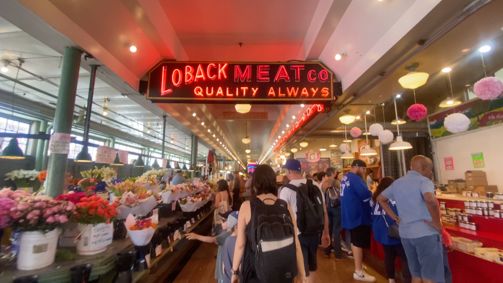
This was the last day of my trip and even though I am not a city gal, I felt like I had to explore Seattle before leaving, especially since I’m flying in and out of the Seattle Airport. When doing some quick research on the area, I saw that the Park Place Market was one of the city’s main attractions. So that’s where I went!
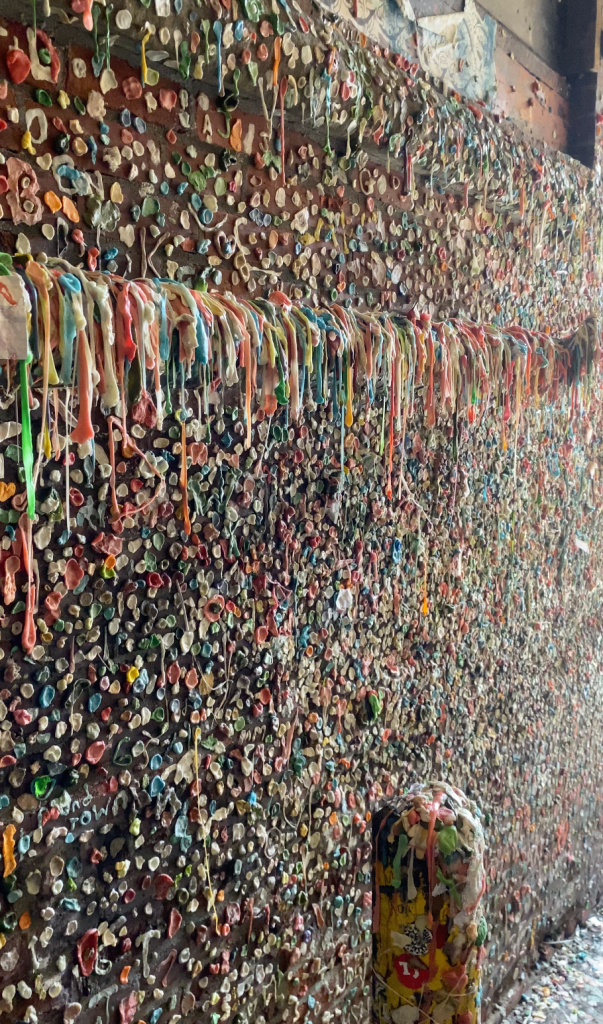
I found a place to park my car for a couple hours while I explored the market. There are a bunch of different shops inside, everything from fish, to antique collectibles, to a magic emporium. There’s even an alleyway where the walls and floor are covered in chewing gum. ew.

This is also home to the Original Starbucks store, the first-ever Starbucks location, which was established in 1971. I was pretty excited about this because I worked for Starbucks throughout college and was always a big fan of their coffee. I didn’t go inside because the line was about 50+ people deep, but it was cool to see.

Closing Notes:
Originally this trip was supposed to be a week longer because I was supposed to hike 97 miles on the Wonderland Trail in Mount Rainier National Park. But after finding out the trail was still 90% snow-covered, I had to cancel those plans and rearrange my trip schedule.
It all worked out in the end and I had a fantastic time traveling around the Olympic Peninsula. It was everything I hoped for; from rainforest, to mountain top, to shoreline, it was all a magical experience. I felt like a little fairy wandering around this new environment.
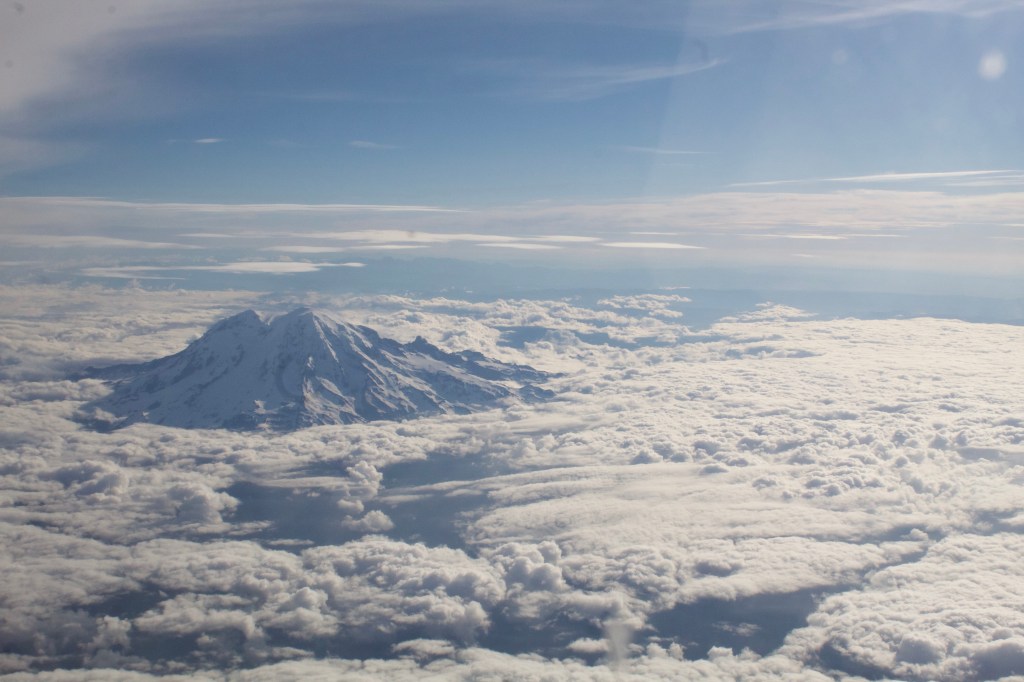
As I looked out the window on my plane ride back to San Diego, I could see the top of Mount Rainier peeking out above the clouds and I started imagining my next trip back. Hopefully I’ll be back soon with my sister for a PNW road trip!
P.S. I will be uploading a Youtube video of my trip soon, so keep an eye out!
You can find more from me by checking out…
Instagram: https://www.instagram.com/beeswildlife/
TikTok: https://www.tiktok.com/@beeswild_life
Youtube: https://www.youtube.com/channel/UCT1rnc431OET_igUzxapkYA
Amazon Storefront: https://www.amazon.com/shop/beeswildlife


Thank you for sharing Ms Bee…..I felt like I was on the journey with you.
I can’t wait to go on another remote roadtrip/hike with you again……Happy Trails
LikeLike